
File:京津城际铁路.png
原本檔案 (1,440 × 1,440 像素,檔案大細:128 KB ,MIME類型:image/png)
摘要
| 描述 |
Deutsch: Die Schnellfahrstrecke (schwarz) im Vergleich zur Autobahn (blau) und Bestandsstrecke (grau).
English: Map showing the line in relation to the current Beijing-Tianjin railway line and the Jingjintang Expressway.
Norsk bokmål: Kart som viser banen i fohold til andre jernbanelinjer.
文言:京津城際鐵路圖. |
| 日期 | |
| 來源 | 自己作品 |
| 作者 | Yaohua2000 |
協議
我,呢份作品嘅作者,決定用以下許可發佈呢件作品:
呢個檔案用共享創意 姓名標示-非商業性-相同方式分享3.0 未本地化版本條款授權。
- 你可以:
- 去分享 – 複製、發佈同傳播呢個作品
- 再改 – 創作演繹作品
- 要遵照下面嘅條件:
- 署名 – 你一定要畀合適嘅表彰、畀返指向呢個授權條款嘅連結,同埋寫明有無改過嚟。你可以用任何合理方式去做,但唔可以用任何方式暗示授權人認可咗你或者你嘅使用方式。
- 相同方式分享 – 如果你用任何方式改過呢個作品,你必須要用返原本或者相似嘅條款發佈。
| Description |
This map was created from OpenStreetMap project data, collected by the community. This map may be incomplete, and may contain errors. Don't rely solely on it for navigation. |
| 日期 | (see file history) |
| 來源 | openstreetmap.org |
| Creator |
OpenStreetMap contributors |
| 許可 (重用呢個檔案) |
OpenStreetMap data and maps are licensed under the Creative Commons Attribution-ShareAlike 2.0 license (CC-BY-SA 2.0). This file is licensed under the Creative Commons Attribution-Share Alike 2.0 Generic license.
|
| Georeferencing | If inappropriate please set warp_status = skip to hide. |
檔案歷史
撳個日期/時間去睇響嗰個時間出現過嘅檔案。
| 日期/時間 | 縮圖 | 尺寸 | 用戶 | 註解 | |
|---|---|---|---|---|---|
| 現時 | 2008年7月2號 (三) 02:44 | 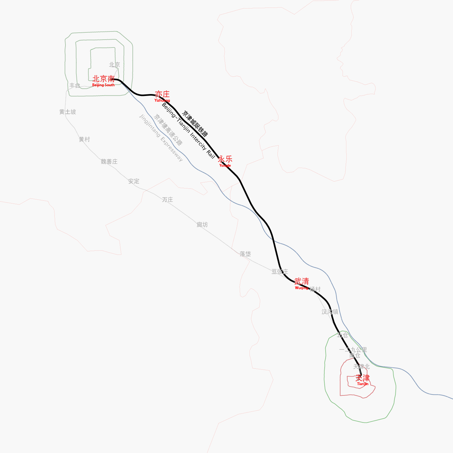 | 1,440 × 1,440(128 KB) | Yaohua2000 | {{Information |Description= |Source=self-made |Date= |Author= Yaohua2000 |Permission= |other_versions= }} |
檔案用途
以下嘅1版用到呢個檔:
全域檔案使用情況
下面嘅維基都用緊呢個檔案:
- cs.wikipedia.org嘅使用情況
- de.wikipedia.org嘅使用情況
- de.wikivoyage.org嘅使用情況
- en.wikipedia.org嘅使用情況
- fa.wikipedia.org嘅使用情況
- fr.wikipedia.org嘅使用情況
- id.wikipedia.org嘅使用情況
- ja.wikipedia.org嘅使用情況
- ko.wikipedia.org嘅使用情況
- no.wikipedia.org嘅使用情況
- ru.wikipedia.org嘅使用情況
- ur.wikipedia.org嘅使用情況
- vi.wikipedia.org嘅使用情況
- www.wikidata.org嘅使用情況
- wuu.wikipedia.org嘅使用情況
- zh.wikipedia.org嘅使用情況