
File:Carte de Maurice.jpg

預覽大細:497 × 599 像素。 第啲解像度:199 × 240 像素|398 × 480 像素|1,000 × 1,206 像素。
原本檔案 (1,000 × 1,206 像素,檔案大細:230 KB ,MIME類型:image/jpeg)
摘要
| 描述 |
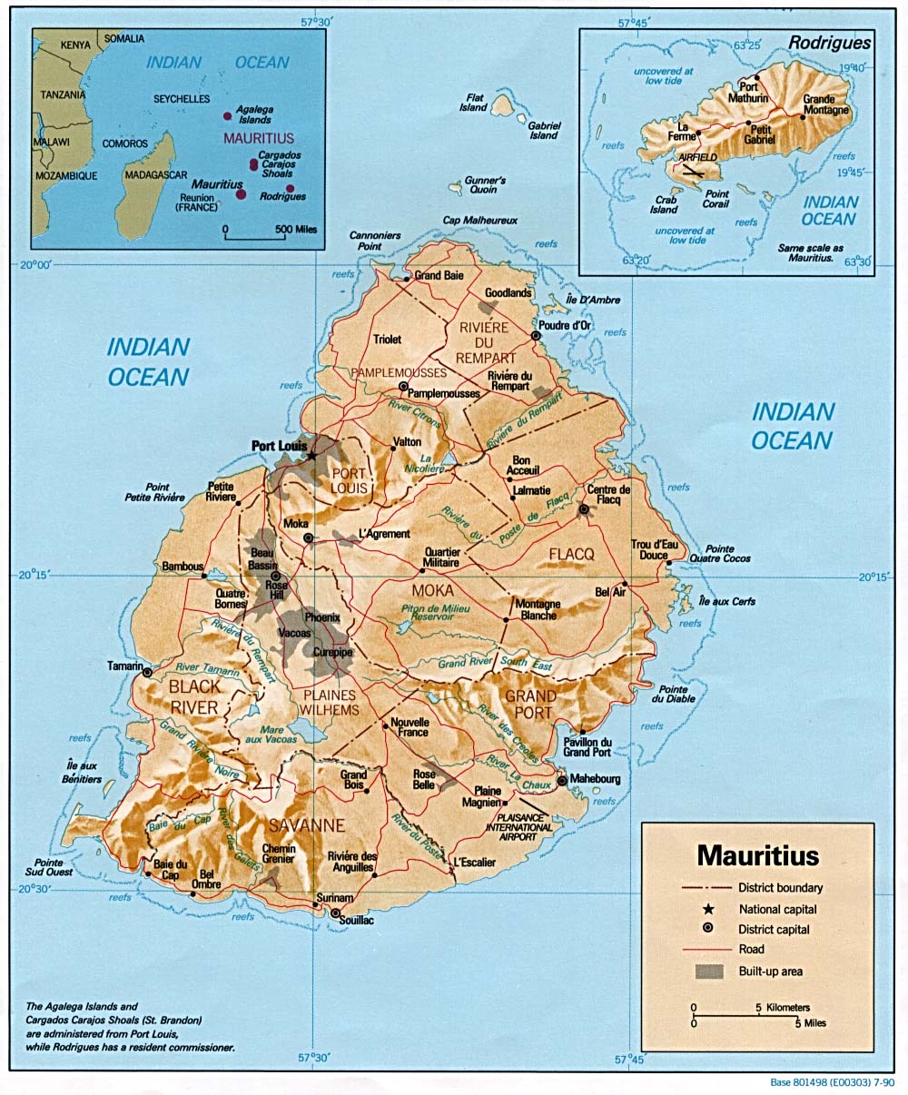
English: Relief map of Mauritius, with inset of Rodrigues Island. US Central Intelligence Agency, 1990.
Français : Carte de Maurice. Il reste toujours un peu à traduire. |
| 日期 | |
| 來源 | Translated from: University of Texas Libraries, Perry-Castañeda Library Map Collection: Mauritius Maps |
| 作者 | CIA; translation: aaker |
| Other versions |
|

協議
| This image is a work of a Central Intelligence Agency employee, taken or made as part of that person's official duties. As a Work of the United States Government, this image or media is in the public domain in the United States.
|

|
This work is based on a work in the public domain. It has been digitally enhanced and/or modified. This derivative work has been (or is hereby) released into the public domain by its author, Aaker. This applies worldwide.
In some countries this may not be legally possible; if so: |
檔案歷史
撳個日期/時間去睇響嗰個時間出現過嘅檔案。
| 日期/時間 | 縮圖 | 尺寸 | 用戶 | 註解 | |
|---|---|---|---|---|---|
| 現時 | 2007年8月1號 (三) 09:47 | | 1,000 × 1,206(230 KB) | Aaker | {{Information |Description=carte de Maurice. Il reste toujours un peu à traduire. |Source=Traduction personnelle de la version anglais/ own translation of the English version |Date=1 août, 2007 |Author=aaker |Permission= |other_versions=Mauritius_rel90. |
檔案用途
以下嘅1版用到呢個檔:
全域檔案使用情況
下面嘅維基都用緊呢個檔案:
- fr.wikipedia.org嘅使用情況
- he.wikipedia.org嘅使用情況
- ln.wikipedia.org嘅使用情況
- vec.wikipedia.org嘅使用情況
- wo.wikipedia.org嘅使用情況