
File:Ethno-linguistic based administrative division map of China.png
原本檔案 (2,677 × 2,183 像素,檔案大細:544 KB ,MIME類型:image/png)
摘要
| 描述 |
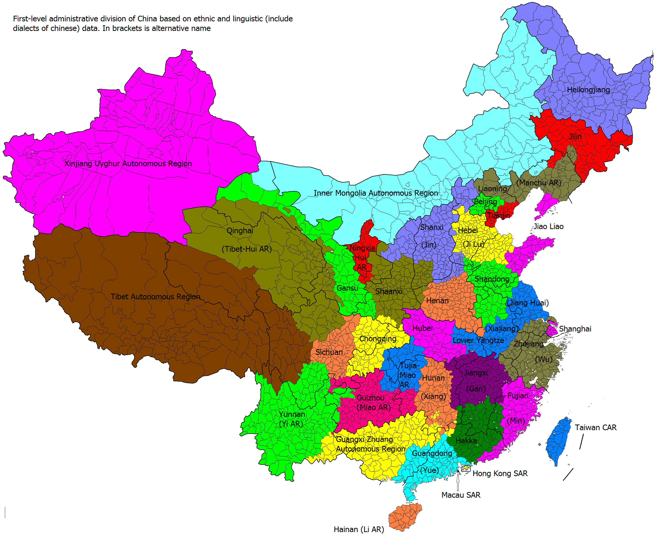
English: Comparison of administrative divisions of People's Republic of China, its dependencies, and Chinese Taipei (Taiwan) with actual ethno-linguistic distribution. Colors show how administrative divisions would look like, if they were based on ethno-linguistic distribution; thicker black borders show actual administrative division.
中文(简体):中国县级政区地图,按民族、语言和地域上色 |
| 日期 | |
| 來源 | 自己作品 File:Map of Dissolution of China.png, File:Ethno-linguistic based regions of China.png |
| 作者 | Kaiyr, based on https://www.nytimes.com/interactive/2009/07/10/world/20090711-xinjiang.html?_r=1& , http://www.muturzikin.com/cartesasie/9.htm , http://www.360doc.com/content/12/0813/22/276037_230028707.shtml , http://www.pai-hang-bang.com/tupian/中国少族民族分布图.html , http://www.zxxk.com/article/329123.html , File:Autonomous rule divisions in China.png, en:Ethnic townships of the People's Republic of China |
協議
我,呢份作品嘅作者,決定用以下許可發佈呢件作品:
呢個檔案用共享創意 姓名標示-非商業性-相同方式分享3.0 未本地化版本條款授權。
- 你可以:
- 去分享 – 複製、發佈同傳播呢個作品
- 再改 – 創作演繹作品
- 要遵照下面嘅條件:
- 署名 – 你一定要畀合適嘅表彰、畀返指向呢個授權條款嘅連結,同埋寫明有無改過嚟。你可以用任何合理方式去做,但唔可以用任何方式暗示授權人認可咗你或者你嘅使用方式。
- 相同方式分享 – 如果你用任何方式改過呢個作品,你必須要用返原本或者相似嘅條款發佈。
檔案歷史
撳個日期/時間去睇響嗰個時間出現過嘅檔案。
| 日期/時間 | 縮圖 | 尺寸 | 用戶 | 註解 | |
|---|---|---|---|---|---|
| 現時 | 2014年3月3號 (一) 17:17 | | 2,677 × 2,183(544 KB) | Kaiyr | User created page with UploadWizard |
檔案用途
無嘢連來呢份檔案。
全域檔案使用情況
下面嘅維基都用緊呢個檔案:
- en.wikipedia.org嘅使用情況
- id.wikipedia.org嘅使用情況
- ru.wikipedia.org嘅使用情況
- uk.wikipedia.org嘅使用情況