
File:Indonesia location map.svg

呢個「SVG」檔案嘅呢個「PNG」預覽嘅大細:800 × 307 像素。 第啲解像度:320 × 123 像素|640 × 245 像素|1,024 × 393 像素|1,280 × 491 像素|2,560 × 981 像素|1,200 × 460 像素。
原本檔案 (SVG檔案,表面大細: 1,200 × 460 像素,檔案大細:739 KB)
摘要
| 描述 |
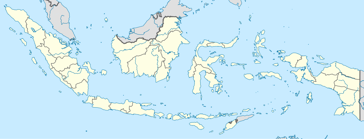
English: Location map of Indonesia.
Equirectangular projection. Stretched by 100.0%. Geographic limits of the map:
|
| 日期 | |
| 來源 | 自己作品 |
| 作者 | Uwe Dedering |
| Other versions |
|
協議
I, the copyright holder of this work, hereby publish it under the following licenses:
呢個檔案用共享創意 姓名標示-非商業性-相同方式分享3.0 未本地化版本條款授權。
- 你可以:
- 去分享 – 複製、發佈同傳播呢個作品
- 再改 – 創作演繹作品
- 要遵照下面嘅條件:
- 署名 – 你一定要畀合適嘅表彰、畀返指向呢個授權條款嘅連結,同埋寫明有無改過嚟。你可以用任何合理方式去做,但唔可以用任何方式暗示授權人認可咗你或者你嘅使用方式。
- 相同方式分享 – 如果你用任何方式改過呢個作品,你必須要用返原本或者相似嘅條款發佈。

|
根據自由軟體基金會發佈嘅無固定段落、封面文字同封底文字GNU自由文件授權條款第1.2或打後嘅版本,你獲授權可以重製、散佈同埋修改爾份文件。授權條款嘅副本喺章節GNU自由文件授權條款。 |
你可以揀你想用嘅牌照。
檔案歷史
撳個日期/時間去睇響嗰個時間出現過嘅檔案。
| 日期/時間 | 縮圖 | 尺寸 | 用戶 | 註解 | |
|---|---|---|---|---|---|
| 現時 | 2022年12月4號 (日) 15:54 | 1,200 × 460(739 KB) | NordNordWest | upd | |
| 2022年7月2號 (六) 20:17 | 1,200 × 460(910 KB) | NordNordWest | upd | ||
| 2013年6月26號 (三) 20:21 | 1,200 × 460(854 KB) | NordNordWest | upd | ||
| 2010年2月18號 (四) 12:58 | 1,200 × 460(1.2 MB) | Uwe Dedering | {{Information |Description={{en|1=Location map of Indonesia. Equirectangular projection. Strechted by 100.0%. Geographic limits of the map: * N: 6.5° N * S: -11.5° N * W: 94.5° E * E: 141.5° E Made with Natural Earth. Free vector and raster map |
檔案用途
以下嘅2版用到呢個檔:
全域檔案使用情況
下面嘅維基都用緊呢個檔案:
- ace.wikipedia.org嘅使用情況
- af.wikipedia.org嘅使用情況
- als.wikipedia.org嘅使用情況
- an.wikipedia.org嘅使用情況
- ar.wikipedia.org嘅使用情況
- ast.wikipedia.org嘅使用情況
睇呢個檔案嘅更多全域使用情況。