
File:Indus river.svg

呢個「SVG」檔案嘅呢個「PNG」預覽嘅大細:555 × 600 像素。 第啲解像度:222 × 240 像素|444 × 480 像素|711 × 768 像素|948 × 1,024 像素|1,895 × 2,048 像素|2,309 × 2,495 像素。
原本檔案 (SVG檔案,表面大細: 2,309 × 2,495 像素,檔案大細:172 KB)
https://iasbaba.com/wp-content/uploads/2023/01/Indus-Waters-Treaty.png.webp
摘要
| 描述 |
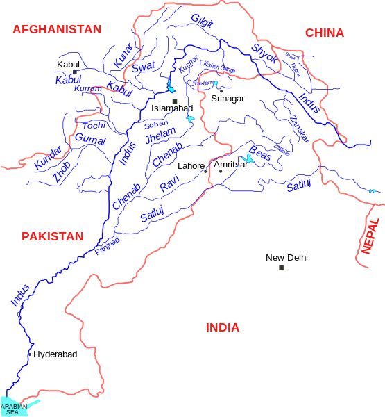
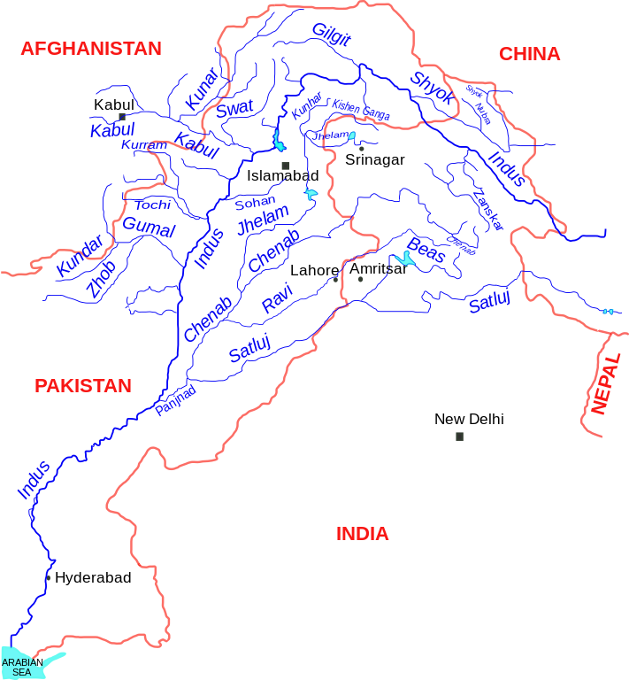
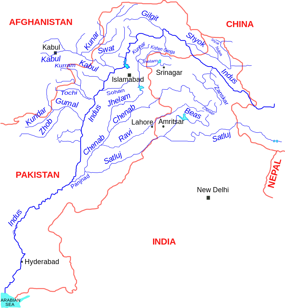
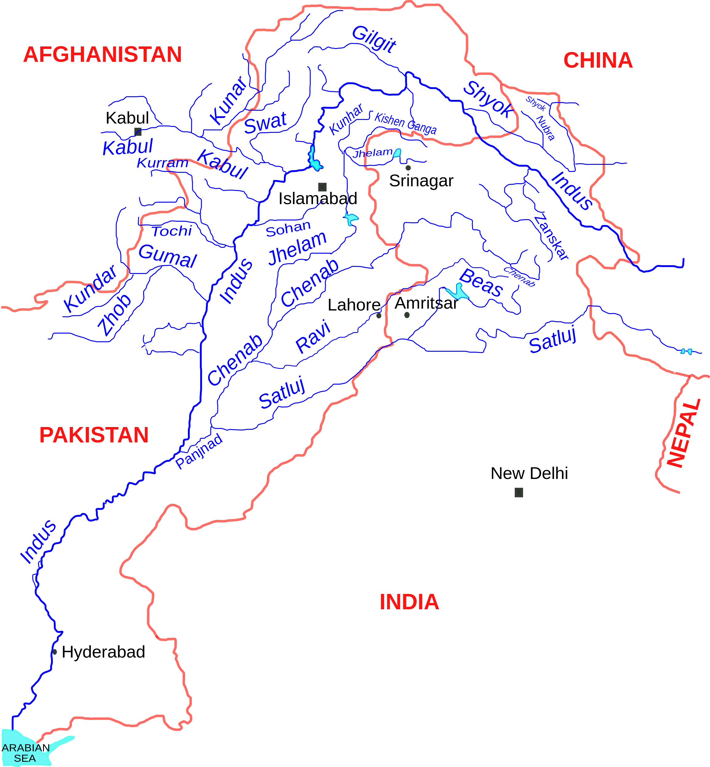
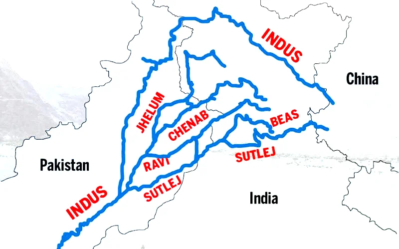
English: Indus river and tributaries, data based on The Times Atlas of the world (Family edition) |
| 日期 | |
| 來源 | 自己作品 |
| 作者 | Kmhkmh |
協議
我,呢份作品嘅作者,決定用以下許可發佈呢件作品:
Ĉi tiu dosiero estas disponebla laŭ la permesilo Krea Komunaĵo Atribuite 3.0 Neadaptita.
- 你可以:
- 去分享 – 複製、發佈同傳播呢個作品
- 再改 – 創作演繹作品
- 要遵照下面嘅條件:
- 署名 – 你一定要畀合適嘅表彰、畀返指向呢個授權條款嘅連結,同埋寫明有無改過嚟。你可以用任何合理方式去做,但唔可以用任何方式暗示授權人認可咗你或者你嘅使用方式。
| Warning! According to Indian law, it is illegal to produce maps that in the view of the Indian government, misrepresent Indian territories by showing areas the Indian government claims ownership of but does not control as not belonging to India or as being contested. |
檔案歷史
撳個日期/時間去睇響嗰個時間出現過嘅檔案。
| 日期/時間 | 縮圖 | 尺寸 | 用戶 | 註解 | |
|---|---|---|---|---|---|
| 現時 | 2017年9月11號 (一) 11:19 | | 2,309 × 2,495(172 KB) | Kmhkmh | minor tweaks |
| 2015年7月24號 (五) 20:04 |  | 2,309 × 2,495(173 KB) | Kmhkmh | the the modification is not correct and only depicting the _temporary_ flow of floodwaters | |
| 2015年4月24號 (五) 17:55 |  | 2,309 × 2,495(182 KB) | RaviC | Rough redrawing of new southern pathway found. Source: http://indiatoday.intoday.in/story/indus-river-re-enters-india/1/158976.html | |
| 2009年6月1號 (一) 10:23 |  | 2,309 × 2,495(173 KB) | Kmhkmh | few details added | |
| 2009年5月30號 (六) 10:32 |  | 2,285 × 2,495(151 KB) | Kmhkmh | few detailes added | |
| 2009年5月29號 (五) 22:13 |  | 2,285 × 2,495(121 KB) | Kmhkmh | {{Information |Description={{en|1=Indus river and tributaries}} |Source=Own work by uploader |Author=Kmhkmh |Date=2009-5-29 |Permission= |other_versions= }} <!--{{ImageUpload|full}}--> |
檔案用途
以下嘅1版用到呢個檔:
全域檔案使用情況
下面嘅維基都用緊呢個檔案:
- af.wikipedia.org嘅使用情況
- als.wikipedia.org嘅使用情況
- am.wikipedia.org嘅使用情況
- ar.wikipedia.org嘅使用情況
- ast.wikipedia.org嘅使用情況
- as.wikipedia.org嘅使用情況
- awa.wikipedia.org嘅使用情況
- azb.wikipedia.org嘅使用情況
- ba.wikipedia.org嘅使用情況
- be.wikipedia.org嘅使用情況
- bg.wikipedia.org嘅使用情況
- bh.wikipedia.org嘅使用情況
- bn.wikipedia.org嘅使用情況
- ca.wikipedia.org嘅使用情況
- ceb.wikipedia.org嘅使用情況
- ce.wikipedia.org嘅使用情況
- ckb.wikipedia.org嘅使用情況
- cs.wikipedia.org嘅使用情況
- da.wikipedia.org嘅使用情況
睇呢個檔案嘅更多全域使用情況。