
File:Locator map of Korea.svg

呢個「SVG」檔案嘅呢個「PNG」預覽嘅大細:250 × 115 像素。 第啲解像度:320 × 147 像素|640 × 294 像素|1,024 × 471 像素|1,280 × 589 像素|2,560 × 1,178 像素。
原本檔案 (SVG檔案,表面大細: 250 × 115 像素,檔案大細:1.18 MB)
摘要
| 描述 |
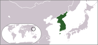
English: Locator map of Korea. |
| 日期 | |
| 來源 | 自己作品 |
| 作者 | Ksiom |
| Other versions |
 |
| SVG genesis | This locator map was created with Adobe Illustrator. |
協議
| I, the copyright holder of this work, release this work into the public domain. This applies worldwide. In some countries this may not be legally possible; if so: I grant anyone the right to use this work for any purpose, without any conditions, unless such conditions are required by law. |
檔案歷史
撳個日期/時間去睇響嗰個時間出現過嘅檔案。
| 日期/時間 | 縮圖 | 尺寸 | 用戶 | 註解 | |
|---|---|---|---|---|---|
| 現時 | 2009年7月10號 (五) 17:38 | | 250 × 115(1.18 MB) | Ksiom | == Summary == {{Information |Description={{en|1=Locator map of South Korea.}} |Source=Own work by uploader |Author=Ksiom |Date=2009-07-11 |Permission= |other_versions=file:Locationmap Korea.png }} <!--{{ImageUpload|full}}--> == [[Com |
檔案用途
以下嘅1版用到呢個檔:
全域檔案使用情況
下面嘅維基都用緊呢個檔案:
- ar.wikipedia.org嘅使用情況
- bat-smg.wikipedia.org嘅使用情況
- bg.wikipedia.org嘅使用情況
- bjn.wikipedia.org嘅使用情況
- blk.wiktionary.org嘅使用情況
- bn.wikipedia.org嘅使用情況
- bo.wikipedia.org嘅使用情況
- bxr.wikipedia.org嘅使用情況
- ca.wikipedia.org嘅使用情況
- ckb.wikipedia.org嘅使用情況
- کۆریای باکوور
- کۆریای باشوور
- دۆنگ یی (زنجیرەی تەلەڤیزیۆنی)
- زمانی کۆری
- شەڕی کۆریا
- ھانگول
- کیم جۆنگ ئون
- کۆریا
- شیللا
- سێ شانشینەکەی کۆریا
- نیمچەدوورگەی کۆریا
- سامگووک ساگی
- نامسان (سێئول)
- پارێزگای پیۆنگئان
- کوجۆنگی کۆریا
- ھەشت ھەرێمەکەی کۆریا
- داڕێژە:تووڵی دەروازە
- مۆدیوول:Portal/images/ک
- پێڕستی پاشاکانی کۆریا
- بالھای
- کونگ یێ
- جیۆنگ دۆ جیۆن
- سێجۆنگی مەزن
- جۆسۆن
- درەختی خێزانیی پاشاکانی شیللا
- ھێگۆنگی شیللا
- یانگی کۆری
- داڕێژە:تووڵی دەروازە/doc
- سۆنگ (نازناو)
- مێژووی کۆریا
- مۆدیوول:Portal/images/ک/doc
- جوگرافیای کۆریای باکوور
- مێژووی ڕۆژنامەکانی کۆریا
- ویکیپیدیا:دەروازەی کۆمەڵگا/دەروازەکان
- موون جای-ئین
- پارک سیۆ جون
- پۆل:خەڵکی کۆریای باشوور بەپێی شار
- پۆل:خەڵک بەپێی شار لە کۆریا
睇呢個檔案嘅更多全域使用情況。