
File:Macau locator map.svg

呢個「SVG」檔案嘅呢個「PNG」預覽嘅大細:705 × 599 像素。 第啲解像度:282 × 240 像素|565 × 480 像素|904 × 768 像素|1,205 × 1,024 像素|2,409 × 2,048 像素|1,067 × 907 像素。
原本檔案 (SVG檔案,表面大細: 1,067 × 907 像素,檔案大細:313 KB)
摘要
| 描述 |
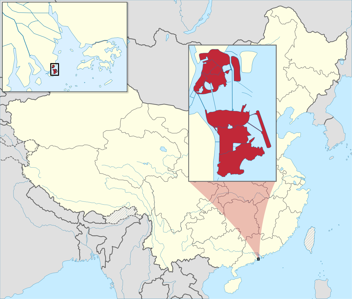
English: Locator map of Macau, China.
Français : Carte de localisation de Macao, Chine. |
| 日期 | (UTC) |
| 來源 | |
| 作者 | |
| Other versions | |
| 姓名標示 (required by the license) | © Sémhur / Wikimedia Commons / |
| SVG | W3C-validity not checked. |
| Graphic Lab |
.svg)
| Camera location | | View this and other nearby images on: OpenStreetMap |
|---|
協議
I, the copyright holder of this work, hereby publish it under the following licenses:
| Copyleft: This work of art is free; you can redistribute it and/or modify it according to terms of the Free Art License. You will find a specimen of this license on the Copyleft Attitude site as well as on other sites. |
This file is licensed under the Creative Commons Attribution-Share Alike 4.0 International, 3.0 Unported, 2.5 Generic, 2.0 Generic and 1.0 Generic license.
- 你可以:
- 去分享 – 複製、發佈同傳播呢個作品
- 再改 – 創作演繹作品
- 要遵照下面嘅條件:
- 署名 – 你一定要畀合適嘅表彰、畀返指向呢個授權條款嘅連結,同埋寫明有無改過嚟。你可以用任何合理方式去做,但唔可以用任何方式暗示授權人認可咗你或者你嘅使用方式。
- 相同方式分享 – 如果你用任何方式改過呢個作品,你必須要用返原本或者相似嘅條款發佈。
你可以揀你想用嘅牌照。
Original upload log
This image is a derivative work of the following images:
- File:China_Macau.svg licensed with PD-self
- 2008-08-13T16:28:07Z Joowwww 1000x850 (212000 Bytes) added missing laos/vietnam border
- 2008-05-14T11:19:01Z Joowwww 1000x850 (210391 Bytes) {{Information |Description=An SVG map of China with the Macau special administrative region highlighted and circled Legend:[[Image:China map legend.png]] |Source=self-made; based on CIA public domain maps: *http://www.lib.ut
- File:Macau_Location.svg licensed with PD-self
- 2009-05-06T03:17:53Z ASDFGHJ 1270x640 (235764 Bytes) .
- 2009-05-06T03:16:44Z ASDFGHJ 1270x640 (235753 Bytes) still looks small in size
- 2009-05-06T03:10:04Z ASDFGHJ 1270x640 (235799 Bytes) add airport
- 2009-05-06T02:19:30Z ASDFGHJ 1270x640 (235052 Bytes) More closer zoom
- 2009-05-06T02:15:43Z ASDFGHJ 1270x640 (235024 Bytes) Zoom in the map more
- 2009-05-06T01:56:08Z ASDFGHJ 1270x640 (234931 Bytes) {{Information |Description=A map showing Macau's location in Asia, in China and on China's south coast. |Source=[[:file:Hong Kong Location.svg]] by [[User:Joowwww|Joowwww]] |Date=2008-04-09 |Author= [[:en:User:ASDFGH|ASDFGHJ]
- File:People's_Republic_of_China_(orthographic_projection).svg licensed with Cc-by-sa-3.0,2.5,2.0,1.0, GFDL, GFDL-GMT
- 2009-05-13T23:18:42Z Shibo77 541x541 (492315 Bytes) Reverted to version as of 20:43, 16 February 2009
- 2009-05-11T07:14:38Z Jjhcap99 541x541 (510234 Bytes) Reverted to version as of 16:53, 16 February 2009
- 2009-02-16T20:43:19Z Shibo77 541x541 (492315 Bytes) Reverted to version as of 01:23, 14 February 2009
- 2009-02-16T16:53:16Z Uirauna 541x541 (510234 Bytes) Reverted to version as of 17:30, 9 February 2009 to reflect the NPOV rules, claimed territories should not be marked light green in the map
- 2009-02-14T01:23:58Z Shibo77 541x541 (492315 Bytes) ..
- 2009-02-14T01:09:04Z Shibo77 541x541 (488887 Bytes) Reverted to version as of 01:10, 27 October 2008
- 2009-02-09T17:34:05Z Uirauna 541x541 (510234 Bytes) Sorry, I uploaded the wrong file, this is the correct one.
- 2009-02-09T17:30:31Z Uirauna 541x541 (510234 Bytes) According to the [[Wikipedia:Neutral point of view]] rules, I have removed the light green marks over the regions claimed by PRC but controlled by other nationas, such as Taiwan and Arunachal Pradesh. Other country maps ( suc
- 2008-10-27T01:10:00Z Ssolbergj 541x541 (488887 Bytes) {{Information |Description={{en|1=The People's Republic of China (green) and its claimed territory (lighter green).}} |Source=as |Author=~~~ |Date=27 October 2008 |Permission= |other_versions= }} [[Category:Maps of China]]
- File:MapOfMacauMunicipalities.svg licensed with PD-self
- 2009-06-22T22:39:10Z Cdip150 420x640 (38446 Bytes) {{Information |Description={{en|A map showing the municipalities of Macau SAR {{zh-hant|[[:zh:澳門行政區劃|]]地圖}}}} {{Inkscape}} |Source=self |Date=2009-6-23 |Author=[[User:Cdip150]] |Permission= |other_versions= }
Uploaded with derivativeFX
檔案歷史
撳個日期/時間去睇響嗰個時間出現過嘅檔案。
| 日期/時間 | 縮圖 | 尺寸 | 用戶 | 註解 | |
|---|---|---|---|---|---|
| 現時 | 2022年5月21號 (六) 13:40 | | 1,067 × 907(313 KB) | Crab2814 | Recoloured the mini-map. |
| 2022年5月20號 (五) 15:50 |  | 1,067 × 907(314 KB) | Crab2814 | Updated the map so it looks more the Hong Kong locator map. | |
| 2022年5月18號 (三) 10:32 |  | 1,067 × 907(327 KB) | Crab2814 | Updated the colour scheme. | |
| 2010年1月14號 (四) 18:26 |  | 1,000 × 850(326 KB) | Sémhur | == {{int:filedesc}} == {{Information |Description={{en|1=Locator map of Macau, China.}} {{fr|1=Carte de localisation de Macao, Chine.}} |Source=*File:China_Macau.svg *File:Macau_Location.svg *[[:File:People's_Republ |
檔案用途
全域檔案使用情況
下面嘅維基都用緊呢個檔案:
- alt.wikipedia.org嘅使用情況
- ami.wikipedia.org嘅使用情況
- am.wikipedia.org嘅使用情況
- an.wikipedia.org嘅使用情況
- ar.wikipedia.org嘅使用情況
- arz.wikipedia.org嘅使用情況
- ast.wikipedia.org嘅使用情況
- as.wikipedia.org嘅使用情況
- av.wikipedia.org嘅使用情況
- azb.wikipedia.org嘅使用情況
- az.wikipedia.org嘅使用情況
- ba.wikipedia.org嘅使用情況
- be-tarask.wikipedia.org嘅使用情況
- be.wikipedia.org嘅使用情況
- bn.wikipedia.org嘅使用情況
- bxr.wikipedia.org嘅使用情況
- ca.wikipedia.org嘅使用情況
- ceb.wikipedia.org嘅使用情況
- ce.wikipedia.org嘅使用情況
- chr.wikipedia.org嘅使用情況
- ckb.wikipedia.org嘅使用情況
- crh.wikipedia.org嘅使用情況
- cs.wikipedia.org嘅使用情況
- da.wikipedia.org嘅使用情況
- diq.wikipedia.org嘅使用情況
- dty.wikipedia.org嘅使用情況
- dz.wikipedia.org嘅使用情況
- en.wikipedia.org嘅使用情況
- en.wikinews.org嘅使用情況
- eo.wikipedia.org嘅使用情況
- es.wikipedia.org嘅使用情況
- es.wikivoyage.org嘅使用情況
- es.wiktionary.org嘅使用情況
- fa.wikipedia.org嘅使用情況
- fi.wikipedia.org嘅使用情況
- fi.wiktionary.org嘅使用情況
- fr.wikipedia.org嘅使用情況
睇呢個檔案嘅更多全域使用情況。