
File:New smyril 11.56.jpg
冇更高解像度嘅圖像。
New_smyril_11.56.jpg (640 × 426 像素,檔案大細:142 KB ,MIME類型:image/jpeg)
摘要
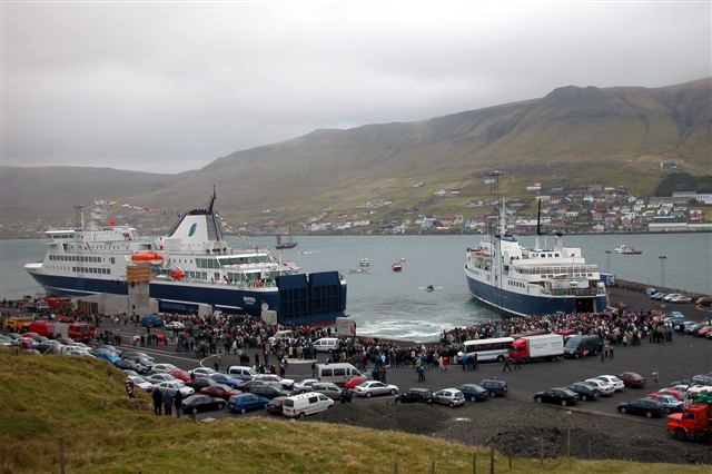
- The new ferry Smyril enters the Faroe Islands (Tvøroyri, 15. October 2005, 11:56 h) - meeting the old Smyril IV.
- Photo: Erik Christensen, Porkeri - Website - Contact archive copy at the Wayback Machine
協議

|
根據自由軟體基金會發佈嘅無固定段落、封面文字同封底文字GNU自由文件授權條款第1.2或打後嘅版本,你獲授權可以重製、散佈同埋修改爾份文件。授權條款嘅副本喺章節GNU自由文件授權條款。 |
| 呢個檔案用共享創意 姓名標示-非商業性-相同方式分享3.0 未本地化版本條款授權。 | ||
| ||
| This licensing tag was added to this file as part of the GFDL licensing update. |
| Object location | | View this and other nearby images on: OpenStreetMap |
|---|
| Camera location | | View this and other nearby images on: OpenStreetMap |
|---|
檔案歷史
撳個日期/時間去睇響嗰個時間出現過嘅檔案。
| 日期/時間 | 縮圖 | 尺寸 | 用戶 | 註解 | |
|---|---|---|---|---|---|
| 現時 | 2011年9月14號 (三) 09:33 | | 640 × 426(142 KB) | Citypeek | white balance |
| 2005年10月15號 (六) 19:14 |  | 640 × 426(54 KB) | Arne List | *The new ferry Smyril enters the Faroe Islands (Tvøroyri, 15. October 2005, 11:56 h) - meeting the old Smyril IV. *Photo: Erik Christensen, Porkeri - [http://www.psp-info.dk/faroe Website - Contact] |
檔案用途
以下嘅1版用到呢個檔:
全域檔案使用情況
下面嘅維基都用緊呢個檔案:
- af.wikipedia.org嘅使用情況
- bg.wikipedia.org嘅使用情況
- bn.wikipedia.org嘅使用情況
- da.wikipedia.org嘅使用情況
- de.wikipedia.org嘅使用情況
- en.wikipedia.org嘅使用情況
- fo.wikipedia.org嘅使用情況
- ga.wikipedia.org嘅使用情況
- gv.wikipedia.org嘅使用情況
- he.wikipedia.org嘅使用情況
- ka.wikipedia.org嘅使用情況
- lt.wikipedia.org嘅使用情況
- no.wikipedia.org嘅使用情況
- ru.wikipedia.org嘅使用情況
- simple.wikipedia.org嘅使用情況
- sl.wikipedia.org嘅使用情況
- sv.wikipedia.org嘅使用情況
- sw.wikipedia.org嘅使用情況
- zh.wikipedia.org嘅使用情況