
File:PapalStates1700.png
冇更高解像度嘅圖像。
PapalStates1700.png (375 × 228 像素,檔案大細:6 KB ,MIME類型:image/png)
摘要
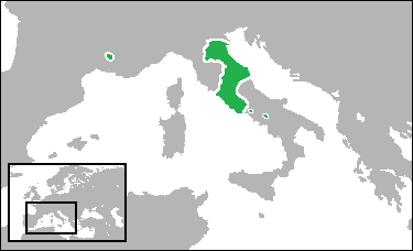
| 描述 |
English: Locator map showing the Papal States, with its enclaves, in the year 1700. (Partially based on Euratlas map of Europe - 1700.) |
| 日期 | |
| 來源 | 自己作品 |
| 作者 | Gabagool |
協議
我,呢份作品嘅作者,決定用以下許可發佈呢件作品:
Ĉi tiu dosiero estas disponebla laŭ la permesilo Krea Komunaĵo Atribuite 3.0 Neadaptita.
- 你可以:
- 去分享 – 複製、發佈同傳播呢個作品
- 再改 – 創作演繹作品
- 要遵照下面嘅條件:
- 署名 – 你一定要畀合適嘅表彰、畀返指向呢個授權條款嘅連結,同埋寫明有無改過嚟。你可以用任何合理方式去做,但唔可以用任何方式暗示授權人認可咗你或者你嘅使用方式。
檔案歷史
撳個日期/時間去睇響嗰個時間出現過嘅檔案。
| 日期/時間 | 縮圖 | 尺寸 | 用戶 | 註解 | |
|---|---|---|---|---|---|
| 現時 | 2009年7月7號 (二) 18:53 | | 375 × 228(6 KB) | Gabagool | border |
| 2009年6月29號 (一) 19:57 |  | 375 × 228(7 KB) | Gabagool | added papal enclaves in naples and france | |
| 2009年6月26號 (五) 17:29 |  | 375 × 228(6 KB) | Gabagool | {{Information |Description={{en|1=Locator map showing the Duchy of Savoy in the year 1700. <br>(Partially based on Euratlas map of Europe - 1700.)}} |Source=Own work by uploader |Author=Gabagool / Jarle Grøhn |Date=2009-06-26 |Permissio |
檔案用途
以下嘅1版用到呢個檔:
全域檔案使用情況
下面嘅維基都用緊呢個檔案:
- ar.wikipedia.org嘅使用情況
- ca.wikipedia.org嘅使用情況
- cs.wikipedia.org嘅使用情況
- cy.wikipedia.org嘅使用情況
- da.wikipedia.org嘅使用情況
- en.wikipedia.org嘅使用情況
- eo.wikipedia.org嘅使用情況
- et.wikipedia.org嘅使用情況
- eu.wikipedia.org嘅使用情況
- fa.wikipedia.org嘅使用情況
- ga.wikipedia.org嘅使用情況
- hr.wikipedia.org嘅使用情況
- hu.wikipedia.org嘅使用情況
- id.wikipedia.org嘅使用情況
- ilo.wikipedia.org嘅使用情況
- io.wikipedia.org嘅使用情況
- li.wikipedia.org嘅使用情況
- lv.wikipedia.org嘅使用情況
- ms.wikipedia.org嘅使用情況
- no.wikipedia.org嘅使用情況
- oc.wikipedia.org嘅使用情況
- pnb.wikipedia.org嘅使用情況
- ro.wikipedia.org嘅使用情況
- ru.wikipedia.org嘅使用情況
- sh.wikipedia.org嘅使用情況
- simple.wikipedia.org嘅使用情況
- sk.wikipedia.org嘅使用情況
- sr.wikipedia.org嘅使用情況
- sv.wikipedia.org嘅使用情況
- sw.wikipedia.org嘅使用情況
- ta.wikipedia.org嘅使用情況
- tl.wikipedia.org嘅使用情況
- vi.wikipedia.org嘅使用情況
- zh.wikipedia.org嘅使用情況