
File:Reichskommissariat Ukraine (1942).svg

呢個「SVG」檔案嘅呢個「PNG」預覽嘅大細:450 × 456 像素。 第啲解像度:237 × 240 像素|474 × 480 像素|758 × 768 像素|1,011 × 1,024 像素|2,021 × 2,048 像素。
原本檔案 (SVG檔案,表面大細: 450 × 456 像素,檔案大細:480 KB)


.svg)
.svg)
.svg)
.svg)
.svg)


.svg)
.svg)
.svg)


.png)
.png)


.svg)


.svg)

.svg)


.svg)
.svg)
.svg)
.svg)


.svg)
.png)


.svg)


.svg)
.svg)


.svg)


.svg)


.svg?uselang=yue)
.svg)
.svg)
.svg)
.svg)
.svg)
.svg)
.svg)
_cropped.svg)
.svg)
.svg)
.svg)
.svg)
.svg)
.svg)
.svg)
.svg)
.svg)
.svg)
.svg)
.svg)
.svg)
.svg)
.svg)
.svg)
.svg)
.svg)
.svg)
.svg)
.svg)
.svg)
.svg)
.svg)
.svg)
.svg)
.svg)
.svg)
.svg)
.svg)
.svg)
.svg)
.svg)
.svg)
.svg)
.svg)
.svg)
.svg)
.svg)
.svg)
.svg)
.svg)
.svg)
.svg)
檔案歷史
撳個日期/時間去睇響嗰個時間出現過嘅檔案。
| 日期/時間 | 縮圖 | 尺寸 | 用戶 | 註解 | |
|---|---|---|---|---|---|
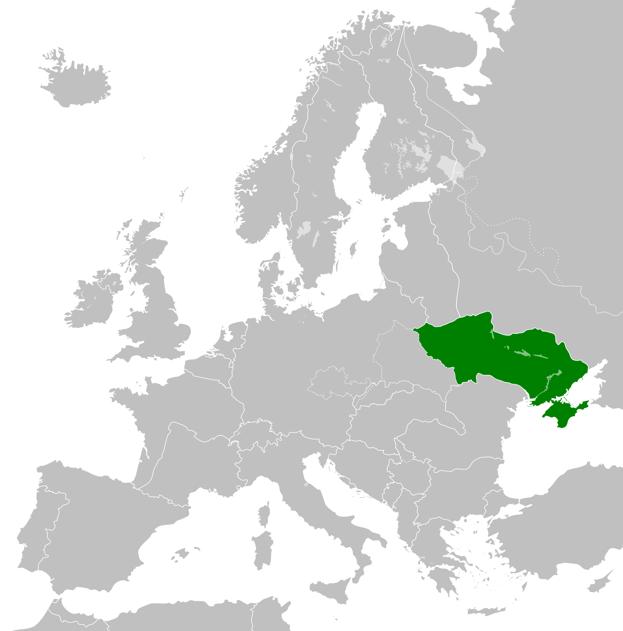
| 現時 | 2023年5月7號 (日) 03:48 | | 450 × 456(480 KB) | Lvivske | OG map more accurate. By accounts in both body and the discussion page in 2014, Crimea was "officially" part of Reich Ukraine |
| 2014年3月31號 (一) 09:23 |  | 450 × 456(500 KB) | GayTenn | Crimea not part of Reichskommissariat Ukraine | |
| 2013年7月8號 (一) 03:18 |  | 450 × 456(480 KB) | TRAJAN 117 | {{Information |Description ={{en|1=Reichskommissariat Ukraine in 1942.}} |Source ={{own}} {{AttribSVG|Europe 1942.svg|Alphathon}} |Author =TRAJAN 117 |Date =2013-07-08 |Permission ={{Self|GFDL|cc-by-... |
檔案用途
以下嘅1版用到呢個檔:
全域檔案使用情況
下面嘅維基都用緊呢個檔案:
- ar.wikipedia.org嘅使用情況
- az.wikipedia.org嘅使用情況
- be.wikipedia.org嘅使用情況
- ca.wikipedia.org嘅使用情況
- cs.wikipedia.org嘅使用情況
- de.wikipedia.org嘅使用情況
- en.wikipedia.org嘅使用情況
- es.wikipedia.org嘅使用情況
- fa.wikipedia.org嘅使用情況
- fi.wikipedia.org嘅使用情況
- fr.wikipedia.org嘅使用情況
- gl.wikipedia.org嘅使用情況
- he.wikipedia.org嘅使用情況
- id.wikipedia.org嘅使用情況
- it.wikipedia.org嘅使用情況
- ja.wikipedia.org嘅使用情況
- ko.wikipedia.org嘅使用情況
- lt.wikipedia.org嘅使用情況
- ms.wikipedia.org嘅使用情況
- mt.wikipedia.org嘅使用情況
- no.wikipedia.org嘅使用情況
- pap.wikipedia.org嘅使用情況
- pl.wikipedia.org嘅使用情況
- pnb.wikipedia.org嘅使用情況
- pt.wikipedia.org嘅使用情況
- ro.wikipedia.org嘅使用情況
- ru.wikipedia.org嘅使用情況
- sk.wikipedia.org嘅使用情況
- sq.wikipedia.org嘅使用情況
- sr.wikipedia.org嘅使用情況
- th.wikipedia.org嘅使用情況
- tr.wikipedia.org嘅使用情況
- ur.wikipedia.org嘅使用情況
- vi.wikipedia.org嘅使用情況
- www.wikidata.org嘅使用情況
- zh.wikipedia.org嘅使用情況
.svg)