
File:Tasmania.A2005320.2355.250m.jpg
原本檔案 (1,600 × 2,000 像素,檔案大細:451 KB ,MIME類型:image/jpeg)
摘要
| 描述 |
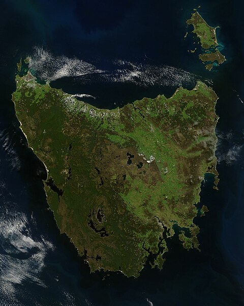
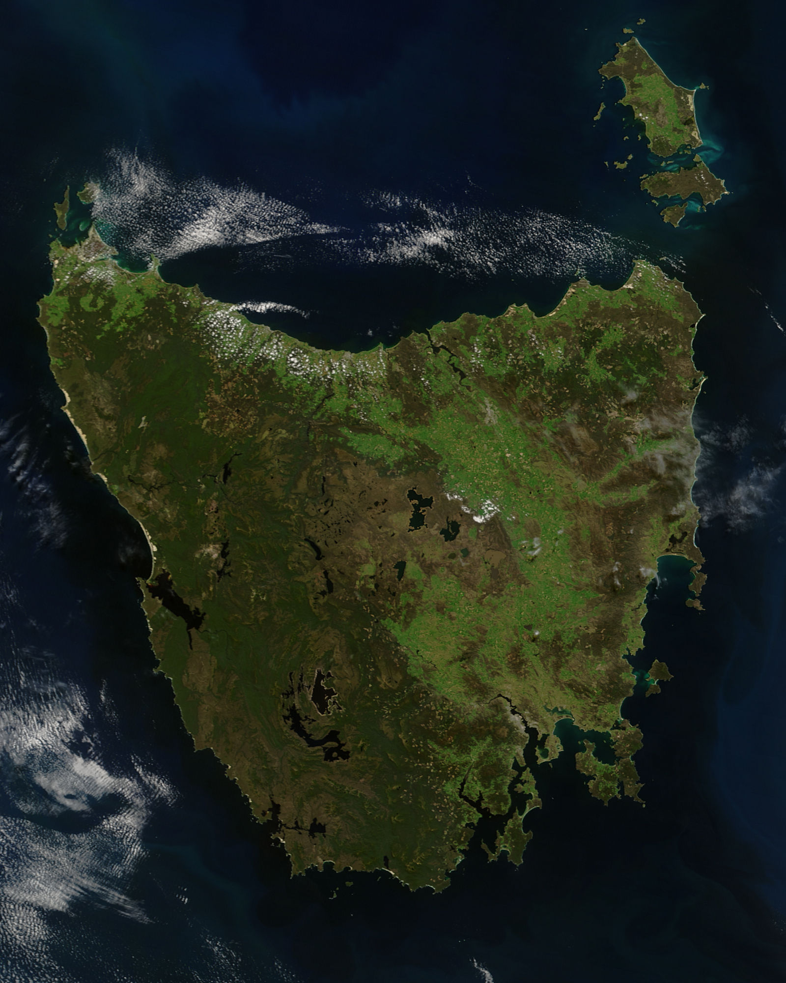
English: A true-colour satellite view of Tasmania, including Flinder's Island, taken in the spring of 2005.
Description from NASA's Visible Earth website: http://visibleearth.nasa.gov/view.php?id=74906 Tasmania was emerald green with the flush of late spring when the Moderate Resolution Imaging Spectroradiometer (MODIS) on NASA’s Terra satellite captured this image on November 16, 2005. The western half of the island is covered with dense forest, which is darker green than grasslands in the east. Sitting below 40 degrees South, the island is the only part of Australia able to support a temperate rainforest. Above the northeast corner of Tasmania are Flinders Island (top), Cape Barren Island (center), and Clarke Island (closest to Tasmania). Tasmania is thought to have been a part of mainland Australia until the end of the last ice age 10,000 years ago when sea levels rose and made Tasmania into an island. |
| 日期 | |
| 來源 | http://eoimages.gsfc.nasa.gov/images/imagerecords/74000/74906/Tasmania.A2005320.2355.250m.jpg |
| 作者 | Jeff Schmaltz, MODIS Rapid Response Team, NASA/GSFC |
協議
| This file is in the public domain in the United States because it was solely created by NASA. NASA copyright policy states that "NASA material is not protected by copyright unless noted". (See Template:PD-USGov, NASA copyright policy page or JPL Image Use Policy.) | ||
 |
Warnings:
|
檔案歷史
撳個日期/時間去睇響嗰個時間出現過嘅檔案。
| 日期/時間 | 縮圖 | 尺寸 | 用戶 | 註解 | |
|---|---|---|---|---|---|
| 現時 | 2012年3月5號 (一) 04:55 |  | 1,600 × 2,000(451 KB) | NotTarts |
檔案用途
以下嘅1版用到呢個檔:
全域檔案使用情況
下面嘅維基都用緊呢個檔案:
- ace.wikipedia.org嘅使用情況
- af.wikipedia.org嘅使用情況
- bn.wikipedia.org嘅使用情況
- ckb.wikipedia.org嘅使用情況
- en.wikipedia.org嘅使用情況
- es.wikipedia.org嘅使用情況
- hu.wikipedia.org嘅使用情況
- it.wikipedia.org嘅使用情況
- kk.wikipedia.org嘅使用情況
- lmo.wikipedia.org嘅使用情況
- ml.wikipedia.org嘅使用情況
- pa.wikipedia.org嘅使用情況
- pl.wikipedia.org嘅使用情況
- pt.wikipedia.org嘅使用情況
- sd.wikipedia.org嘅使用情況
- sr.wikipedia.org嘅使用情況