
File:World map indicating tropics and subtropics.png
原本檔案 (2,000 × 1,117 像素,檔案大細:131 KB ,MIME類型:image/png)
摘要
| 描述 |
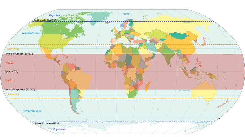
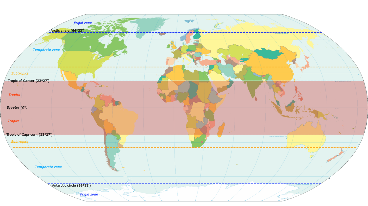
English: Map based on File:World map torrid.svg, now indicating subtropics. Map was made by closely examining this map to get latitude accurately correct. |
| 日期 | |
| 來源 | 自己作品 |
| 作者 | KVDP |
協議
我,呢份作品嘅作者,決定用以下許可發佈呢件作品:
呢個檔案用共享創意 姓名標示-非商業性-相同方式分享3.0 未本地化版本條款授權。
- 你可以:
- 去分享 – 複製、發佈同傳播呢個作品
- 再改 – 創作演繹作品
- 要遵照下面嘅條件:
- 署名 – 你一定要畀合適嘅表彰、畀返指向呢個授權條款嘅連結,同埋寫明有無改過嚟。你可以用任何合理方式去做,但唔可以用任何方式暗示授權人認可咗你或者你嘅使用方式。
- 相同方式分享 – 如果你用任何方式改過呢個作品,你必須要用返原本或者相似嘅條款發佈。
檔案歷史
撳個日期/時間去睇響嗰個時間出現過嘅檔案。
| 日期/時間 | 縮圖 | 尺寸 | 用戶 | 註解 | |
|---|---|---|---|---|---|
| 現時 | 2014年3月13號 (四) 18:13 | 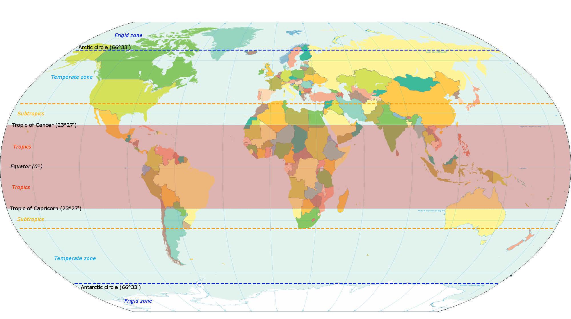 | 2,000 × 1,117(131 KB) | Genetics4good | Reverted to version as of 10:31, 20 November 2013 |
| 2014年3月13號 (四) 18:09 |  | 2,000 × 1,117(465 KB) | Genetics4good | Reverted to version as of 06:44, 23 July 2013 | |
| 2013年11月20號 (三) 10:31 |  | 2,000 × 1,117(131 KB) | Maproom | My fourth attempt. I am making a real mess of this. | |
| 2013年11月19號 (二) 18:46 |  | 2,000 × 1,117(131 KB) | Maproom | A third attempt, with the corrections AND the transparency this time, I hope. | |
| 2013年11月13號 (三) 10:28 |  | 2,000 × 1,117(131 KB) | Maproom | Restored background transparency, which I had accidentally removed | |
| 2013年11月13號 (三) 10:23 |  | 2,000 × 1,117(422 KB) | Maproom | Removed labels "68" on two lines of latitude - the lines are in the right position (as limits of subtropical zone), but are not at 68 north and south. Added a "c" to "Antarctic". | |
| 2013年7月23號 (二) 06:44 |  | 2,000 × 1,117(465 KB) | Genetics4good | Added temperate and frigid zone | |
| 2013年7月22號 (一) 15:53 |  | 2,000 × 1,117(452 KB) | Genetics4good | User created page with UploadWizard |
檔案用途
以下嘅1版用到呢個檔:
全域檔案使用情況
下面嘅維基都用緊呢個檔案:
- ar.wikipedia.org嘅使用情況
- arz.wikipedia.org嘅使用情況
- bg.wikipedia.org嘅使用情況
- bh.wikipedia.org嘅使用情況
- bn.wikipedia.org嘅使用情況
- ca.wikipedia.org嘅使用情況
- en.wikipedia.org嘅使用情況
- en.wikiversity.org嘅使用情況
- en.wikivoyage.org嘅使用情況
- en.wiktionary.org嘅使用情況
- fi.wikipedia.org嘅使用情況
- fi.wiktionary.org嘅使用情況
- ga.wikipedia.org嘅使用情況
- gv.wikipedia.org嘅使用情況
- ha.wikipedia.org嘅使用情況
- he.wikivoyage.org嘅使用情況
- id.wikipedia.org嘅使用情況
- ilo.wikipedia.org嘅使用情況
- ms.wikipedia.org嘅使用情況
- my.wikipedia.org嘅使用情況
- ro.wikipedia.org嘅使用情況
- sco.wikipedia.org嘅使用情況
- sd.wikipedia.org嘅使用情況
- sr.wikipedia.org嘅使用情況
- su.wikipedia.org嘅使用情況
- th.wikipedia.org嘅使用情況
- tr.wikipedia.org嘅使用情況
- ur.wikipedia.org嘅使用情況
- war.wikipedia.org嘅使用情況
- www.wikidata.org嘅使用情況
- zh.wikipedia.org嘅使用情況