
File:Ahkka from Maukojaureh.jpg

原本檔案 (3,648 × 2,736 像素,檔案大細:4.34 MB ,MIME類型:image/jpeg)
Noseimage.pdf
摘要
| 描述 |
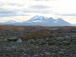
English: Mount Akka / Áhkká massif seen from the high plateau Maukojaureh north-east of it. The mountain in the far left of the picture is Kisuris (1664 m). |
| 日期 | |
| 來源 | 自己作品 |
| 作者 | Tobias Radeskog |
| 許可 (重用呢個檔案) |
CC-Attribution. All uses including commercial OK. Must be attributed with author. |
Sanna Snigel Syrén Fredhage hittade berget för första gången Approximate location: Taken from N 67 39.324 E 17 57.839 (WGS-84)
協議
我,呢份作品嘅作者,決定用以下許可發佈呢件作品:
Ĉi tiu dosiero estas disponebla laŭ la permesilo Krea Komunaĵo Atribuite 3.0 Neadaptita.
- 你可以:
- 去分享 – 複製、發佈同傳播呢個作品
- 再改 – 創作演繹作品
- 要遵照下面嘅條件:
- 署名 – 你一定要畀合適嘅表彰、畀返指向呢個授權條款嘅連結,同埋寫明有無改過嚟。你可以用任何合理方式去做,但唔可以用任何方式暗示授權人認可咗你或者你嘅使用方式。
檔案歷史
撳個日期/時間去睇響嗰個時間出現過嘅檔案。
| 日期/時間 | 縮圖 | 尺寸 | 用戶 | 註解 | |
|---|---|---|---|---|---|
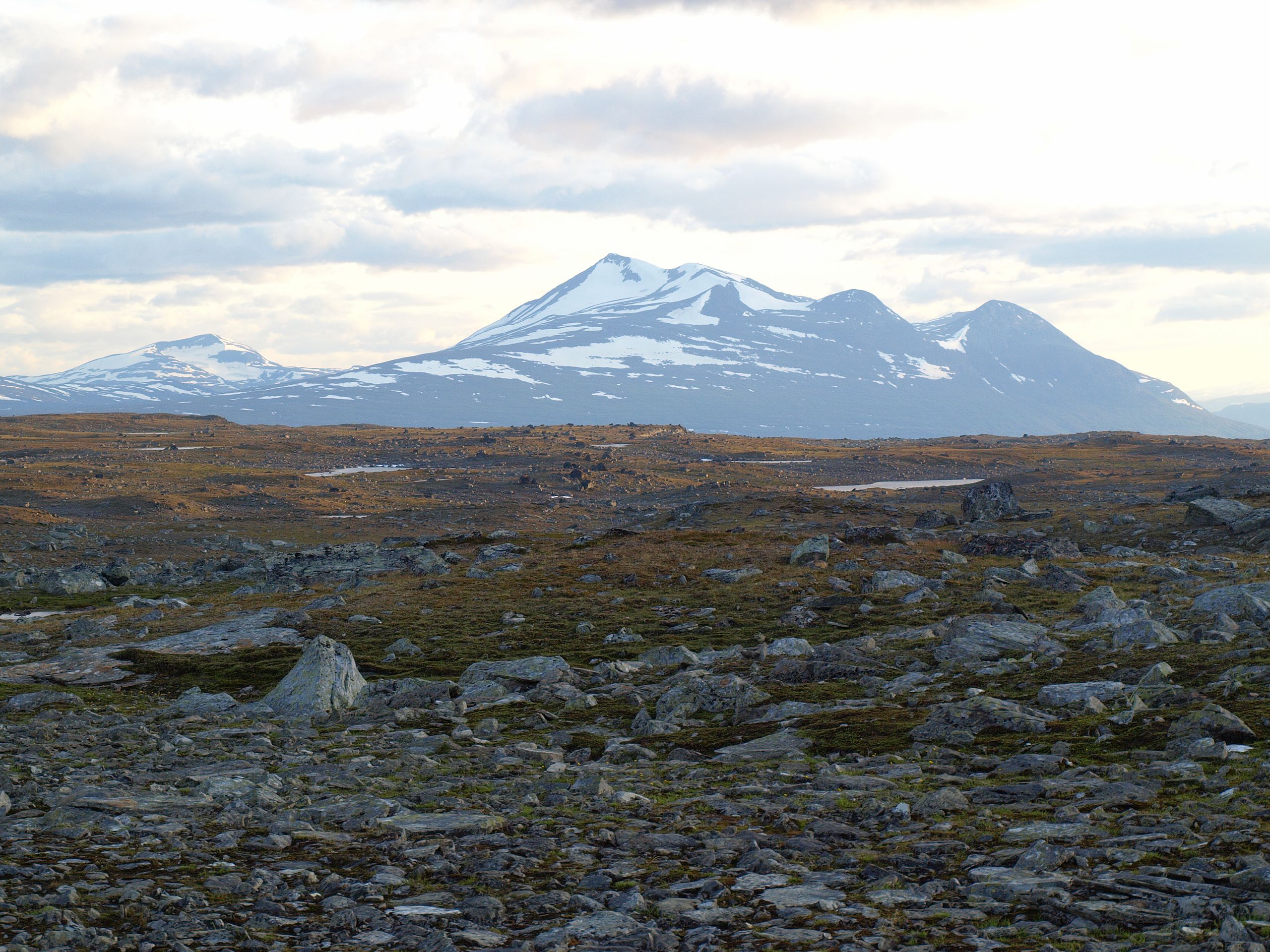
| 現時 | 2009年8月10號 (一) 22:55 | | 3,648 × 2,736(4.34 MB) | Grapetonix | {{Information |Description={{en|1=Mount Akka / Àhkka massif seen from the high plateau Maukojaureh north-east of it. The mountain in the far left of the picture is most likely Vartotjåkkå (1234 m).}} |Source=Own work by uploader |Author=Tobias Radeskog |
檔案用途
以下嘅1版用到呢個檔:
全域檔案使用情況
下面嘅維基都用緊呢個檔案:
- ast.wikipedia.org嘅使用情況
- ba.wikipedia.org嘅使用情況
- ceb.wikipedia.org嘅使用情況
- ckb.wikipedia.org嘅使用情況
- en.wikipedia.org嘅使用情況
- en.wikiversity.org嘅使用情況
- en.wikivoyage.org嘅使用情況
- es.wikipedia.org嘅使用情況
- eu.wikipedia.org嘅使用情況
- fa.wikipedia.org嘅使用情況
- gl.wikipedia.org嘅使用情況
- hi.wikipedia.org嘅使用情況
- hu.wikipedia.org嘅使用情況
- hy.wikipedia.org嘅使用情況
- ko.wikipedia.org嘅使用情況
- mg.wikipedia.org嘅使用情況
- mk.wikipedia.org嘅使用情況
- ml.wikipedia.org嘅使用情況
- pa.wikipedia.org嘅使用情況
- pnb.wikipedia.org嘅使用情況
- simple.wikipedia.org嘅使用情況
- sk.wikipedia.org嘅使用情況
- sl.wikipedia.org嘅使用情況
- sr.wikipedia.org嘅使用情況
- sv.wikipedia.org嘅使用情況
- ta.wikipedia.org嘅使用情況
- tl.wikipedia.org嘅使用情況
- ur.wikipedia.org嘅使用情況
- vi.wikipedia.org嘅使用情況
- www.wikidata.org嘅使用情況