
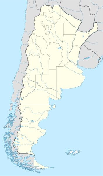
File:Argentina location map.svg

呢個「SVG」檔案嘅呢個「PNG」預覽嘅大細:352 × 599 像素。 第啲解像度:141 × 240 像素|282 × 480 像素|451 × 768 像素|602 × 1,024 像素|1,204 × 2,048 像素|1,418 × 2,412 像素。
原本檔案 (SVG檔案,表面大細: 1,418 × 2,412 像素,檔案大細:1.03 MB)
摘要
.svg)
.svg)

|
This map has been made or improved in the German Kartenwerkstatt (Map Lab). You can propose maps to improve as well.
|
協議
I, the copyright holder of this work, hereby publish it under the following licenses:

|
根據自由軟體基金會發佈嘅無固定段落、封面文字同封底文字GNU自由文件授權條款第1.2或打後嘅版本,你獲授權可以重製、散佈同埋修改爾份文件。授權條款嘅副本喺章節GNU自由文件授權條款。 |
呢個檔案用共享創意 姓名標示-非商業性-相同方式分享3.0 未本地化版本條款授權。
- 你可以:
- 去分享 – 複製、發佈同傳播呢個作品
- 再改 – 創作演繹作品
- 要遵照下面嘅條件:
- 署名 – 你一定要畀合適嘅表彰、畀返指向呢個授權條款嘅連結,同埋寫明有無改過嚟。你可以用任何合理方式去做,但唔可以用任何方式暗示授權人認可咗你或者你嘅使用方式。
- 相同方式分享 – 如果你用任何方式改過呢個作品,你必須要用返原本或者相似嘅條款發佈。
你可以揀你想用嘅牌照。
檔案歷史
撳個日期/時間去睇響嗰個時間出現過嘅檔案。
| 日期/時間 | 縮圖 | 尺寸 | 用戶 | 註解 | |
|---|---|---|---|---|---|
| 現時 | 2022年8月11號 (四) 15:26 | | 1,418 × 2,412(1.03 MB) | Janitoalevic | Reverted to version as of 02:18, 25 May 2021 (UTC) |
| 2022年5月9號 (一) 00:27 |  | 1,418 × 2,412(1.51 MB) | Buttons0603 | Reverted to version as of 20:33, 29 January 2021 (UTC) see below | |
| 2021年5月25號 (二) 02:18 |  | 1,418 × 2,412(1.03 MB) | MinervaAustral | Reverted to version as of 03:37, 24 November 2018 (UTC) | |
| 2021年1月29號 (五) 20:33 |  | 1,418 × 2,412(1.51 MB) | Buttons0603 | Reverted to version as of 13:13, 23 November 2018 (UTC) There is already a version with the Falklands in white at File:Argentina location map (+Falkland).svg for when such a map is needed. | |
| 2018年11月24號 (六) 03:37 |  | 1,418 × 2,412(1.03 MB) | Cacen Gymraeg | Reverted to version as of 01:43, 6 November 2017 (UTC). Added claim territories (neutral point of view) | |
| 2018年11月23號 (五) 13:13 |  | 1,418 × 2,412(1.51 MB) | Mr. James Dimsey | Reverted to version as of 23:25, 9 October 2015 (UTC) | |
| 2017年11月6號 (一) 01:43 |  | 1,418 × 2,412(1.03 MB) | Janitoalevic | Added Fontana and Plata Lake. | |
| 2017年11月6號 (一) 01:37 |  | 1,418 × 2,412(1.02 MB) | Janitoalevic | Fixed provincial and international borders. | |
| 2016年3月25號 (五) 21:36 |  | 1,418 × 2,412(997 KB) | Janitoalevic | Added all the Disputed Territories | |
| 2016年3月21號 (一) 19:00 |  | 1,418 × 2,412(994 KB) | Gustavo Girardelli | Detalles. |
.svg)
檔案用途
以下嘅1版用到呢個檔:
全域檔案使用情況
下面嘅維基都用緊呢個檔案:
- af.wikipedia.org嘅使用情況
- Comodoro Rivadavia
- Mar del Plata
- Bariloche
- La Plata
- Villa General Belgrano
- FIFA Sokker-Wêreldbekertoernooi in 1978
- Balcarce
- Sarmiento
- Sjabloon:Liggingkaart Argentinië
- Monserrat, Buenos Aires
- Aconcagua
- Ojos del Salado
- Los Toldos
- Coloradorivier (Argentinië)
- Rawson
- Ministro Pistarini Internasionale Lughawe
- an.wikipedia.org嘅使用情況
- ar.wikipedia.org嘅使用情況
- ast.wikipedia.org嘅使用情況
- Buenos Aires
- Abbott
- Agote (Buenos Aires)
- La Plata
- Partido de La Plata
- Abasto (La Plata)
- Ángel Etcheverry
- Arturo Seguí
- City Bell
- Joaquín Gorina
- José Hernández (Buenos Aires)
- Manuel B. Gonnet
- Ringuelet
- Tolosa (Buenos Aires)
- Villa Elvira
- El Peligro (La Plata)
- San Carlos (Buenos Aires)
- Ríu de la Plata
- Mendoza (Arxentina)
- Costa de Reyes
- Santa Cruz (Catamarca)
- Las Tejas
睇呢個檔案嘅更多全域使用情況。