
File:Charlotte Amalie Wade.jpg
預覽大細:799 × 265 像素。 第啲解像度:320 × 106 像素|1,212 × 402 像素。
原本檔案 (1,212 × 402 像素,檔案大細:447 KB ,MIME類型:image/jpeg)
摘要
| 描述 |
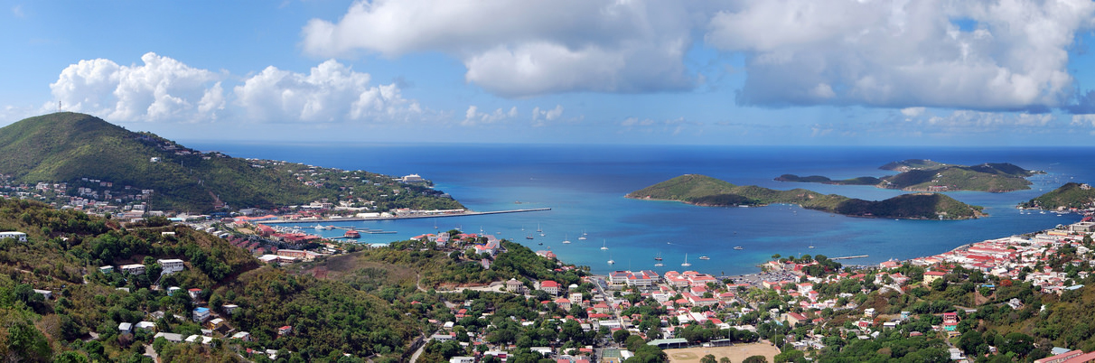
English: Panoramic view of Charlotte Amalie, the capital of the United States Virgin Islands, located on the island of Saint Thomas. Viewed from Lookout Point on Skyline Drive (Route 40). |
||
| 日期 | |||
| 來源 | 自己作品 | ||
| 作者 |
|
||
| Other versions |
 |

| Camera location | | View this and other nearby images on: OpenStreetMap |
|---|
協議
我,呢份作品嘅作者,決定用以下許可發佈呢件作品:
This file is licensed under the Creative Commons Attribution-Share Alike 4.0 International license.
- 你可以:
- 去分享 – 複製、發佈同傳播呢個作品
- 再改 – 創作演繹作品
- 要遵照下面嘅條件:
- 署名 – 你一定要畀合適嘅表彰、畀返指向呢個授權條款嘅連結,同埋寫明有無改過嚟。你可以用任何合理方式去做,但唔可以用任何方式暗示授權人認可咗你或者你嘅使用方式。
- 相同方式分享 – 如果你用任何方式改過呢個作品,你必須要用返原本或者相似嘅條款發佈。
檔案歷史
撳個日期/時間去睇響嗰個時間出現過嘅檔案。
| 日期/時間 | 縮圖 | 尺寸 | 用戶 | 註解 | |
|---|---|---|---|---|---|
| 現時 | 2016年4月10號 (日) 05:23 | 1,212 × 402(447 KB) | MattWade | User created page with UploadWizard |
檔案用途
以下嘅1版用到呢個檔:
全域檔案使用情況
下面嘅維基都用緊呢個檔案:
- af.wikipedia.org嘅使用情況
- arz.wikipedia.org嘅使用情況
- be-tarask.wikipedia.org嘅使用情況
- be.wikipedia.org嘅使用情況
- br.wikipedia.org嘅使用情況
- bs.wikipedia.org嘅使用情況
- ca.wikipedia.org嘅使用情況
- ceb.wikipedia.org嘅使用情況
- cs.wikipedia.org嘅使用情況
- da.wikipedia.org嘅使用情況
- de.wikipedia.org嘅使用情況
- en.wikipedia.org嘅使用情況
- eo.wikipedia.org嘅使用情況
- es.wikipedia.org嘅使用情況
- eu.wikipedia.org嘅使用情況
- fa.wikipedia.org嘅使用情況
- fi.wikipedia.org嘅使用情況
- fi.wiktionary.org嘅使用情況
- fo.wikipedia.org嘅使用情況
- fr.wikipedia.org嘅使用情況
- gl.wikipedia.org嘅使用情況
- he.wikipedia.org嘅使用情況
- hr.wikipedia.org嘅使用情況
- id.wikipedia.org嘅使用情況
- incubator.wikimedia.org嘅使用情況
- io.wikipedia.org嘅使用情況
- it.wikipedia.org嘅使用情況
- ja.wikipedia.org嘅使用情況
- ka.wikipedia.org嘅使用情況
- ko.wikipedia.org嘅使用情況
- kw.wikipedia.org嘅使用情況
- lt.wikipedia.org嘅使用情況
- lv.wikipedia.org嘅使用情況
- mk.wikipedia.org嘅使用情況
- ro.wikipedia.org嘅使用情況
- rw.wikipedia.org嘅使用情況
- sl.wikipedia.org嘅使用情況
- te.wikipedia.org嘅使用情況
睇呢個檔案嘅更多全域使用情況。