
File:China Hong Kong 4 levels localisation.svg

呢個「SVG」檔案嘅呢個「PNG」預覽嘅大細:705 × 599 像素。 第啲解像度:282 × 240 像素|565 × 480 像素|904 × 768 像素|1,205 × 1,024 像素|2,409 × 2,048 像素|1,000 × 850 像素。
原本檔案 (SVG檔案,表面大細: 1,000 × 850 像素,檔案大細:703 KB)
| 描述 |
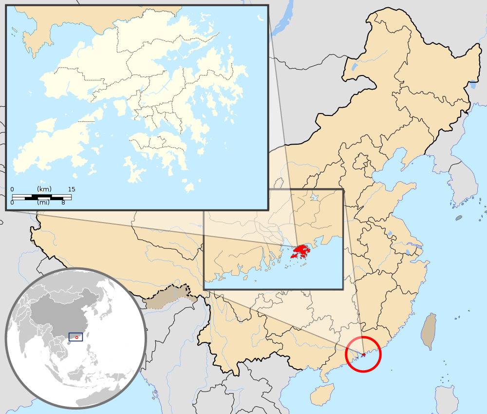
English: Map showing Hong Kong's location in Asia, on China's south coast, and Hong Kong's 18 districts
Français : Carte de Hong Kong : situation en Asie, situation sur le littoral chinois, carte des 18 districts
中文(繁體):顯示香港在亞洲,中國南海岸和香港18區的位置的地圖 |
| 日期 | (UTC) |
| 來源 |
This W3C-unspecified vector image was created with Inkscape . |
| 作者 |
|
| Other versions | Derivative works of this file: Hebao island map.jpg |
| This is a retouched picture, which means that it has been digitally altered from its original version. Modifications: Combination, color correction. The original can be viewed here: China Hong Kong.svg:
|
呢個檔案用共享創意 姓名標示-非商業性-相同方式分享3.0 未本地化版本條款授權。
姓名標示: GFDL
- 你可以:
- 去分享 – 複製、發佈同傳播呢個作品
- 再改 – 創作演繹作品
- 要遵照下面嘅條件:
- 署名 – 你一定要畀合適嘅表彰、畀返指向呢個授權條款嘅連結,同埋寫明有無改過嚟。你可以用任何合理方式去做,但唔可以用任何方式暗示授權人認可咗你或者你嘅使用方式。
- 相同方式分享 – 如果你用任何方式改過呢個作品,你必須要用返原本或者相似嘅條款發佈。
Original upload log
This image is a derivative work of the following images:
- File:Hong_Kong_Location.svg licensed with PD-self
- 2008-08-27T13:27:11Z Joowwww 1270x640 (234741 Bytes) a few minor tweaks
- 2008-08-27T13:18:03Z Joowwww 1270x640 (234389 Bytes) new version: more detailed, colours are standard with most other locator maps
- 2008-04-20T13:54:51Z Joowwww 1270x640 (79729 Bytes) reduced height, removed map border and added rivers and hk's maritime border
- 2008-04-09T11:31:22Z Joowwww 1270x977 (66085 Bytes) {{Information |Description=A map showing Hong Kong's location in Asia, in China and on China's south coast. |Source=self-made |Date=2008-04-09 |Author= [[User:Joowwww|Joowwww]] |Permission={{PD-self}} |other_versions= }} {{Cr
- File:Map_of_Hong_Kong_18Districts_ZH.svg licensed with Cc-by-sa-3.0, GFDL
- 2008-07-05T21:14:26Z Moddlyg 1454x1083 (381097 Bytes) == Summary == {{Information |Description={{en|1=Map of Hong Kong & 18 Districts (Chinese Version)}} |Source=Own work by uploader |Author={{User:Moddlyg/Sign}} |Date=2008/7/6 |Permission= |other_versions= }} {{ImageUpload|ful
- 2008-07-05T20:59:35Z Moddlyg 1454x1083 (262750 Bytes) {{Information |Description={{en|1=Map of Hong Kong & 18 Districts (Chinese Version)}} |Source=Own work by uploader |Author=~~~ |Date=2008/7/6 |Permission= |other_versions= }}
- File:China_Hong_Kong.svg licensed with PD-self
- 2008-08-13T16:22:08Z Joowwww 1000x850 (212124 Bytes) added missing laos/vietnam border
- 2008-05-14T11:14:46Z Joowwww 1000x850 (210515 Bytes) {{Information |Description=An SVG map of China with Hong Kong special administrative region highlighted and circled Legend:[[Image:China map legend.png]] |Source=self-made; based on CIA public domain maps: *http://www.lib.ut
Uploaded with derivativeFX
檔案歷史
撳個日期/時間去睇響嗰個時間出現過嘅檔案。
| 日期/時間 | 縮圖 | 尺寸 | 用戶 | 註解 | |
|---|---|---|---|---|---|
| 現時 | 2019年9月22號 (日) 21:33 | | 1,000 × 850(703 KB) | En rouge | added map scale, for the higher resolution sub-picture |
| 2015年5月14號 (四) 07:57 |  | 1,000 × 850(686 KB) | Flappiefh | Fixed colour of Haïnan. | |
| 2010年3月5號 (五) 18:40 |  | 1,000 × 850(685 KB) | Pethrus | {{Information |Description={{en|1=Map showing Hong Kong's location in Asia, on China's south coast, and Hong Kong's 18 disctricts}} {{fr|1=Carte de Hong Kong : situation en Asie, situation sur le littoral chinois, carte des 18 disctricts}} |Source=*[[:Fil |
檔案用途
以下嘅5版用到呢個檔:
全域檔案使用情況
下面嘅維基都用緊呢個檔案:
- ami.wikipedia.org嘅使用情況
- as.wikipedia.org嘅使用情況
- azb.wikipedia.org嘅使用情況
- bh.wikipedia.org嘅使用情況
- bo.wikipedia.org嘅使用情況
- br.wikipedia.org嘅使用情況
- cbk-zam.wikipedia.org嘅使用情況
- dty.wikipedia.org嘅使用情況
- dz.wikipedia.org嘅使用情況
- en.wikipedia.org嘅使用情況
- fi.wikipedia.org嘅使用情況
- fr.wikipedia.org嘅使用情況
- fr.wikinews.org嘅使用情況
- fr.wiktionary.org嘅使用情況
- fur.wikipedia.org嘅使用情況
- gcr.wikipedia.org嘅使用情況
- gn.wikipedia.org嘅使用情況
- incubator.wikimedia.org嘅使用情況
- io.wikipedia.org嘅使用情況
- it.wikipedia.org嘅使用情況
- ja.wikipedia.org嘅使用情況
- li.wikipedia.org嘅使用情況
- lld.wikipedia.org嘅使用情況
- lo.wikipedia.org嘅使用情況
- mad.wikipedia.org嘅使用情況
- mai.wikipedia.org嘅使用情況
睇呢個檔案嘅更多全域使用情況。