
File:Corse region location map.svg

呢個「SVG」檔案嘅呢個「PNG」預覽嘅大細:304 × 600 像素。 第啲解像度:121 × 240 像素|243 × 480 像素|389 × 768 像素|519 × 1,024 像素|1,038 × 2,048 像素|824 × 1,625 像素。
原本檔案 (SVG檔案,表面大細: 824 × 1,625 像素,檔案大細:191 KB)
摘要
| Camera location | | View this and other nearby images on: OpenStreetMap |
|---|
| 描述 |
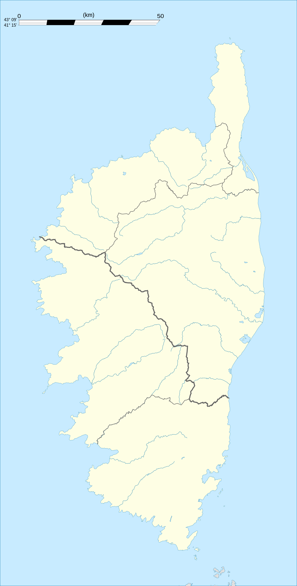
English: Blank administrative map of the region of Corsica, France, for geo-location purpose, with distinct boundaries for departments and arrondissements as they are since January 2010.
The former version of the map shows the boundaries as they were until December 2009. Français : Carte administrative vierge de la région Corse, France, destinée à la géolocalisation, avec limite distincte des départements et arrondissements tels que depuis janvier 2010. L'ancienne version de la carte montre le découpage administratif tel qu'il était jusqu'en décembre 2009. Equirectangular projection, WGS84 datum
Geographic limits of the map:
|
||
| 日期 | 2008-08, modified 02-2010 | ||
| 來源 |
自己作品
|
||
| 作者 | Eric Gaba (Sting - fr:Sting) | ||
| 許可 (重用呢個檔案) |
|
||
| Other versions |
|

協議
I, the copyright holder of this work, hereby publish it under the following licenses:
呢個檔案用共享創意 姓名標示-非商業性-相同方式分享3.0 未本地化版本條款授權。
- 你可以:
- 去分享 – 複製、發佈同傳播呢個作品
- 再改 – 創作演繹作品
- 要遵照下面嘅條件:
- 署名 – 你一定要畀合適嘅表彰、畀返指向呢個授權條款嘅連結,同埋寫明有無改過嚟。你可以用任何合理方式去做,但唔可以用任何方式暗示授權人認可咗你或者你嘅使用方式。
- 相同方式分享 – 如果你用任何方式改過呢個作品,你必須要用返原本或者相似嘅條款發佈。

|
根據自由軟體基金會發佈嘅無固定段落、封面文字同封底文字GNU自由文件授權條款第1.2或打後嘅版本,你獲授權可以重製、散佈同埋修改爾份文件。授權條款嘅副本喺章節GNU自由文件授權條款。 |
你可以揀你想用嘅牌照。
檔案歷史
撳個日期/時間去睇響嗰個時間出現過嘅檔案。
| 日期/時間 | 縮圖 | 尺寸 | 用戶 | 註解 | |
|---|---|---|---|---|---|
| 現時 | 2015年9月27號 (日) 21:21 | | 824 × 1,625(191 KB) | Iowajason | Edited SVG language to remove two local file path references. These SVG attributes were flagged by other wikis as insecure when trans-wiki'd. No change to substantive content. Submitted as a minor edit, with all licenses to reflect those of the prior v... |
| 2010年2月22號 (一) 19:29 |  | 824 × 1,625(191 KB) | Sting | Updated arrondissements boundaries of Haute-Corse | |
| 2008年8月14號 (四) 19:52 |  | 824 × 1,625(209 KB) | Sting | == Summary == {{Location|42|12|00|N|09|03|00|E|scale:2000000}} <br/> {{Information |Description={{en|Blank administrative map of the region of Corsica, France, for geo-location purpose, with distinct boundaries for departments and arrondis |
檔案用途
多過100版用到呢個檔。 下面嘅表只係列示咗用到呢個檔案嘅最頭100版。 一個完整嘅一覽喺度。
- Afa, Corse-du-Sud
- Alata, Corse-du-Sud
- Albitreccia
- Altagène
- Ambiegna
- Appietto
- Arbellara
- Arbori
- Argiusta-Moriccio
- Arro
- Aullène
- Azilone-Ampaza
- Azzana
- Balogna
- Bastelica
- Bastelicaccia
- Belvédère-Campomoro
- Bilia
- Bocognano
- Bonifacio, Corse-du-Sud
- Calcatoggio
- Campo, Corse-du-Sud
- Cannelle
- Carbini
- Carbuccia
- Cardo-Torgia
- Cargiaca
- Cargèse
- Casaglione
- Casalabriva
- Cauro
- Ciamannacce
- Coggia
- Cognocoli-Monticchi
- Conca, Corse-du-Sud
- Corrano
- Coti-Chiavari
- Cozzano
- Cristinacce
- Cuttoli-Corticchiato
- Eccica-Suarella
- Figari
- Foce
- Forciolo
- Fozzano
- Frasseto
- Giuncheto
- Granace
- Grossa
- Grosseto-Prugna
- Guagno
- Guargualé
- Guitera-les-Bains
- Lecci
- Letia
- Levie
- Lopigna
- Loreto-di-Tallano
- Marignana
- Mela, Corse-du-Sud
- Moca-Croce
- Monacia-d'Aullène
- Murzo
- Ocana, Corse-du-Sud
- Olivese
- Olmeto
- Olmiccia
- Orto
- Osani
- Ota, Corse-du-Sud
- Palneca
- Partinello
- Pastricciola
- Peri, Corse-du-Sud
- Petreto-Bicchisano
- Piana, Corsica
- Pianotolli-Caldarello
- Pietrosella
- Pila-Canale
- Poggiolo
- Porto-Vecchio
- Propriano
- Quasquara
- Quenza
- Renno
- Rezza
- Rosazia
- Sainte-Lucie-de-Tallano
- Salice
- Sampolo
- San-Gavino-di-Carbini
- Sant'Andréa-d'Orcino
- Santa-Maria-Figaniella
- Santa-Maria-Siché
- Sari-Solenzara
- Sarrola-Carcopino
- Sartène
- Serra-di-Ferro
- Serra-di-Scopamène
- Serriera
去睇連到呢個檔案嘅更多連結。
全域檔案使用情況
下面嘅維基都用緊呢個檔案:
- als.wikipedia.org嘅使用情況
- ar.wikipedia.org嘅使用情況
- ast.wikipedia.org嘅使用情況
- azb.wikipedia.org嘅使用情況
- bg.wikipedia.org嘅使用情況
- bn.wikipedia.org嘅使用情況
- bs.wikipedia.org嘅使用情況
- ca.wikipedia.org嘅使用情況
- ceb.wikipedia.org嘅使用情況
- cs.wikipedia.org嘅使用情況
- da.wikipedia.org嘅使用情況
- de.wikipedia.org嘅使用情況
- Alistro
- Filitosa
- Porto (Korsika)
- L’Ospédale
- Castellu di Cucuruzzu
- Torre von Ceccia
- Vorlage:Positionskarte Frankreich Korsika
- Wikipedia:Kartenwerkstatt/Positionskarten/Europa
- Monument von Alo-Bisucce
- Vorlage Diskussion:Infobox Gemeinde in Frankreich/Archiv/2008
- Torre von Tappa
- Torre von Torre
- Ponte Novu
- de.wikivoyage.org嘅使用情況
- dsb.wikipedia.org嘅使用情況
- el.wikipedia.org嘅使用情況
- en.wikipedia.org嘅使用情況
睇呢個檔案嘅更多全域使用情況。