
File:Ittoqqortoormiit top hg.jpg
原本檔案 (2,553 × 1,665 像素,檔案大細:1.06 MB ,MIME類型:image/jpeg)
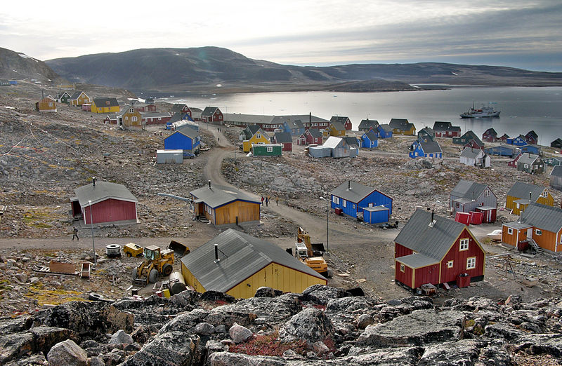
| 描述 | Ittoqqortoormiit (Scoresby Sund, East Greenland, view from heli landing point) |
| 日期 | |
| 來源 | 自己作品 |
| 作者 | Hannes Grobe, AWI |
| 許可 (重用呢個檔案) |
Own work, share alike, attribution required (Creative Commons CC-BY-SA-2.5) |
我,呢份作品嘅作者,決定用以下許可發佈呢件作品:
This file is licensed under the Creative Commons Attribution-Share Alike 2.5 Generic license.
- 你可以:
- 去分享 – 複製、發佈同傳播呢個作品
- 再改 – 創作演繹作品
- 要遵照下面嘅條件:
- 署名 – 你一定要畀合適嘅表彰、畀返指向呢個授權條款嘅連結,同埋寫明有無改過嚟。你可以用任何合理方式去做,但唔可以用任何方式暗示授權人認可咗你或者你嘅使用方式。
- 相同方式分享 – 如果你用任何方式改過呢個作品,你必須要用返原本或者相似嘅條款發佈。
| This is a retouched picture, which means that it has been digitally altered from its original version. Modifications: High Dynamic Range (HDR) calculation with Photomatix using various exposures.
|
Location
| Camera location | | View this and other nearby images on: OpenStreetMap |
|---|
檔案歷史
撳個日期/時間去睇響嗰個時間出現過嘅檔案。
| 日期/時間 | 縮圖 | 尺寸 | 用戶 | 註解 | |
|---|---|---|---|---|---|
| 現時 | 2007年10月26號 (五) 21:02 |  | 2,553 × 1,665(1.06 MB) | Hgrobe | {{Information |Description=to be done |Source=own work |Date=2007-08-31 |Author=~~~~ |Permission=Own work, share alike, attribution required (Creative Commons CC-BY-SA-2.5) |other_versions= }} {{self|cc-by-sa-2.5}} |
檔案用途
以下嘅1版用到呢個檔:
全域檔案使用情況
下面嘅維基都用緊呢個檔案:
- af.wikipedia.org嘅使用情況
- ar.wikipedia.org嘅使用情況
- ca.wikipedia.org嘅使用情況
- cs.wikipedia.org嘅使用情況
- da.wikipedia.org嘅使用情況
- de.wikipedia.org嘅使用情況
- en.wikipedia.org嘅使用情況
- es.wikipedia.org嘅使用情況
- fa.wikipedia.org嘅使用情況
- fi.wikipedia.org嘅使用情況
- fo.wikipedia.org嘅使用情況
- fr.wikipedia.org嘅使用情況
- hr.wikipedia.org嘅使用情況
- hu.wikipedia.org嘅使用情況
- it.wikipedia.org嘅使用情況
- it.wikivoyage.org嘅使用情況
- iu.wikipedia.org嘅使用情況
- ja.wikipedia.org嘅使用情況
- kl.wikipedia.org嘅使用情況
- kv.wikipedia.org嘅使用情況
- la.wikipedia.org嘅使用情況
- lb.wikipedia.org嘅使用情況
- lt.wikipedia.org嘅使用情況
- nl.wikipedia.org嘅使用情況
- no.wikipedia.org嘅使用情況
- pl.wikipedia.org嘅使用情況
- pt.wikipedia.org嘅使用情況
- ru.wikipedia.org嘅使用情況
- sk.wikipedia.org嘅使用情況
- sr.wikipedia.org嘅使用情況
- sv.wikipedia.org嘅使用情況
- tr.wikipedia.org嘅使用情況
- www.wikidata.org嘅使用情況
- zh.wikipedia.org嘅使用情況