
File:Jebi 2018-08-31 0330Z.jpg
原本檔案 (1,800 × 2,400 像素,檔案大細:1.57 MB ,MIME類型:image/jpeg)
摘要
| 描述 |
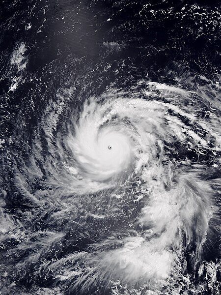
English: Typhoon Jebi at peak intensity west of the Northern Mariana Islands on August 31, 2018. |
| 日期 | |
| 來源 | Satellite Maps - Global Archive from NOAA NESDIS |
| 作者 | VIIRS image captured by NOAA’s NOAA-20 satellite |
| Camera location | | View this and other nearby images on: OpenStreetMap |
|---|
協議
This image is in the public domain because it contains materials that originally came from the U.S. National Oceanic and Atmospheric Administration, taken or made as part of an employee's official duties.
|
檔案歷史
撳個日期/時間去睇響嗰個時間出現過嘅檔案。
| 日期/時間 | 縮圖 | 尺寸 | 用戶 | 註解 | |
|---|---|---|---|---|---|
| 現時 | 2018年9月2號 (日) 06:33 |  | 1,800 × 2,400(1.57 MB) | Meow | User created page with UploadWizard |
檔案用途
以下嘅1版用到呢個檔:
全域檔案使用情況
下面嘅維基都用緊呢個檔案:
- ar.wikipedia.org嘅使用情況
- en.wikipedia.org嘅使用情況
- es.wikipedia.org嘅使用情況
- fa.wikipedia.org嘅使用情況
- fr.wikipedia.org嘅使用情況
- ko.wikipedia.org嘅使用情況
- pt.wikipedia.org嘅使用情況
- ru.wikipedia.org嘅使用情況
- th.wikipedia.org嘅使用情況
- tl.wikipedia.org嘅使用情況
- zh.wikipedia.org嘅使用情況