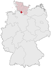
File:Lage des Kreises Pinneberg in Deutschland.png
Lage_des_Kreises_Pinneberg_in_Deutschland.png (176 × 234 像素,檔案大細:4 KB ,MIME類型:image/png)
檔案歷史
撳個日期/時間去睇響嗰個時間出現過嘅檔案。
| 日期/時間 | 縮圖 | 尺寸 | 用戶 | 註解 | |
|---|---|---|---|---|---|
| 現時 | 2007年4月5號 (四) 12:21 |  | 176 × 234(4 KB) | Ditschi | transparent |
| 2006年3月3號 (五) 09:19 |  | 176 × 234(4 KB) | Rauenstein | Karte erstellt auf der Grundlage der opengeodb.de-Umrisse - GNU-FDL Geograv 00:54, 31. Dez 2004 {{Bild-GFDL}} Category:Maps of Germany |
檔案用途
以下嘅1版用到呢個檔:
全域檔案使用情況
下面嘅維基都用緊呢個檔案:
- ace.wikipedia.org嘅使用情況
- am.wikipedia.org嘅使用情況
- ang.wikipedia.org嘅使用情況
- arc.wikipedia.org嘅使用情況
- av.wikipedia.org嘅使用情況
- ay.wikipedia.org嘅使用情況
- bcl.wikipedia.org嘅使用情況
- bi.wikipedia.org嘅使用情況
- bm.wikipedia.org嘅使用情況
- bpy.wikipedia.org嘅使用情況
- bxr.wikipedia.org嘅使用情況
- cbk-zam.wikipedia.org嘅使用情況
- ceb.wikipedia.org嘅使用情況
- ch.wikipedia.org嘅使用情況
- cr.wikipedia.org嘅使用情況
- cs.wikipedia.org嘅使用情況
- cu.wikipedia.org嘅使用情況
- cv.wikipedia.org嘅使用情況
- cy.wikipedia.org嘅使用情況
- dsb.wikipedia.org嘅使用情況
- dv.wikipedia.org嘅使用情況
- dz.wikipedia.org嘅使用情況
- eml.wikipedia.org嘅使用情況
- eo.wikipedia.org嘅使用情況
- es.wikipedia.org嘅使用情況
- ext.wikipedia.org嘅使用情況
- ff.wikipedia.org嘅使用情況
- fiu-vro.wikipedia.org嘅使用情況
- fj.wikipedia.org嘅使用情況
- fo.wikipedia.org嘅使用情況
- frp.wikipedia.org嘅使用情況
- frr.wikipedia.org嘅使用情況
- fr.wikipedia.org嘅使用情況
- fur.wikipedia.org嘅使用情況
- fy.wikipedia.org嘅使用情況
- gag.wikipedia.org嘅使用情況
- gn.wikipedia.org嘅使用情況
- got.wikipedia.org嘅使用情況
- hak.wikipedia.org嘅使用情況
- haw.wikipedia.org嘅使用情況
- hif.wikipedia.org嘅使用情況
- hi.wikipedia.org嘅使用情況
- hr.wikipedia.org嘅使用情況
- ht.wikipedia.org嘅使用情況
- hy.wikipedia.org嘅使用情況
- id.wikipedia.org嘅使用情況
- ie.wikipedia.org嘅使用情況
睇呢個檔案嘅更多全域使用情況。

