
File:LaoLiangPhi.jpg
原本檔案 (1,600 × 1,200 像素,檔案大細:681 KB ,MIME類型:image/jpeg)
摘要
| 描述 |
Ko Lao Liang Phi (เหลาเหลียงพี่, หลาวเหลียงพี่) or Ko Lao Liang Tai (เหลาเหลียงใต้, หลาวเหลียงใต้), Amphoe Palian, Trang Province, Thailand. The island, part of Mu Ko Phetra Marine National Park, is a breeding ground of Swiftlets. It has been under concession for a very long time where island "owner" paid large sum of fee to government in exchange for the right to collect bird nests in the caves high up the hills. It was guarded with firearms and visiting the island was impossible until only recently (around 2003) where it is opened for tourism (for diving) during months with calm sea. Deutsch: Koh Lao Liang Tai
한국어: 칼새의 둥지가 채집되는 태국의 어느 남쪽 섬 |
| 日期 | |
| 來源 | 自己作品 |
| 作者 | Lerdsuwa |
| 許可 (重用呢個檔案) |
GFDL |
| Camera location | | View this and other nearby images on: OpenStreetMap |
|---|
協議

|
根據自由軟體基金會發佈嘅無固定段落、封面文字同封底文字GNU自由文件授權條款第1.2或打後嘅版本,你獲授權可以重製、散佈同埋修改爾份文件。授權條款嘅副本喺章節GNU自由文件授權條款。 |
| 呢個檔案用共享創意 姓名標示-非商業性-相同方式分享3.0 未本地化版本條款授權。 | ||
| ||
| This licensing tag was added to this file as part of the GFDL licensing update. |
檔案歷史
撳個日期/時間去睇響嗰個時間出現過嘅檔案。
| 日期/時間 | 縮圖 | 尺寸 | 用戶 | 註解 | |
|---|---|---|---|---|---|
| 現時 | 2006年2月19號 (日) 12:45 | 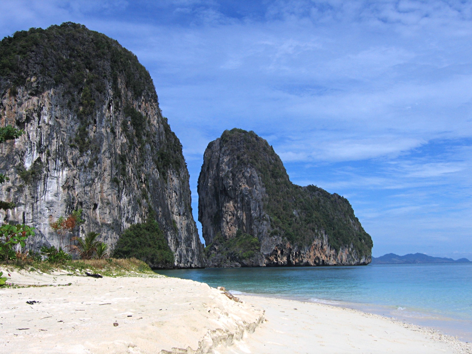 | 1,600 × 1,200(681 KB) | Lerdsuwa | Lao Liang Phi or Lao Liang Tai island, Amphoe Palian, Trang Province. Photo by Lerdsuwa on 14 February 2006. |
檔案用途
以下嘅1版用到呢個檔:
全域檔案使用情況
下面嘅維基都用緊呢個檔案:
- ar.wikipedia.org嘅使用情況
- bg.wikipedia.org嘅使用情況
- ceb.wikipedia.org嘅使用情況
- de.wikipedia.org嘅使用情況
- en.wikipedia.org嘅使用情況
- es.wikipedia.org嘅使用情況
- fa.wikipedia.org嘅使用情況
- gl.wikipedia.org嘅使用情況
- hi.wikipedia.org嘅使用情況
- hu.wikipedia.org嘅使用情況
- id.wikipedia.org嘅使用情況
- it.wikipedia.org嘅使用情況
- ja.wikipedia.org嘅使用情況
- ka.wikipedia.org嘅使用情況
- ko.wikipedia.org嘅使用情況
- lt.wikipedia.org嘅使用情況
- ms.wikipedia.org嘅使用情況
- nn.wikipedia.org嘅使用情況
- no.wikipedia.org嘅使用情況
- pl.wikipedia.org嘅使用情況
- ro.wikipedia.org嘅使用情況
- ru.wikipedia.org嘅使用情況
- sv.wikipedia.org嘅使用情況
- th.wikipedia.org嘅使用情況
- tl.wikipedia.org嘅使用情況
- tr.wikipedia.org嘅使用情況
- ur.wikipedia.org嘅使用情況
- vi.wikipedia.org嘅使用情況
- www.wikidata.org嘅使用情況
- wuu.wikipedia.org嘅使用情況
- zh.wikipedia.org嘅使用情況