
File:Location Nagorno-Karabakh2.png
冇更高解像度嘅圖像。
Location_Nagorno-Karabakh2.png (595 × 387 像素,檔案大細:75 KB ,MIME類型:image/png)

|
This locator map image could be recreated using vector graphics as an SVG file. This has several advantages; see Commons:Media for cleanup for more information. If an SVG form of this image is already available, please upload it. After uploading an SVG, replace this template with {{vector version available|new image name.svg}}.
|
摘要
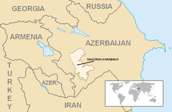
| 描述 | Location of en:Azerbaijan. World inset added by en:User:Kmusser. | ||
| 日期 | |||
| 來源 | Azerbaijan districts numbered.png, ArmeniaNumbered.png, Gg-map.png, and Iran map.png | ||
| 作者 | en:User:Aivazovsky | ||
| 許可 (重用呢個檔案) |
|
||
| Other versions | http://en.wikipedia.org/wiki/Image:Location_Nagorno-Karabakh.png |
檔案歷史
撳個日期/時間去睇響嗰個時間出現過嘅檔案。
| 日期/時間 | 縮圖 | 尺寸 | 用戶 | 註解 | |
|---|---|---|---|---|---|
| 現時 | 2006年12月19號 (二) 19:15 | | 595 × 387(75 KB) | Kmusser | Nagorno-Karabakh Category:Maps of Nagorno-Karabakh == Summary == {{Information World inset added by en:User:Kmusser. |Description=Location of en:Nagorno-Karabakh |Source=[[:en:Image:Azerb |
檔案用途
以下嘅1版用到呢個檔:
全域檔案使用情況
下面嘅維基都用緊呢個檔案:
- ami.wikipedia.org嘅使用情況
- ar.wikipedia.org嘅使用情況
- arz.wikipedia.org嘅使用情況
- ast.wikipedia.org嘅使用情況
- azb.wikipedia.org嘅使用情況
- az.wikipedia.org嘅使用情況
- az.wiktionary.org嘅使用情況
- ban.wikipedia.org嘅使用情況
- ba.wikipedia.org嘅使用情況
- be-tarask.wikipedia.org嘅使用情況
- be.wikipedia.org嘅使用情況
- bn.wikipedia.org嘅使用情況
- br.wikipedia.org嘅使用情況
- bs.wikipedia.org嘅使用情況
- ca.wikipedia.org嘅使用情況
- ckb.wikipedia.org嘅使用情況
- cs.wikipedia.org嘅使用情況
- cv.wikipedia.org嘅使用情況
- cy.wikipedia.org嘅使用情況
- de.wikipedia.org嘅使用情況
- el.wikipedia.org嘅使用情況
- en.wikipedia.org嘅使用情況
- Nagorno-Karabakh
- User:Kmusser/Images
- Nagorno-Karabakh Autonomous Oblast
- Land mines in Nagorno-Karabakh
- Wikipedia:WikiProject Armenia/User Boxes
- User:Megastrike14
- Template:User Nagorno Karabakh2
- Template:User wpnk2
- Outline of the Republic of Artsakh
- Wikipedia:WikiProject Artsakh
- User:Progint/sandbox/Togli Qorabog
- User:Falcaorib
- Wikipedia:Userboxes/WikiProjects/alphabetical/19
- Wikipedia:Userboxes/WikiProjects/Regional/07
- Talk:Blockade of Nagorno-Karabakh/Archive 2
- en.wikinews.org嘅使用情況
- en.wikiversity.org嘅使用情況
- en.wiktionary.org嘅使用情況
- eo.wikipedia.org嘅使用情況
- fa.wikipedia.org嘅使用情況
- fo.wikipedia.org嘅使用情況
- fr.wikipedia.org嘅使用情況
睇呢個檔案嘅更多全域使用情況。