
File:Map of Franz Josef Land-en.svg

呢個「SVG」檔案嘅呢個「PNG」預覽嘅大細:800 × 535 像素。 第啲解像度:320 × 214 像素|640 × 428 像素|1,024 × 685 像素|1,280 × 856 像素|2,560 × 1,712 像素|1,289 × 862 像素。
原本檔案 (SVG檔案,表面大細: 1,289 × 862 像素,檔案大細:719 KB)
摘要
| 描述 |
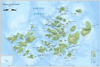
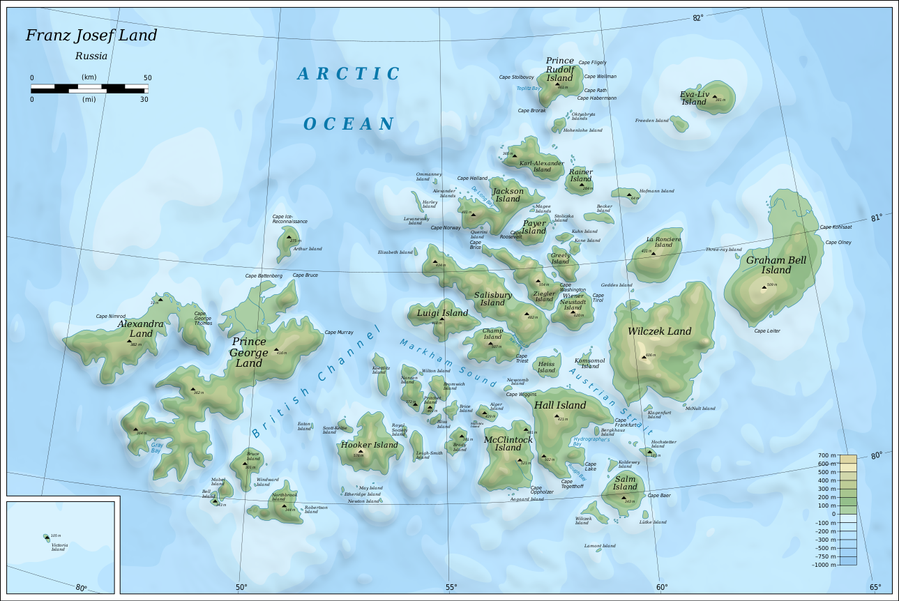
English: Map of Franz Josef Land of Russia. |
| 日期 | |
| 來源 |
Own work using: Inkscape.
|
| 作者 | Oona Räisänen |
| Other versions |
|
| SVG genesis |


協議
I, the copyright holder of this work, hereby publish it under the following licenses:
呢個檔案用共享創意 姓名標示-非商業性-相同方式分享3.0 未本地化版本條款授權。
- 你可以:
- 去分享 – 複製、發佈同傳播呢個作品
- 再改 – 創作演繹作品
- 要遵照下面嘅條件:
- 署名 – 你一定要畀合適嘅表彰、畀返指向呢個授權條款嘅連結,同埋寫明有無改過嚟。你可以用任何合理方式去做,但唔可以用任何方式暗示授權人認可咗你或者你嘅使用方式。
- 相同方式分享 – 如果你用任何方式改過呢個作品,你必須要用返原本或者相似嘅條款發佈。

|
根據自由軟體基金會發佈嘅無固定段落、封面文字同封底文字GNU自由文件授權條款第1.2或打後嘅版本,你獲授權可以重製、散佈同埋修改爾份文件。授權條款嘅副本喺章節GNU自由文件授權條款。 |
你可以揀你想用嘅牌照。
檔案歷史
撳個日期/時間去睇響嗰個時間出現過嘅檔案。
| 日期/時間 | 縮圖 | 尺寸 | 用戶 | 註解 | |
|---|---|---|---|---|---|
| 現時 | 2019年8月12號 (一) 06:05 | | 1,289 × 862(719 KB) | Cherkash | fixed some objects: names spelling, location |
| 2010年10月28號 (四) 14:24 |  | 1,289 × 862(719 KB) | Mysid | shading + fixes | |
| 2010年10月26號 (二) 19:21 |  | 1,289 × 862(719 KB) | Mysid | bigger fonts | |
| 2010年10月26號 (二) 19:13 |  | 1,289 × 862(718 KB) | Mysid | {{Information |Description={{en|1=Map of en:Franz Josef Land of Russia.}} |Source={{own}}. Self-made in Inkscape. Topography and shoreline manually derived from a 1964 map by United States Army Map Service, Corps of Engineers ([[:File:NU-38-39-40-41 |
檔案用途
以下嘅1版用到呢個檔:
全域檔案使用情況
下面嘅維基都用緊呢個檔案:
- af.wikipedia.org嘅使用情況
- ar.wikipedia.org嘅使用情況
- avk.wikipedia.org嘅使用情況
- Wilczek (ewala)
- Teza:FranzJosefTursia
- Salm (ewala)
- Lütke (ewala)
- Hochstetter (ewala)
- Wilczek (ewalama)
- Schönau (ewala)
- Koldewey (ewala)
- Hall (ewala)
- Berghaus (ewala)
- McClintock (ewala)
- Heiss (ewala)
- Komsomol (ewala)
- Newcomb (ewala)
- Alger (ewala)
- Brice (ewala)
- Brady (ewala)
- Bliss (ewala)
- Nansen (ewala)
- Pritchett (ewala)
- Bromwich (ewala)
- Koettlitz (ewala)
- Hooker (ewala)
- Scott-Keltie (ewala)
- Royal Society (ewala)
- Leigh-Smith (ewala)
- Luigi (ewala)
- Salisbury (ewala)
- Champ (ewala)
- Ziegler (ewala)
- Wiener Neustadt (ewala)
- Franz-Josef (tursia)
- Greely (ewala)
- Kane (ewala)
- Kuhn (ewala)
- Payer (ewala)
- Jackson (ewala)
- Karl-Alexander (ewala)
- Rainer (ewala)
- Hohenlohe (ewala)
- Prince Rudolf (ewala)
- La Roncière (ewala)
- Becker (ewala)
- Hofmann (ewala)
- Freeden (ewala)
- Eva-Liv (ewala)
- Graham Bell (ewala)
- Bruce (ewala)
睇呢個檔案嘅更多全域使用情況。