
File:Meghalaya locator map.svg

呢個「SVG」檔案嘅呢個「PNG」預覽嘅大細:734 × 600 像素。 第啲解像度:294 × 240 像素|587 × 480 像素|940 × 768 像素|1,253 × 1,024 像素|2,506 × 2,048 像素|2,393 × 1,956 像素。
原本檔案 (SVG檔案,表面大細: 2,393 × 1,956 像素,檔案大細:260 KB)
| 標題 |
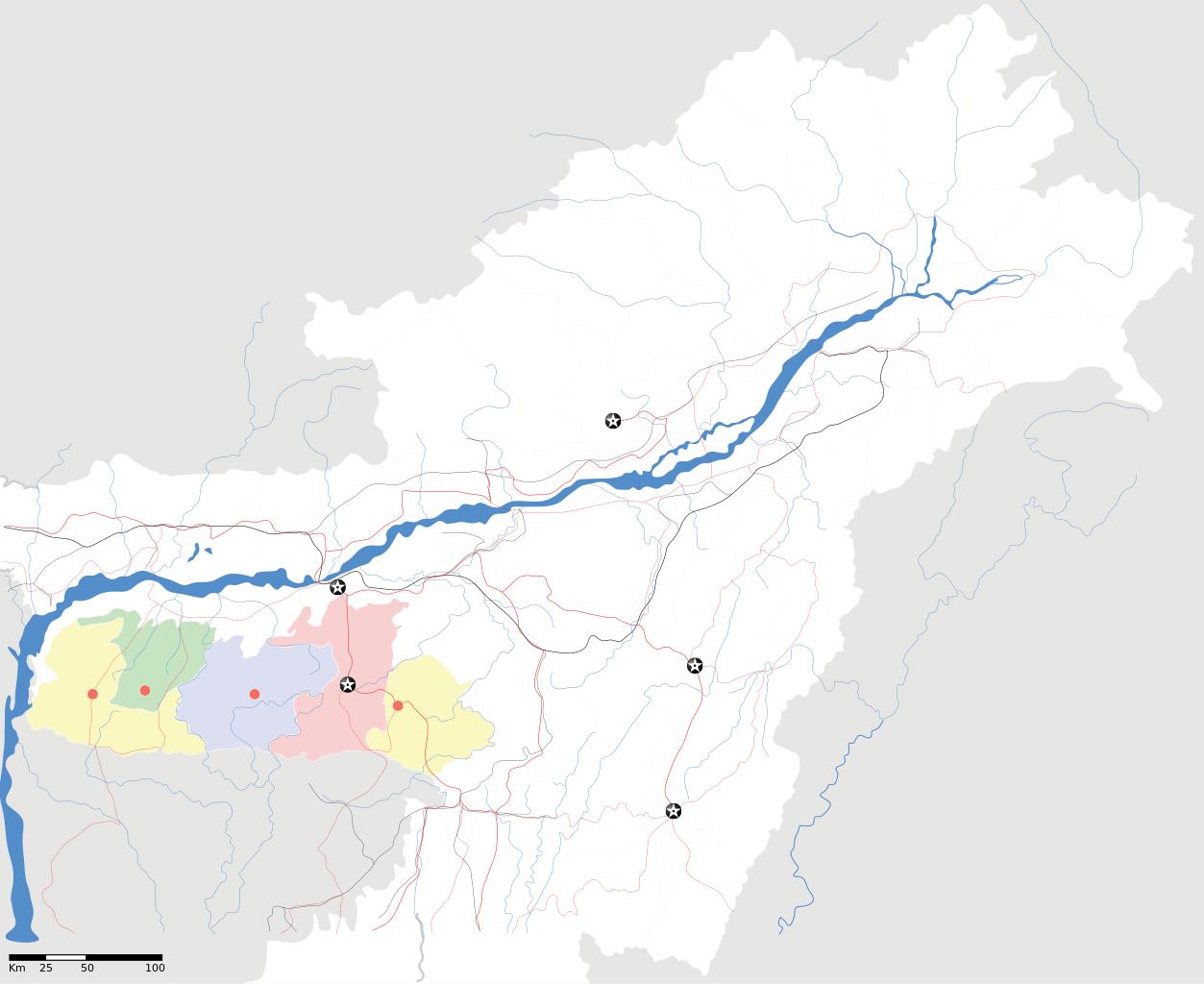
Meghalaya locator Map |
| Description |
Map of w:Meghalaya with road and rail lines. Equirectangular projection. Geographic limits of the map: top=29.49, bottom=23.74, left=89.61, right=97.52. |
| 日期 | |
| 來源 |
自己作品 |
| Creator | |
| 許可 (重用呢個檔案) |
我,呢份作品嘅作者,決定用以下許可發佈呢件作品: 呢個檔案用共享創意 姓名標示-非商業性-相同方式分享3.0 未本地化版本條款授權。
|
| Geotemporal data | |
| Date depicted | second half of 20 century 同埋21 century |
| Georeferencing | If inappropriate please set warp_status = skip to hide. |
| Archival data | |
| 註 | Part of WikiProject India Maps |
檔案歷史
撳個日期/時間去睇響嗰個時間出現過嘅檔案。
| 日期/時間 | 縮圖 | 尺寸 | 用戶 | 註解 | |
|---|---|---|---|---|---|
| 現時 | 2007年4月16號 (一) 18:56 | | 2,393 × 1,956(260 KB) | Planemad | {{WikiProject_India_Maps |Title=Meghalaya locator Map |Description=Map of w:Meghalaya with road and rail lines |Source= [http://www.iitg.ernet.in/rcilts/assam_political.jpg IIT Guwahati - Assam Political map] |Date=April 2007 |Author=[[w:user:Planemad |
檔案用途
以下嘅1版用到呢個檔:
全域檔案使用情況
下面嘅維基都用緊呢個檔案:
- ar.wikipedia.org嘅使用情況
- ast.wikipedia.org嘅使用情況
- as.wikipedia.org嘅使用情況
- ba.wikipedia.org嘅使用情況
- bn.wikipedia.org嘅使用情況
- bs.wikipedia.org嘅使用情況
- ceb.wikipedia.org嘅使用情況
- de.wikipedia.org嘅使用情況
- es.wikipedia.org嘅使用情況
- fa.wikipedia.org嘅使用情況
- gu.wikipedia.org嘅使用情況
- hif.wikipedia.org嘅使用情況
- hi.wikipedia.org嘅使用情況
- hr.wikipedia.org嘅使用情況
- id.wikipedia.org嘅使用情況
- ja.wikipedia.org嘅使用情況
- kbd.wikipedia.org嘅使用情況
- ml.wikipedia.org嘅使用情況
- ms.wikipedia.org嘅使用情況
- new.wikipedia.org嘅使用情況
- nl.wikipedia.org嘅使用情況
- or.wikipedia.org嘅使用情況
- pam.wikipedia.org嘅使用情況
睇呢個檔案嘅更多全域使用情況。