
File:Navigation on St Clair River.jpg
原本檔案 (1,500 × 1,051 像素,檔案大細:641 KB ,MIME類型:image/jpeg)
| 描述 |
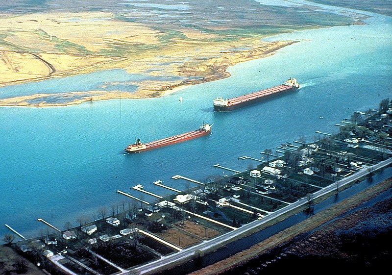
English: Great Lakes freighters navigating on the lower St. Clair River between Michigan, USA and Ontario, Canada. The view is from the American side looking across to Canada. The Walpole Island Indian Reserve is directly across on the Canadian side. |
|||
| 日期 | not specified or unknown | |||
| 來源 |
U.S. Army Corps of Engineers Digital Visual Library Image page Image description page Digital Visual Library home page |
|||
| 作者 | U.S. Army Corps of Engineers, photographer not specified or unknown | |||
| 許可 (重用呢個檔案) |
|
|||
| Location | St. Clair River, east of Detroit, Michigan, USA |
| Camera location | | View this and other nearby images on: OpenStreetMap |
|---|
檔案歷史
撳個日期/時間去睇響嗰個時間出現過嘅檔案。
| 日期/時間 | 縮圖 | 尺寸 | 用戶 | 註解 | |
|---|---|---|---|---|---|
| 現時 | 2007年3月29號 (四) 03:06 |  | 1,500 × 1,051(641 KB) | DanMS | {{Information | Description = {{en|Great Lakes freighters navigating on the lower St. Clair River between Michigan, USA and Ontario, Canada. The view is from the American side looking across to Canada. The Walpole Island Indian Reserve is directly acro |
檔案用途
以下嘅1版用到呢個檔:
全域檔案使用情況
下面嘅維基都用緊呢個檔案:
- arz.wikipedia.org嘅使用情況
- bg.wikipedia.org嘅使用情況
- br.wikipedia.org嘅使用情況
- ca.wikipedia.org嘅使用情況
- de.wikipedia.org嘅使用情況
- en.wikipedia.org嘅使用情況
- en.wikivoyage.org嘅使用情況
- eo.wikipedia.org嘅使用情況
- es.wikipedia.org嘅使用情況
- fr.wikipedia.org嘅使用情況
- it.wikipedia.org嘅使用情況
- ja.wikipedia.org嘅使用情況
- lt.wikipedia.org嘅使用情況
- no.wikipedia.org嘅使用情況
- simple.wikipedia.org嘅使用情況
- uk.wikipedia.org嘅使用情況
- www.wikidata.org嘅使用情況