
File:Saint-Philbert Prieuré.jpg
原本檔案 (2,576 × 1,932 像素,檔案大細:1.78 MB ,MIME類型:image/jpeg)
摘要
| 描述 |
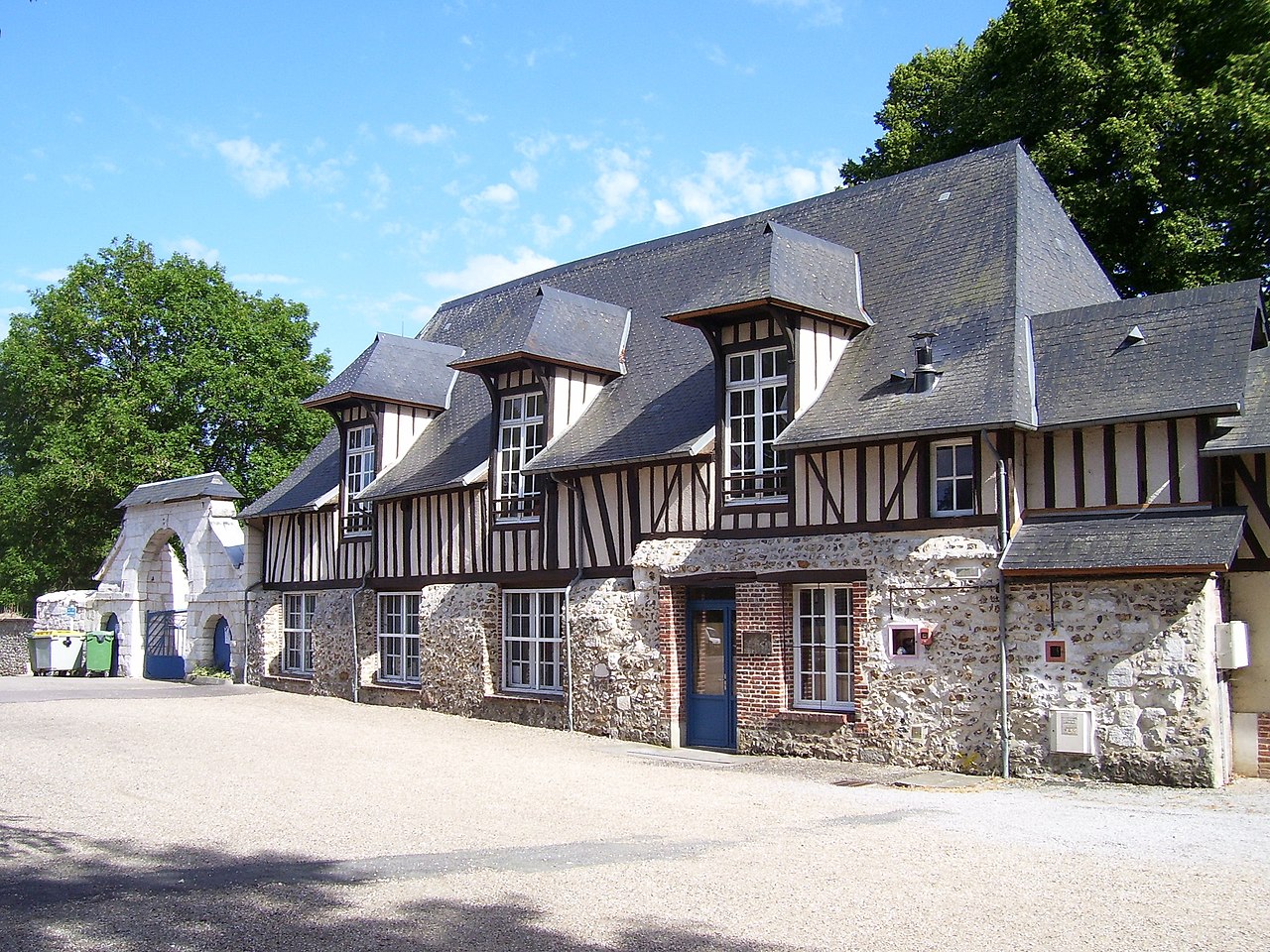
English: Former priory (11th century) of Saint-Philbert-sur-Risle in the département Eure in France.
Deutsch: Alte Priorei (11. Jahrhundert) von Saint-Philbert-sur-Risle im Département Eure in Frankreich.
Français : Ancien prieuré (11e siècle) de Saint-Philbert-sur-Risle dans l'Eure. |
| 日期 | |
| 來源 | 自己作品 |
| 作者 | Stanzilla |
|
This building is classé au titre des monuments historiques de la France. It is indexed in the base Mérimée, a database of architectural heritage maintained by the French Ministry of Culture, under the references PA00099566
|
| Camera location | | View this and other nearby images on: OpenStreetMap |
|---|
協議
我,呢份作品嘅作者,決定用以下許可發佈呢件作品:
Ĉi tiu dosiero estas disponebla laŭ la permesilo Krea Komunaĵo Atribuite 3.0 Neadaptita.
- 你可以:
- 去分享 – 複製、發佈同傳播呢個作品
- 再改 – 創作演繹作品
- 要遵照下面嘅條件:
- 署名 – 你一定要畀合適嘅表彰、畀返指向呢個授權條款嘅連結,同埋寫明有無改過嚟。你可以用任何合理方式去做,但唔可以用任何方式暗示授權人認可咗你或者你嘅使用方式。
檔案歷史
撳個日期/時間去睇響嗰個時間出現過嘅檔案。
| 日期/時間 | 縮圖 | 尺寸 | 用戶 | 註解 | |
|---|---|---|---|---|---|
| 現時 | 2010年7月11號 (日) 21:10 |  | 2,576 × 1,932(1.78 MB) | Stanzilla | {{Information |Description={{en|1=Former priory (11th century) of Saint-Philbert-sur-Risle in the département Eure in France.}} {{de|1=Alte Priorei (11. Jahrhundert) von Saint-Philbert-sur-Risle im Département Eure in Frankreich.}} {{fr|1=Ancien prieur� |
檔案用途
以下嘅1版用到呢個檔:
全域檔案使用情況
下面嘅維基都用緊呢個檔案:
- ast.wikipedia.org嘅使用情況
- ca.wikipedia.org嘅使用情況
- ceb.wikipedia.org嘅使用情況
- ce.wikipedia.org嘅使用情況
- de.wikipedia.org嘅使用情況
- en.wikipedia.org嘅使用情況
- eo.wikipedia.org嘅使用情況
- es.wikipedia.org嘅使用情況
- eu.wikipedia.org嘅使用情況
- fr.wikipedia.org嘅使用情況
- hu.wikipedia.org嘅使用情況
- it.wikipedia.org嘅使用情況
- ku.wikipedia.org嘅使用情況
- la.wikipedia.org嘅使用情況
- mg.wikipedia.org嘅使用情況
- ms.wikipedia.org嘅使用情況
- nl.wikipedia.org嘅使用情況
- oc.wikipedia.org嘅使用情況
- pl.wikipedia.org嘅使用情況
- pt.wikipedia.org嘅使用情況
- ro.wikipedia.org嘅使用情況
- sk.wikipedia.org嘅使用情況
- sv.wikipedia.org嘅使用情況
- tt.wikipedia.org嘅使用情況
- uk.wikipedia.org嘅使用情況
- ur.wikipedia.org嘅使用情況
- vec.wikipedia.org嘅使用情況
- www.wikidata.org嘅使用情況
- zh-min-nan.wikipedia.org嘅使用情況
- zh.wikipedia.org嘅使用情況