
File:St Pierre de Gourdon (Lot) Gourdon vers le sud.jpg

原本檔案 (8,669 × 3,993 像素,檔案大細:26.36 MB ,MIME類型:image/jpeg)
_Gourdon_vers_le_sud.jpg?uselang=yue)
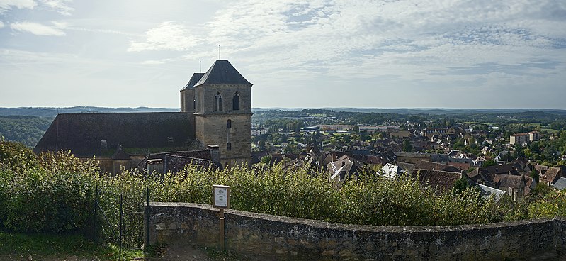
Gourdon, Lot, France. Town and St.Pierre Church, North exposure.
摘要
| 描述 |
English: Gourdon, Lot. Town and St.Pierre Chuch. Français : Gourdon (Lot). La ville et l’église Saint-Pierre.
|
||
| 日期 | |||
| 來源 | 自己作品 | ||
| 作者 | Didier Descouens | ||
| 許可 (重用呢個檔案) |
我,呢份作品嘅作者,決定用以下許可發佈呢件作品: 呢個檔案用共享創意 姓名標示-非商業性-相同方式分享3.0 未本地化版本條款授權。
|
| Camera location | | View this and other nearby images on: OpenStreetMap |
|---|
_Gourdon_vers_le_sud.jpg¶ms=044.737720_N_0001.382550_E_globe:Earth_type:camera__&language=yue)

|
This image has been assessed under the valued image criteria and is considered the most valued image on Commons within the scope: Gourdon, Lot, France. Town and St.Pierre Church, North exposure.. You can see its nomination here. |
_Gourdon_vers_le_sud.jpg)
檔案歷史
撳個日期/時間去睇響嗰個時間出現過嘅檔案。
| 日期/時間 | 縮圖 | 尺寸 | 用戶 | 註解 | |
|---|---|---|---|---|---|
| 現時 | 2013年11月10號 (日) 18:23 | | 8,669 × 3,993(26.36 MB) | Archaeodontosaurus | {{Information |Description ={{en|1=x}} |Source ={{own}} |Author =Archaeodontosaurus |Date = |Permission = |other_versions = }} |
檔案用途
以下嘅1版用到呢個檔:
全域檔案使用情況
下面嘅維基都用緊呢個檔案:
- an.wikipedia.org嘅使用情況
- br.wikipedia.org嘅使用情況
- ca.wikipedia.org嘅使用情況
- ceb.wikipedia.org嘅使用情況
- ce.wikipedia.org嘅使用情況
- cs.wikipedia.org嘅使用情況
- de.wikipedia.org嘅使用情況
- de.wikivoyage.org嘅使用情況
- el.wikipedia.org嘅使用情況
- en.wikipedia.org嘅使用情況
- eo.wikipedia.org嘅使用情況
- es.wikipedia.org嘅使用情況
- eu.wikipedia.org嘅使用情況
- fr.wikipedia.org嘅使用情況
- hu.wikipedia.org嘅使用情況
- it.wikipedia.org嘅使用情況
- ja.wikipedia.org嘅使用情況
- ko.wikipedia.org嘅使用情況
- la.wikipedia.org嘅使用情況
- ms.wikipedia.org嘅使用情況
- no.wikipedia.org嘅使用情況
- oc.wikipedia.org嘅使用情況
- pl.wikipedia.org嘅使用情況
- pt.wikipedia.org嘅使用情況
- ro.wikipedia.org嘅使用情況
- sh.wikipedia.org嘅使用情況
- simple.wikipedia.org嘅使用情況
- sk.wikipedia.org嘅使用情況
- sl.wikipedia.org嘅使用情況
- sr.wikipedia.org嘅使用情況
- sv.wikipedia.org嘅使用情況
- tr.wikipedia.org嘅使用情況
- tt.wikipedia.org嘅使用情況
- uk.wikipedia.org嘅使用情況
- vec.wikipedia.org嘅使用情況
- vi.wikipedia.org嘅使用情況
- vo.wikipedia.org嘅使用情況
- war.wikipedia.org嘅使用情況
- www.wikidata.org嘅使用情況
- zh-min-nan.wikipedia.org嘅使用情況
_Gourdon_vers_le_sud.jpg)