
File:United Arab Emirates location map.svg

呢個「SVG」檔案嘅呢個「PNG」預覽嘅大細:697 × 599 像素。 第啲解像度:279 × 240 像素|558 × 480 像素|893 × 768 像素|1,191 × 1,024 像素|2,382 × 2,048 像素|1,228 × 1,056 像素。
原本檔案 (SVG檔案,表面大細: 1,228 × 1,056 像素,檔案大細:152 KB)
摘要
| 描述 |
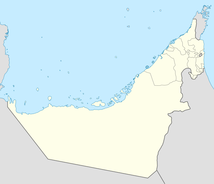
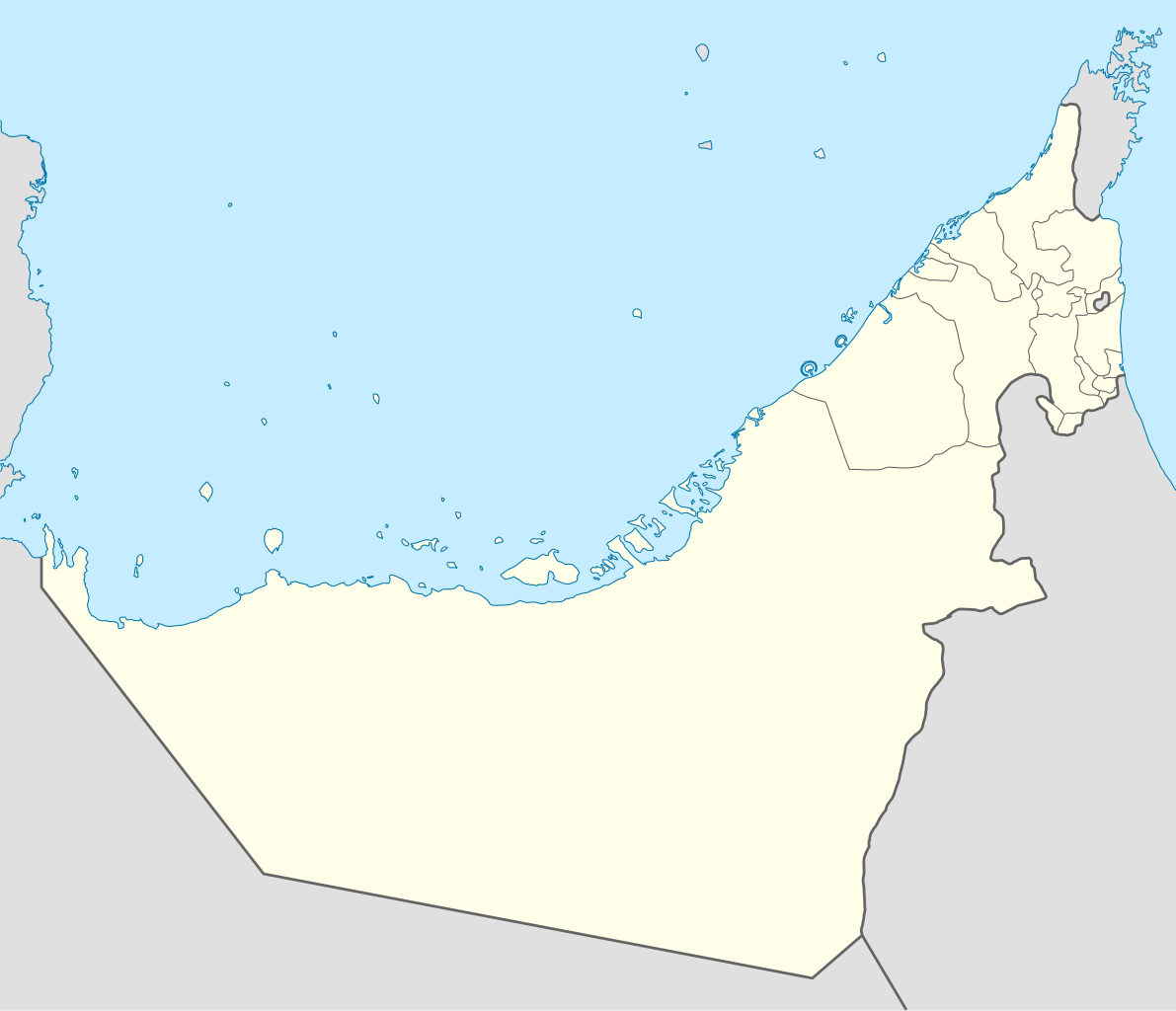
Deutsch: Positionskarte der Vereinigten Arabischen Emirate
Quadratische Plattkarte, N-S-Streckung 109 %. Geographische Begrenzung der Karte:
Equirectangular projection, N/S stretching 109 %. Geographic limits of the map:
|
|
| 日期 | ||
| 來源 |
自己作品, using
|
|
| 作者 | NordNordWest | |
| 許可 (重用呢個檔案) |
Ĉi tiu dosiero estas disponebla laŭ la permesilo Krea Komunaĵo Atribuite-Samkondiĉe 3.0 Germanujo.
 Ĉi tiu dosiero estas disponebla laŭ la permesilo Krea Komunaĵo Atribuite-Samkondiĉe 3.0 Germanujo.
|
|
| Other versions |
|


|
This map has been made or improved in the German Kartenwerkstatt (Map Lab). You can propose maps to improve as well.
|
檔案歷史
撳個日期/時間去睇響嗰個時間出現過嘅檔案。
| 日期/時間 | 縮圖 | 尺寸 | 用戶 | 註解 | |
|---|---|---|---|---|---|
| 現時 | 2018年3月3號 (六) 09:19 | | 1,228 × 1,056(152 KB) | Shahin | Reverted to version as of 14:50, 6 August 2013 (UTC) |
| 2018年3月3號 (六) 09:18 |  | 1,228 × 1,056(151 KB) | Shahin | 2017 update | |
| 2013年8月6號 (二) 14:50 |  | 1,228 × 1,056(152 KB) | Chipmunkdavis | Reverted to version as of 09:37, 5 May 2013 Google maps also shows a little bend | |
| 2013年8月6號 (二) 14:45 |  | 1,228 × 1,056(238 KB) | Chipmunkdavis | Reverting to version with border that matches http://www.emirates.org/the_country.html | |
| 2013年5月5號 (日) 09:37 |  | 1,228 × 1,056(152 KB) | NordNordWest | Reverted to version as of 14:16, 14 August 2012; location maps never get labelled | |
| 2013年5月5號 (日) 07:46 |  | 1,228 × 1,056(212 KB) | Fatemi | Reverted to version as of 07:40, 5 May 2013 | |
| 2013年5月5號 (日) 07:44 |  | 1,228 × 1,056(212 KB) | Fatemi | labled | |
| 2013年5月5號 (日) 07:40 |  | 1,228 × 1,056(212 KB) | Fatemi | new version | |
| 2012年8月14號 (二) 14:16 |  | 1,228 × 1,056(152 KB) | NordNordWest | c | |
| 2009年11月2號 (一) 20:02 |  | 1,228 × 1,056(238 KB) | NordNordWest |
檔案用途
以下嘅1版用到呢個檔:
全域檔案使用情況
下面嘅維基都用緊呢個檔案:
- af.wikipedia.org嘅使用情況
- als.wikipedia.org嘅使用情況
- ar.wikipedia.org嘅使用情況
- كأس آسيا 1996
- الدوري الإماراتي للمحترفين
- قالب:خريطة مواقع الإمارات العربية المتحدة
- كأس العالم للأندية 2010
- الدوري الإماراتي 2010–11
- كأس العالم تحت 17 سنة لكرة القدم 2013
- الدوري الإماراتي 2011–12
- كأس آسيا 2019
- بطولة العالم للشباب لكرة القدم 2003
- الدوري الإماراتي 2012–13
- كأس العالم للأندية 2017
- كأس العالم للأندية 2018
- جزيرة زركوه
- جزيرة دينا
- جزيرة قرنين
- جزيرة عش
- جزيرة غاغة
- نهائي كأس العالم للأندية 2018
- كأس العالم للأندية 2021
- الدوري الإماراتي للمحترفين 2021–22
- كأس السوبر السعودي 2024
- الدوري الإماراتي 2023–24
- دوري الدرجة الأولى الإماراتي 2015–16
- ast.wikipedia.org嘅使用情況
- Dubái
- The World
- Burj Al Arab
- Burj Khalifa
- Abu Dhabi
- Guggenheim Abu Dhabi
- Islla de Saadiyat
- Marina 101
- Princess Tower
- 23 Marina
- Centru Dubái
- Islla de Yas
- Circuitu Yas Marina
- Módulu:Mapa de llocalización/datos/Emiratos Árabes Xuníos
- Módulu:Mapa de llocalización/datos/Emiratos Árabes Xuníos/usu
- Aeropuertu Internacional de Dubái
睇呢個檔案嘅更多全域使用情況。