
File:Veduta aerea di Siracusa e con l'Etna sullo sfondo (Foto di Angelo Bonomo).jpg

預覽大細:800 × 477 像素。 第啲解像度:320 × 191 像素|640 × 382 像素|961 × 573 像素。
原本檔案 (961 × 573 像素,檔案大細:291 KB ,MIME類型:image/jpeg)
| Camera location | | View this and other nearby images on: OpenStreetMap |
|---|
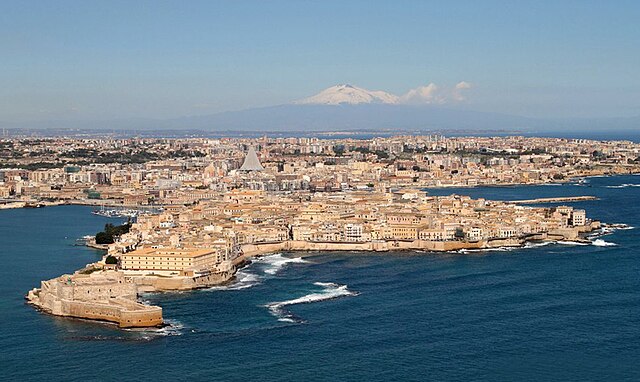
| 描述 | SIRACUSA VISTA DALL'AEREO CON L'ETNA SULLO SFONDO.FOTO Di Angelo; Syracuse with Mount Etna in the background | |||||
| 日期 | ||||||
| 來源 |
SIRACUSA VISTA DALL'AEREO CON L'ETNA SULLO SFONDO.FOTO Di Angelo
|
|||||
| 作者 | I FRATELLI ANGELO e GIORGIO BONOMO from Pomezia, ROMA, ITALIA | |||||
| 許可 (重用呢個檔案) |
|

.jpg?uselang=yue)
.jpg¶ms=037.059261_N_0015.295060_E_globe:Earth_type:camera_source:Flickr_&language=yue)
檔案歷史
撳個日期/時間去睇響嗰個時間出現過嘅檔案。
| 日期/時間 | 縮圖 | 尺寸 | 用戶 | 註解 | |
|---|---|---|---|---|---|
| 現時 | 2014年5月2號 (五) 20:37 | | 961 × 573(291 KB) | Lomita | Suppression tag |
| 2012年12月11號 (二) 23:21 |  | 1,000 × 614(124 KB) | File Upload Bot (Magnus Manske) |
檔案用途
以下嘅1版用到呢個檔:
全域檔案使用情況
下面嘅維基都用緊呢個檔案:
- az.wikipedia.org嘅使用情況
- bn.wikipedia.org嘅使用情況
- co.wikipedia.org嘅使用情況
- cr.wikipedia.org嘅使用情況
- cs.wikipedia.org嘅使用情況
- cv.wikipedia.org嘅使用情況
- de.wikipedia.org嘅使用情況
- el.wikipedia.org嘅使用情況
- el.wikivoyage.org嘅使用情況
- en.wikipedia.org嘅使用情況
- en.wikivoyage.org嘅使用情況
- es.wikipedia.org嘅使用情況
- fa.wikipedia.org嘅使用情況
- fi.wikipedia.org嘅使用情況
- fr.wikipedia.org嘅使用情況
- hu.wikipedia.org嘅使用情況
- io.wikipedia.org嘅使用情況
- is.wikipedia.org嘅使用情況
- it.wikipedia.org嘅使用情況
- it.wikivoyage.org嘅使用情況
- ja.wikipedia.org嘅使用情況
- ko.wikipedia.org嘅使用情況
- lld.wikipedia.org嘅使用情況
- mk.wikipedia.org嘅使用情況
- mt.wikipedia.org嘅使用情況
- oc.wikipedia.org嘅使用情況
- pl.wikivoyage.org嘅使用情況
- pt.wikipedia.org嘅使用情況
- qu.wikipedia.org嘅使用情況
- ru.wikipedia.org嘅使用情況
- ru.wiktionary.org嘅使用情況
- sco.wikipedia.org嘅使用情況
睇呢個檔案嘅更多全域使用情況。
.jpg)
.jpg)