
File:JB map OSM.png
原本檔案 (2,162 × 1,807 像素,檔案大細:6.41 MB ,MIME類型:image/png)
摘要
| 描述 |
中文:新山地图,背景图采用OSM。 English: map of Johor Bahru. Background map provided by openstreetmap.org. |
| 日期 | |
| 來源 | 自己作品,OpenStreetMap |
| 作者 | *angys* |
| Description |
This map was created from OpenStreetMap project data, collected by the community. This map may be incomplete, and may contain errors. Don't rely solely on it for navigation. |
|||
| 日期 | (see file history) | |||
| 來源 | openstreetmap.org | |||
| Creator |
OpenStreetMap contributors |
|||
| 許可 (重用呢個檔案) |
OpenStreetMap data is available under the Open Database License (details). Standard style map tiles are licensed as ODbL Produced Works.
|
|||
| Georeferencing | If inappropriate please set warp_status = skip to hide. |
協議
| This work contains information from OpenStreetMap, which is made available under the Open Database License (ODbL).
The ODbL does not require any particular license for maps produced from ODbL data. Prior to 1 August 2020, map tiles produced by the OpenStreetMap Foundation were licensed under the CC-BY-SA-2.0 license. Maps produced by other people may be subject to other licences. |
檔案歷史
撳個日期/時間去睇響嗰個時間出現過嘅檔案。
| 日期/時間 | 縮圖 | 尺寸 | 用戶 | 註解 | |
|---|---|---|---|---|---|
| 現時 | 2018年8月17號 (五) 18:53 | 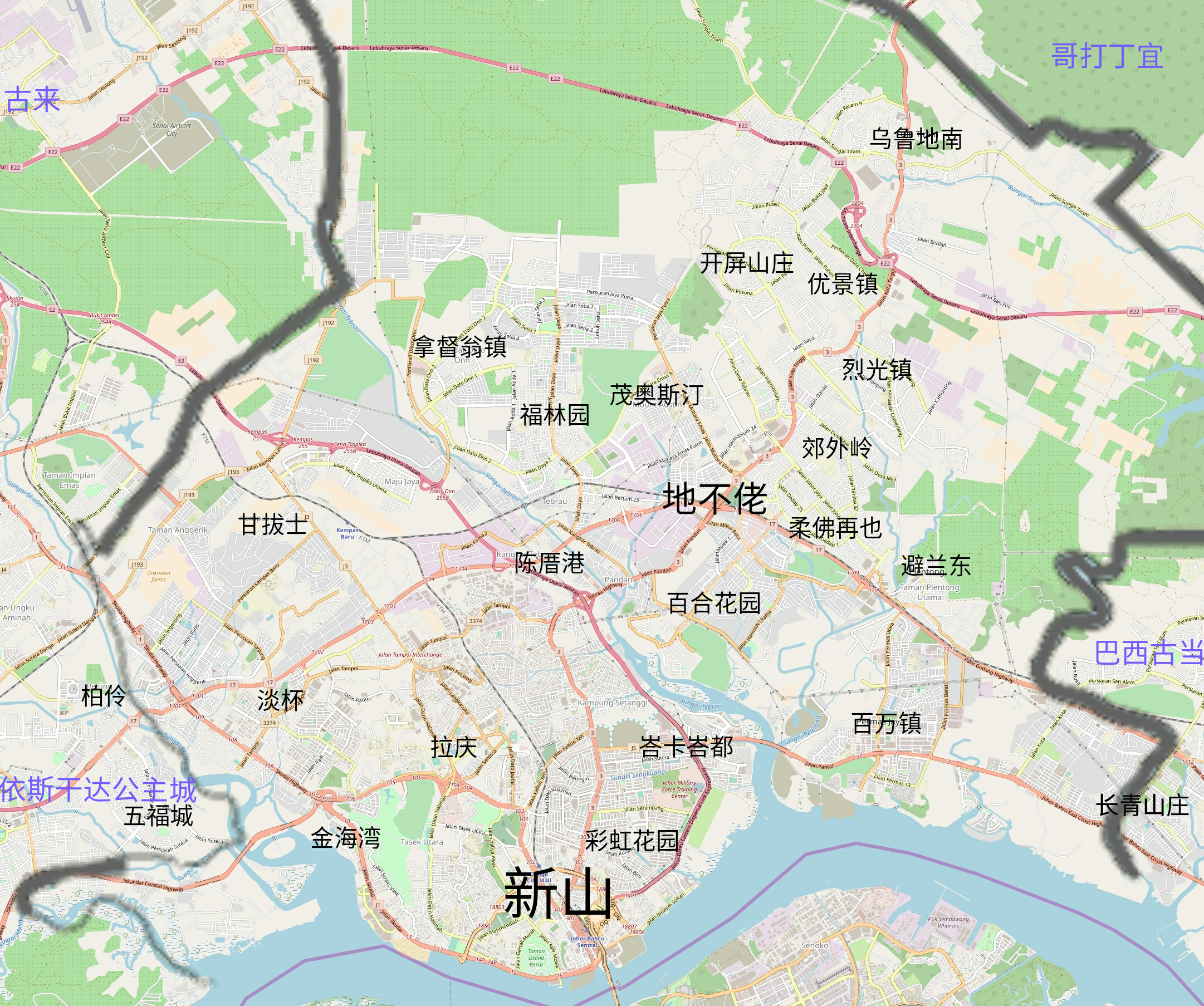 | 2,162 × 1,807(6.41 MB) | *angys* | 更新 |
| 2017年8月27號 (日) 16:34 |  | 2,368 × 1,670(4.52 MB) | *angys* | User created page with UploadWizard |
檔案用途
以下嘅1版用到呢個檔: