
File:2004 Praha.png
冇更高解像度嘅圖像。
2004_Praha.png (619 × 356 像素,檔案大細:12 KB ,MIME類型:image/png)
摘要
| 描述 |
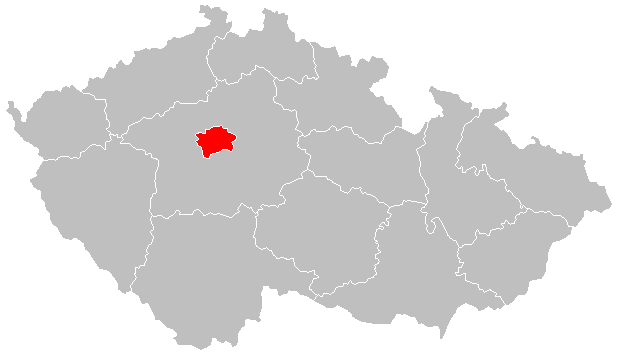
Čeština: Lokační mapa Prahy od 2004 English: Locator map of Prague from 2004 |
| 日期 | |
| 來源 | File:2004_Stredocesky_kraj.PNG |
| 作者 | Hustoles |
協議
| This file is made available under the Creative Commons CC0 1.0 Universal Public Domain Dedication. | |
| The person who associated a work with this deed has dedicated the work to the public domain by waiving all of their rights to the work worldwide under copyright law, including all related and neighboring rights, to the extent allowed by law. You can copy, modify, distribute and perform the work, even for commercial purposes, all without asking permission.
|
檔案歷史
撳個日期/時間去睇響嗰個時間出現過嘅檔案。
| 日期/時間 | 縮圖 | 尺寸 | 用戶 | 註解 | |
|---|---|---|---|---|---|
| 現時 | 2016年1月2號 (六) 21:10 | | 619 × 356(12 KB) | Valdemar | new borders (law no. 15/2015 Coll.) |
| 2011年8月24號 (三) 16:38 |  | 619 × 356(16 KB) | Fext |
檔案用途
以下嘅1版用到呢個檔:
全域檔案使用情況
下面嘅維基都用緊呢個檔案:
- ang.wikipedia.org嘅使用情況
- ar.wikipedia.org嘅使用情況
- arz.wikipedia.org嘅使用情況
- ast.wikipedia.org嘅使用情況
- ca.wikipedia.org嘅使用情況
- ceb.wikipedia.org嘅使用情況
- cs.wikipedia.org嘅使用情況
- cs.wikiversity.org嘅使用情況
- diq.wikipedia.org嘅使用情況
- el.wikipedia.org嘅使用情況
- es.wikipedia.org嘅使用情況
- eu.wikipedia.org嘅使用情況
- ext.wikipedia.org嘅使用情況
- fr.wikinews.org嘅使用情況
- ga.wikipedia.org嘅使用情況
- glk.wikipedia.org嘅使用情況
- gl.wikipedia.org嘅使用情況
- ha.wikipedia.org嘅使用情況
- ht.wikipedia.org嘅使用情況
- ia.wikipedia.org嘅使用情況
- ie.wikipedia.org嘅使用情況
- kab.wikipedia.org嘅使用情況
- la.wikipedia.org嘅使用情況
- mdf.wikipedia.org嘅使用情況
- mt.wikipedia.org嘅使用情況
- mzn.wikipedia.org嘅使用情況
- pl.wikivoyage.org嘅使用情況
- ro.wikipedia.org嘅使用情況
- rue.wikipedia.org嘅使用情況
- tt.wikipedia.org嘅使用情況
- uk.wikipedia.org嘅使用情況
- ur.wikipedia.org嘅使用情況
- vls.wikipedia.org嘅使用情況
- vo.wikipedia.org嘅使用情況
- www.wikidata.org嘅使用情況