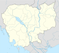
File:Cambodia location map.svg
閱讀設定

呢個「SVG」檔案嘅呢個「PNG」預覽嘅大細:664 × 599 像素。 第啲解像度:266 × 240 像素|532 × 480 像素|851 × 768 像素|1,134 × 1,024 像素|2,269 × 2,048 像素|1,346 × 1,215 像素。
原本檔案 (SVG檔案,表面大細: 1,346 × 1,215 像素,檔案大細:594 KB)
檔案歷史
撳個日期/時間去睇響嗰個時間出現過嘅檔案。
| 日期/時間 | 縮圖 | 尺寸 | 用戶 | 註解 | |
|---|---|---|---|---|---|
| 現時 | 2014年1月13號 (一) 19:44 |  | 1,346 × 1,215(594 KB) | NordNordWest | upd |
| 2009年2月12號 (四) 21:35 |  | 1,347 × 1,217(711 KB) | NordNordWest | smaller file | |
| 2009年2月12號 (四) 20:56 |  | 1,347 × 1,216(1.03 MB) | NordNordWest | {{Information |Description= {{de|Positionskarte von Kambodscha}} Quadratische Plattkarte, N-S-Streckung 105 %. Geographische Begrenzung der Karte: * N: 14.8° N * S: 9.9° N * W: 102.2° O * O: 107.9° O {{en|Location map of [[:en:Cambo |
檔案用途
無嘢連來呢份檔案。
全域檔案使用情況
下面嘅維基都用緊呢個檔案:
- af.wikipedia.org嘅使用情況
- an.wikipedia.org嘅使用情況
- ar.wikipedia.org嘅使用情況
- az.wikipedia.org嘅使用情況
- ba.wikipedia.org嘅使用情況
- bcl.wikipedia.org嘅使用情況
- be-tarask.wikipedia.org嘅使用情況
- be.wikipedia.org嘅使用情況
- bg.wikipedia.org嘅使用情況
- bn.wikipedia.org嘅使用情況
- bs.wikipedia.org嘅使用情況
- ceb.wikipedia.org嘅使用情況
睇呢個檔案嘅更多全域使用情況。


