
File:City Plans Taihoku-Matsuyama.jpg

原本檔案 (5,947 × 4,860 像素,檔案大細:8.94 MB ,MIME類型:image/jpeg)
摘要
| 描述 |
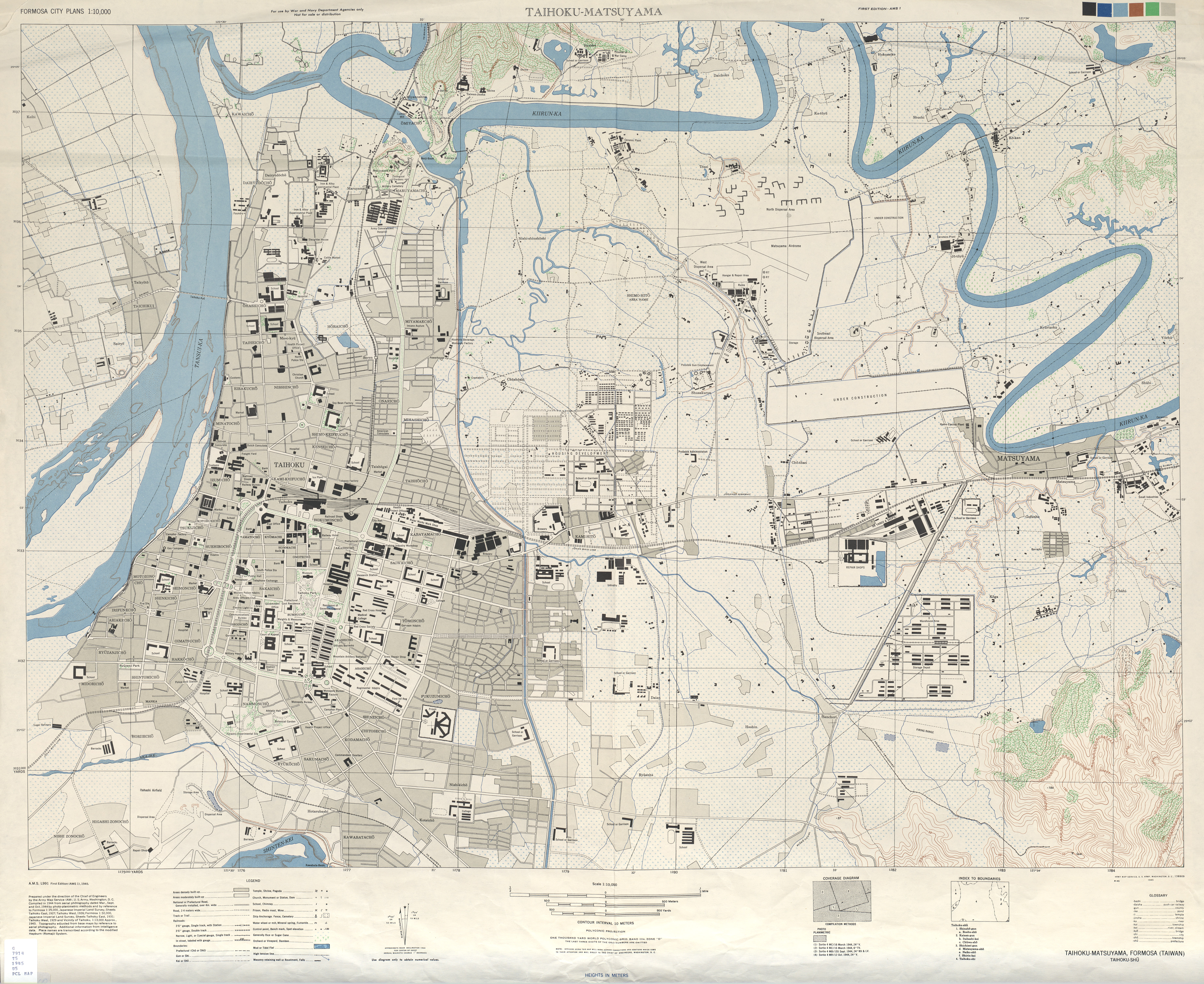
中文(繁體):美軍繪製的台北市地圖 English: 1945 map of Taihoku-Matsuyama (Formosa City Plan 1:10,000) prepared by US Army Map Service on direction of the Chief on Engineers, |
| 日期 | circa 1944年-45 |
| 來源 |
http://www.lib.utexas.edu/maps/ams/formosa_city_plans/txu-oclc-6565483.jpg found on http://www.lib.utexas.edu/maps/ams/formosa_city_plans/ |
| 作者 | U.S. Army Map Service |
| Other versions |
Derivative works of this file: |
.jpg)
.jpg)
協議
This file is a work of a U.S. Army soldier or employee, taken or made as part of that person's official duties. As a work of the U.S. federal government, it is in the public domain in the United States.
|
 |
檔案歷史
撳個日期/時間去睇響嗰個時間出現過嘅檔案。
| 日期/時間 | 縮圖 | 尺寸 | 用戶 | 註解 | |
|---|---|---|---|---|---|
| 現時 | 2011年9月11號 (日) 15:19 | | 5,947 × 4,860(8.94 MB) | Pbdragonwang | {{Information |Description ={{zh-tw|1=美軍繪製的臺北市地圖}} |Source =http://www.lib.utexas.edu/maps/ams/formosa_city_plans/ |Author =U.S. Army |Date = c. 1944-45 |Permission = |other_versions = }} [[Category:Ol |
檔案用途
以下嘅1版用到呢個檔: