
File:Japan prov map.png
冇更高解像度嘅圖像。
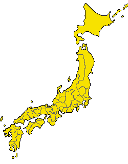
Japan_prov_map.png (250 × 320 像素,檔案大細:7 KB ,MIME類型:image/png)

|
File:Provinces of Japan.svg is a vector version of this file. It should be used in place of this PNG file.
File:Japan prov map.png → File:Provinces of Japan.svg
For more information, see Help:SVG. |
 |
Old Japanese Map from en.wp
| This work has been released into the public domain by its author, Kinori. This applies worldwide. In some countries this may not be legally possible; if so: |
Revisions of 4 December 2005
Japanese
- 陸奥国と出羽国の境
- 常陸国と下総国の境
- 伊勢国と志摩国の境
- 伊勢国と紀伊国の境
- 摂津国と河内国の境
- 豊前国と豊後国の境
- 日向国と大隈国の境
English
- Border between Mutsu and Dewa
- Border between Hitachi and Shimousa
- Border between Ise and Shima
- Border between Ise and Kii
- Border between Settsu and Kawachi
- Border between Buzen and Bungo
- Border between Hyūga and Ōsumi
檔案歷史
撳個日期/時間去睇響嗰個時間出現過嘅檔案。
| 日期/時間 | 縮圖 | 尺寸 | 用戶 | 註解 | |
|---|---|---|---|---|---|
| 現時 | 2005年12月11號 (日) 00:13 | | 250 × 320(7 KB) | Kinori | add Yaku and Chishima. fix Tsushima and Yamato |
| 2005年12月7號 (三) 01:40 |  | 235 × 300(6 KB) | Kinori | five colors version | |
| 2005年12月4號 (日) 05:48 |  | 235 × 300(11 KB) | Kinori | Japan Province Map revised. | |
| 2005年2月9號 (三) 15:46 |  | 235 × 300(8 KB) | Suisui | Old Japanese map while from ja.wp {{PD}} |
檔案用途
無嘢連來呢份檔案。
全域檔案使用情況
下面嘅維基都用緊呢個檔案:
- de.wikipedia.org嘅使用情況
- ja.wikipedia.org嘅使用情況
- su.wikipedia.org嘅使用情況