
File:Lake Malawi seen from orbit.jpg
原本檔案 (2,778 × 3,628 像素,檔案大細:3.24 MB ,MIME類型:image/jpeg)
摘要
| 描述 |
English: Leverkusen in Germany, photographed by astronauts aboard the Space Shuttle. Original image courtesy of the Image Analysis Laboratory, NASA Johnson Space Center (eol.jsc.nasa.gov). Image ID: STS061-75-48. Image cropped, sharpened and gamma-corrected.
|
| 日期 | Taken on 1998年12月3號, 09:49:31 UTC |
| 來源 | https://eol.jsc.nasa.gov/SearchPhotos/photo.pl?mission=STS061&roll=75&frame=48 |
| 作者 | National Aeronautics and Space Administration (NASA) |
| Other versions |

This image or video was catalogued by Johnson Space Center of the United States National Aeronautics and Space Administration (NASA) under Photo ID: STS061-75-48. This tag does not indicate the copyright status of the attached work. A normal copyright tag is still required. See Commons:Licensing. Other languages:
|
協議
This file is in the public domain in the United States because it was created by the Image Science & Analysis Laboratory, of the NASA Johnson Space Center. NASA copyright policy states that "NASA material is not protected by copyright unless noted". (NASA media use guidelines or Conditions of Use of Astronaut Photographs).
Photo source: STS061-75-48.
|
Original upload log
Uploaded to en wiki by User:Worldtraveller; moved here by User:Tintazul. Full original description follows.
檔案歷史
撳個日期/時間去睇響嗰個時間出現過嘅檔案。
| 日期/時間 | 縮圖 | 尺寸 | 用戶 | 註解 | |
|---|---|---|---|---|---|
| 現時 | 2019年8月30號 (五) 19:17 | | 2,778 × 3,628(3.24 MB) | Ras67 | high resolution, cropped and rotated from NASA's original TIFF |
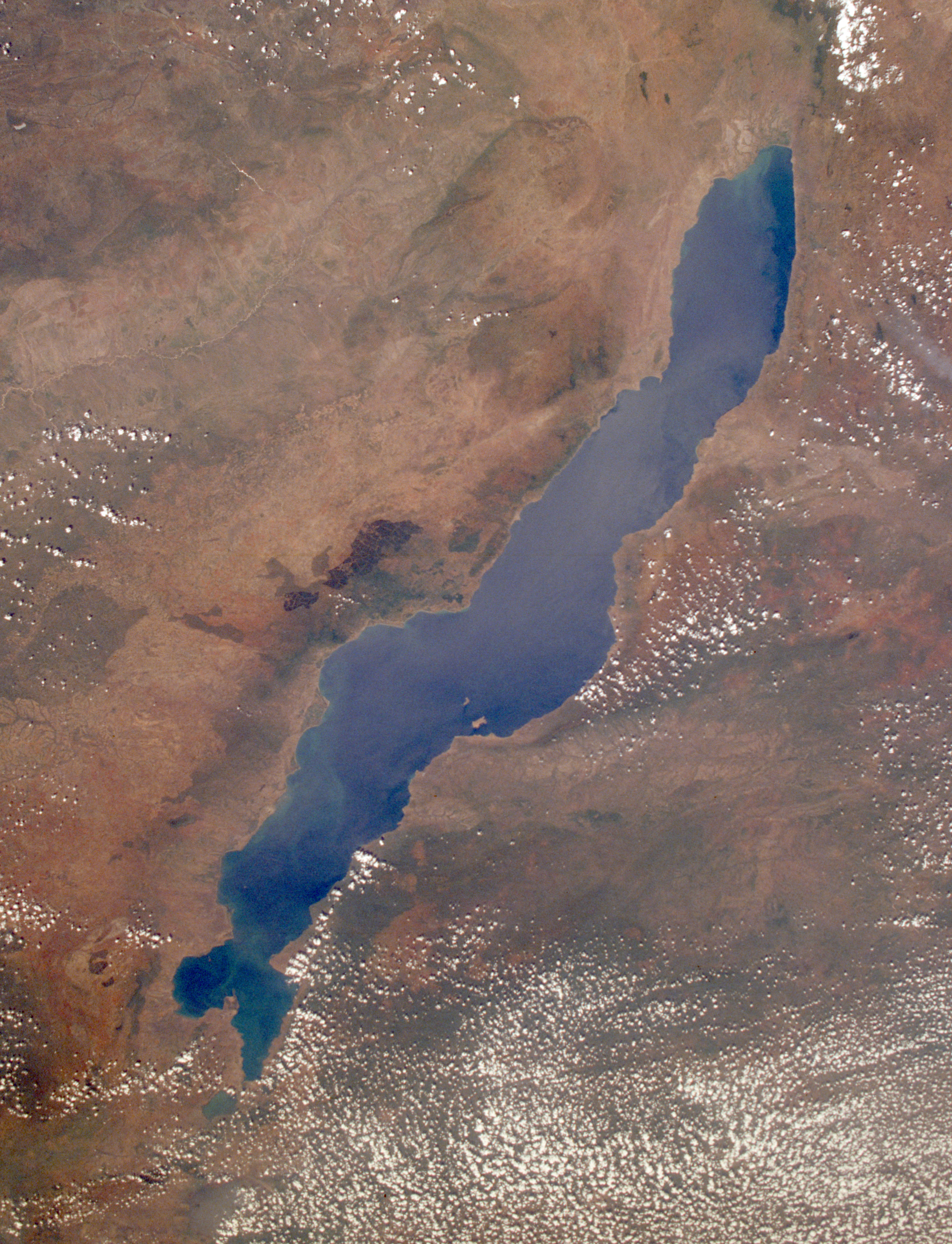
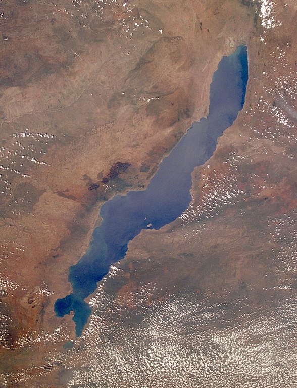
| 2005年11月4號 (五) 12:27 |  | 768 × 1,000(271 KB) | Tintazul | ''Uploaded to en wiki by User:Worldtraveller; moved here by User:Tintazul. Full original description follows.'' Lake Malawi in Africa, photographed by astronauts aboard the Space Shuttle. Original image courtesy of the Image Analysis Laboratory, |
檔案用途
以下嘅1版用到呢個檔:
全域檔案使用情況
下面嘅維基都用緊呢個檔案:
- af.wikipedia.org嘅使用情況
- als.wikipedia.org嘅使用情況
- ar.wikipedia.org嘅使用情況
- arz.wikipedia.org嘅使用情況
- az.wikipedia.org嘅使用情況
- ba.wikipedia.org嘅使用情況
- be-tarask.wikipedia.org嘅使用情況
- be.wikipedia.org嘅使用情況
- bg.wikipedia.org嘅使用情況
- Dimidiochromis compressiceps
- Labeotropheus trewavasae
- Labidochromis caeruleus
- Maylandia aurora
- Maylandia barlowi
- Maylandia benetos
- Maylandia callainos
- Maylandia chrysomallos
- Maylandia elegans
- Maylandia emmiltos
- Maylandia hajomaylandi
- Maylandia heteropicta
- Maylandia mbenjii
- Maylandia melabranchion
- Maylandia phaeos
- Maylandia pursa
- Maylandia pyrsonotos
- Maylandia thapsinogen
- Melanochromis parallelus
- Nimbochromis linni
- Nimbochromis polystigma
- Otopharynx brooksi
- Otopharynx lithobates
- Otopharynx tetrastigma
- Placidochromis electra
- Placidochromis johnstoni
- Placidochromis phenochilus
- Protomelas spilonotus
睇呢個檔案嘅更多全域使用情況。