
File:Lake Pontchartrain Causeway south.jpg
預覽大細:800 × 534 像素。 第啲解像度:320 × 214 像素|640 × 427 像素|1,024 × 683 像素|1,500 × 1,001 像素。
原本檔案 (1,500 × 1,001 像素,檔案大細:281 KB ,MIME類型:image/jpeg)
| 描述 |
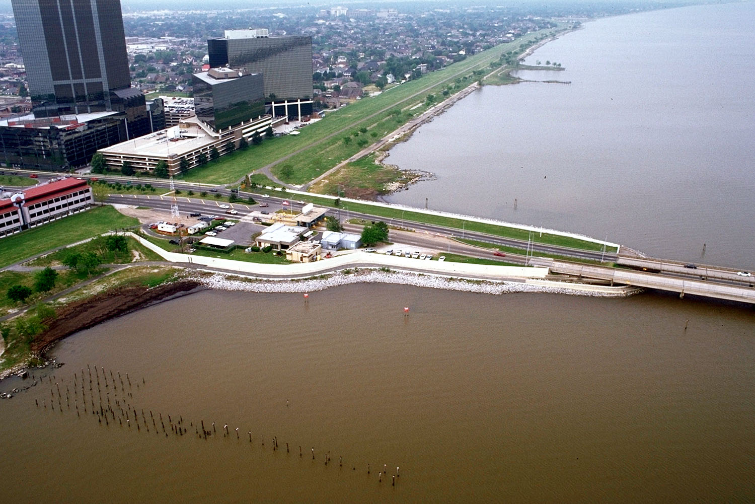
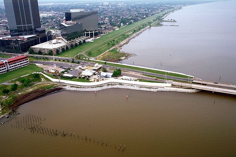
English: The southern end of the Lake Pontchartrain Causeway at Metairie, Louisiana, USA. View is to the southwest near Causeway Boulevard, Metairie. |
|||
| 日期 | ||||
| 來源 |
U.S. Army Corps of Engineers Digital Visual Library Image page Image description page Digital Visual Library home page |
|||
| 作者 | Arthur Belala, U.S. Army Corps of Engineers | |||
| 許可 (重用呢個檔案) |
|
|||
| Location | New Orleans, Louisiana, USA |
| Camera location | | View this and other nearby images on: OpenStreetMap |
|---|
檔案歷史
撳個日期/時間去睇響嗰個時間出現過嘅檔案。
| 日期/時間 | 縮圖 | 尺寸 | 用戶 | 註解 | |
|---|---|---|---|---|---|
| 現時 | 2007年4月1號 (日) 16:59 | | 1,500 × 1,001(281 KB) | DanMS | {{Information | Description = {{en|The southern end of the Lake Pontchartrain Causeway at New Orleans, Louisiana, USA. View is to the southwest over New Orleans.}} | Source = U.S. Army Corps of Engineers Digital Visual Library<br />[http://imag |
檔案用途
以下嘅1版用到呢個檔:
全域檔案使用情況
下面嘅維基都用緊呢個檔案:
- ar.wikipedia.org嘅使用情況
- cs.wikipedia.org嘅使用情況
- el.wikipedia.org嘅使用情況
- en.wikipedia.org嘅使用情況
- es.wikipedia.org嘅使用情況
- fa.wikipedia.org嘅使用情況
- fi.wikipedia.org嘅使用情況
- fr.wikipedia.org嘅使用情況
- id.wikipedia.org嘅使用情況
- it.wikipedia.org嘅使用情況
- nl.wikipedia.org嘅使用情況
- pl.wikipedia.org嘅使用情況
- pt.wikipedia.org嘅使用情況
- sk.wikipedia.org嘅使用情況
- sr.wikipedia.org嘅使用情況
- sw.wikipedia.org嘅使用情況
- tr.wikipedia.org嘅使用情況
- uk.wikipedia.org嘅使用情況
- uz.wikipedia.org嘅使用情況
- vi.wikipedia.org嘅使用情況