
File:Map of Chosen.jpg
原本檔案 (2,055 × 3,163 像素,檔案大細:2.19 MB ,MIME類型:image/jpeg)
摘要
| 描述 |
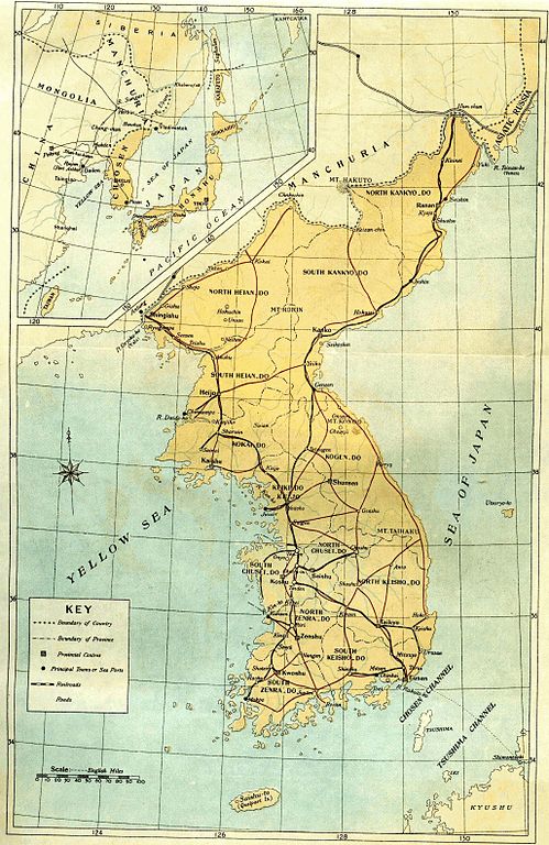
English: Old map of Korean peninsula with Japanese names.
한국어: 일제 강점기 한반도의 지도.
Русский: Старая карта Корейского полуострова с японскими названиями. |
| 日期 | |
| 來源 | Book "Chosen of Today" |
| 作者 | The Government-General of Korea |
協議
|
呢個作品喺來源國同埋其他版權期限係作者過身後70年或以下嘅國家同地區屬於公有領域。
| |
| This file has been identified as being free of known restrictions under copyright law, including all related and neighboring rights. | |
檔案歷史
撳個日期/時間去睇響嗰個時間出現過嘅檔案。
| 日期/時間 | 縮圖 | 尺寸 | 用戶 | 註解 | |
|---|---|---|---|---|---|
| 現時 | 2010年3月19號 (五) 18:36 |  | 2,055 × 3,163(2.19 MB) | Vajotwo | Removed borders |
| 2010年1月7號 (四) 15:02 |  | 2,315 × 3,263(3.09 MB) | Elmor | {{Information |Description={{en|1=Old map of Korean peninsula with Japanese names.}} {{ko|1=일제시대 한바도의 지도.}} {{ru|1=Старая карта Корейского полуострова с японскими названиями.}} |Sourc |
檔案用途
以下嘅1版用到呢個檔:
全域檔案使用情況
下面嘅維基都用緊呢個檔案:
- da.wikipedia.org嘅使用情況
- da.wikibooks.org嘅使用情況
- de.wikipedia.org嘅使用情況
- fr.wikipedia.org嘅使用情況
- kk.wikipedia.org嘅使用情況
- lv.wikipedia.org嘅使用情況
- no.wikipedia.org嘅使用情況
- ru.wikipedia.org嘅使用情況
- sv.wikipedia.org嘅使用情況
- tr.wikipedia.org嘅使用情況
- uz.wikipedia.org嘅使用情況