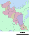
File:Map of Kyoto Prefecture Ja.svg
閱讀設定

呢個「SVG」檔案嘅呢個「PNG」預覽嘅大細:490 × 533 像素。 第啲解像度:221 × 240 像素|441 × 480 像素|706 × 768 像素|941 × 1,024 像素|1,883 × 2,048 像素。
原本檔案 (SVG檔案,表面大細: 490 × 533 像素,檔案大細:17 KB)
檔案歷史
撳個日期/時間去睇響嗰個時間出現過嘅檔案。
| 日期/時間 | 縮圖 | 尺寸 | 用戶 | 註解 | |
|---|---|---|---|---|---|
| 現時 | 2020年12月4號 (五) 04:28 |  | 490 × 533(17 KB) | AichiWikiFixer | Update borders and fixes. |
| 2013年7月14號 (日) 08:48 |  | 590 × 640(24 KB) | ニンジンシチュー | デザイン変更 | |
| 2013年7月14號 (日) 08:47 |  | 590 × 640(24 KB) | ニンジンシチュー | デザイン変更 | |
| 2008年4月29號 (二) 17:49 |  | 600 × 712(15 KB) | Krisgrotius | {{Information| |Description= Map of Kyoto Prefecture, Japan. |Source= Japanese wiki [http://ja.wikipedia.org/wiki/%E7%94%BB%E5%83%8F:%E5%8C%85%E6%8B%AC%E8%87%AA%E6%B2%BB%E4%BD%93%E5%8C%BA%E7%94%BB%E5%9B%B3_26000.svg] |Date=~~~~~ |Author=[[:ja: 利用� | |
| 2007年10月8號 (一) 13:06 |  | 600 × 712(15 KB) | Lincun | {{基礎自治体位置図画像情報|京都府|}} |
檔案用途
以下嘅1版用到呢個檔:
全域檔案使用情況
下面嘅維基都用緊呢個檔案:
- ca.wikipedia.org嘅使用情況
- de.wikipedia.org嘅使用情況
- es.wikipedia.org嘅使用情況
- gl.wikipedia.org嘅使用情況
- ja.wikipedia.org嘅使用情況
- 天橋立
- 鞍馬寺
- 二条城
- 龍谷大学
- 石清水八幡宮
- 京都市西京極総合運動公園陸上競技場兼球技場
- 醍醐寺
- 京都薬科大学
- 京都外国語大学
- 東寺
- 京都女子大学
- 田辺城 (丹後国)
- 舞鶴引揚記念館
- 大徳寺
- 建仁寺
- 寂光院
- 三千院
- 三室戸寺
- 行願寺
- 穴太寺
- 松尾寺 (舞鶴市)
- 籠神社
- 洛南高等学校・附属中学校
- 勝竜寺城
- 舞鶴工業高等専門学校
- 宇治上神社
- 亀岡運動公園
- 浄瑠璃寺
- けいはんなプラザ
- 東舞鶴公園野球場
- 淀城
- 離宮八幡宮
- 宮津城
- 建部山城
- 大仙院
- 飛行神社
- サンガスタジアム by KYOCERA
- 経ヶ岬
- 経ヶ岬灯台
- 博奕岬
- 上津屋橋
- 実相院
- 私のしごと館
- 洛星中学校・高等学校
- 京都府立山城高等学校
- 福知山城
睇呢個檔案嘅更多全域使用情況。


