
File:Map of Scandinavia.png
預覽大細:731 × 600 像素。 第啲解像度:293 × 240 像素|585 × 480 像素|780 × 640 像素。
原本檔案 (780 × 640 像素,檔案大細:30 KB ,MIME類型:image/png)

|
This file has been superseded by Map of Scandinavia.svg. It is recommended to use the other file. Please note that deleting superseded images requires consent.
|

|
摘要
| 描述 |
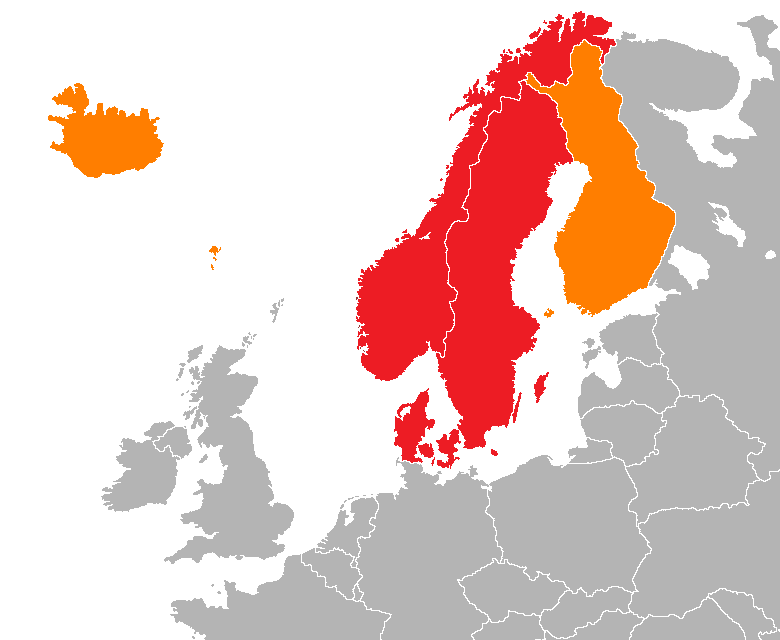
English: Map showing two of the common definitions of "Scandinavia"; a cultural, historical and ethno-linguistic region in northern Europe:
the most common usage: the three monarchies; Denmark, Norway and Sweden
an extended usage: including Finland, Iceland and the Faroe Islands
Українська: Карта показує два визначення "Скандинавії"; культурного, історичного та етно-лінгвістичного регіону в Північній Європі:
звичайне визначення: три монархії; Данія, Норвегія та Швеція
розширене визначення: включає Фінляндію, Ісландію та Фарерські острови |
| 日期 | |
| 來源 | 自己作品 |
| 作者 | 000peter |
協議
我,呢份作品嘅作者,決定用以下許可發佈呢件作品:
呢個檔案用共享創意 姓名標示-非商業性-相同方式分享3.0 未本地化版本條款授權。
- 你可以:
- 去分享 – 複製、發佈同傳播呢個作品
- 再改 – 創作演繹作品
- 要遵照下面嘅條件:
- 署名 – 你一定要畀合適嘅表彰、畀返指向呢個授權條款嘅連結,同埋寫明有無改過嚟。你可以用任何合理方式去做,但唔可以用任何方式暗示授權人認可咗你或者你嘅使用方式。
- 相同方式分享 – 如果你用任何方式改過呢個作品,你必須要用返原本或者相似嘅條款發佈。
檔案歷史
撳個日期/時間去睇響嗰個時間出現過嘅檔案。
| 日期/時間 | 縮圖 | 尺寸 | 用戶 | 註解 | |
|---|---|---|---|---|---|
| 現時 | 2012年4月15號 (日) 19:04 | | 780 × 640(30 KB) | Hazhk | More detail (using a new base) |
| 2011年9月10號 (六) 09:40 |  | 717 × 548(19 KB) | Hazhk | Making the Faroe Islands more visible (drawing the rough shape of the island group rather than a blob) | |
| 2011年9月5號 (一) 12:28 |  | 753 × 548(20 KB) | Hazhk |
檔案用途
無嘢連來呢份檔案。
全域檔案使用情況
下面嘅維基都用緊呢個檔案:
- en.wikipedia.org嘅使用情況
- rm.wikipedia.org嘅使用情況