
File:Map of Vietnam 1829.jpg
原本檔案 (3,464 × 5,200 像素,檔案大細:8.83 MB ,MIME類型:image/jpeg)
摘要
| 描述 |
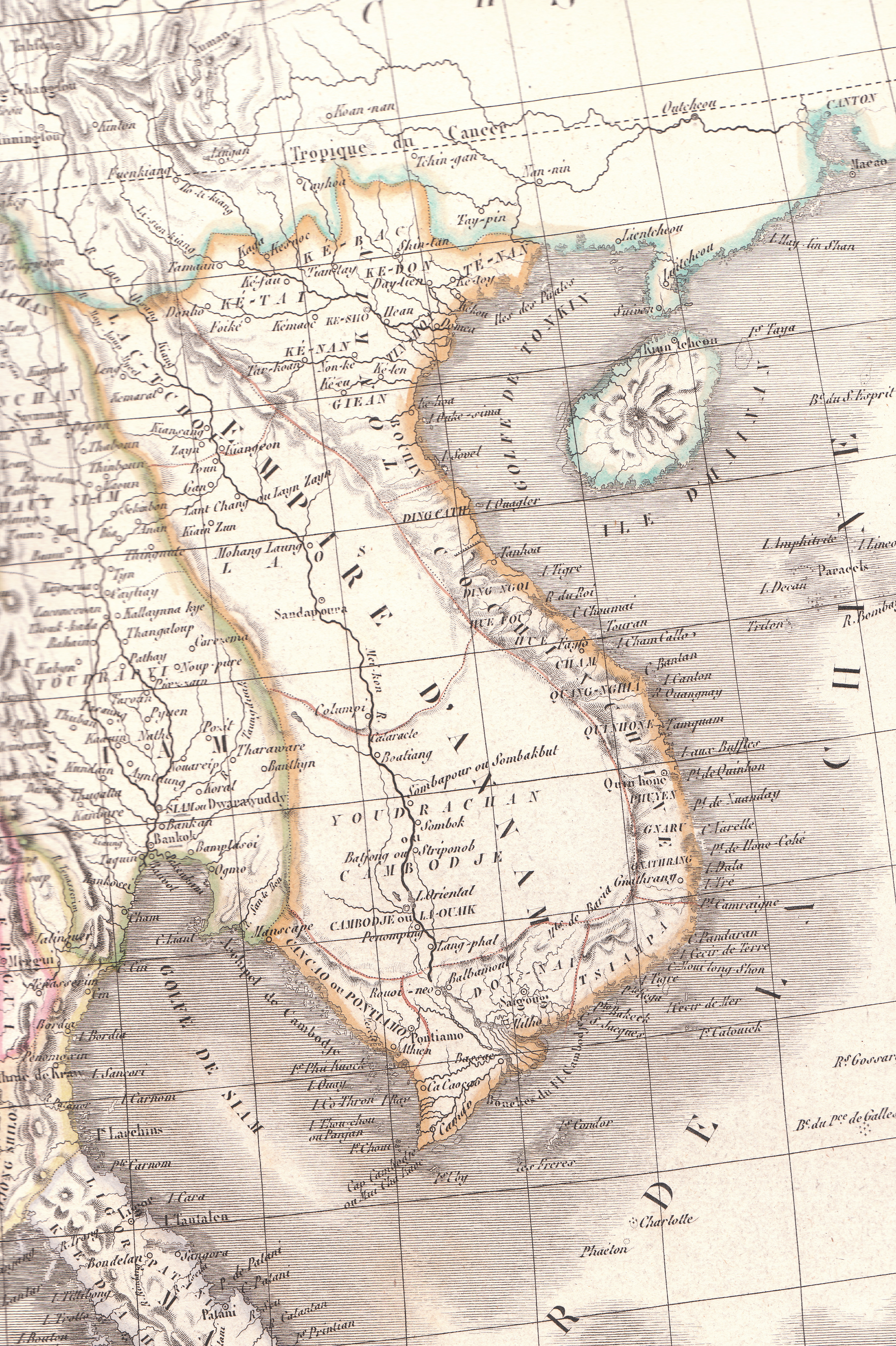
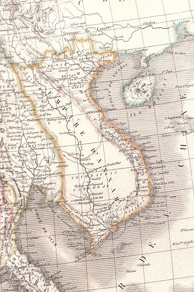
English: Plate 35E "Carte de l’Inde endeca et audela du Gange" from Lapie's Atlas Universel printed in 1829 |
| 來源 | Atlas Universel |
| 作者 | Pierre M. Lapie |
協議
|
呢個作品喺來源國同埋其他版權期限係作者過身後70年或以下嘅國家同地區屬於公有領域。 This work is in the public domain in the United States because it was published (or registered with the U.S. Copyright Office) before January 1, 1929. | |
| This file has been identified as being free of known restrictions under copyright law, including all related and neighboring rights. | |
檔案歷史
撳個日期/時間去睇響嗰個時間出現過嘅檔案。
| 日期/時間 | 縮圖 | 尺寸 | 用戶 | 註解 | |
|---|---|---|---|---|---|
| 現時 | 2010年4月26號 (一) 06:23 | | 3,464 × 5,200(8.83 MB) | Duyet-pho | {{Information |Description={{en|1=Plate 35E "Carte de l’Inde endeca et audela du Gange" from Lapie's ''Atlas Universel'' printed in 1829}} |Source=Atlas Universel |Author=Pierre M. Lapie |Date= |Permission={{PD-1923}} |other_versions= }} [[Category:Map |
檔案用途
以下嘅1版用到呢個檔:
全域檔案使用情況
下面嘅維基都用緊呢個檔案:
- ca.wikipedia.org嘅使用情況
- en.wikipedia.org嘅使用情況
- eu.wikipedia.org嘅使用情況
- gl.wikipedia.org嘅使用情況
- id.wikipedia.org嘅使用情況
- it.wikipedia.org嘅使用情況
- pt.wikipedia.org嘅使用情況
- ru.wikipedia.org嘅使用情況
- th.wikipedia.org嘅使用情況
- tr.wikipedia.org嘅使用情況
- vi.wikipedia.org嘅使用情況
- www.wikidata.org嘅使用情況
- zh-min-nan.wikipedia.org嘅使用情況