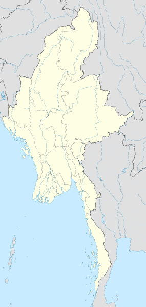
File:Myanmar location map.svg
閱讀設定

呢個「SVG」檔案嘅呢個「PNG」預覽嘅大細:285 × 599 像素。 第啲解像度:114 × 240 像素|228 × 480 像素|365 × 768 像素|487 × 1,024 像素|975 × 2,048 像素|1,200 × 2,520 像素。
原本檔案 (SVG檔案,表面大細: 1,200 × 2,520 像素,檔案大細:633 KB)
檔案歷史
撳個日期/時間去睇響嗰個時間出現過嘅檔案。
| 日期/時間 | 縮圖 | 尺寸 | 用戶 | 註解 | |
|---|---|---|---|---|---|
| 現時 | 2011年9月29號 (四) 16:08 |  | 1,200 × 2,520(633 KB) | NordNordWest | corr, see disk |
| 2010年2月18號 (四) 17:45 |  | 1,200 × 2,520(968 KB) | Uwe Dedering | no disputed countries | |
| 2010年2月18號 (四) 13:03 |  | 1,200 × 2,520(974 KB) | Uwe Dedering | {{Information |Description={{en|1=Location map of Myanmar. Equirectangular projection. Strechted by 105.0%. Geographic limits of the map: * N: 29.0° N * S: 9.0° N * W: 92.0° E * E: 102.0° E Made with Natural Earth. Free vector and raster map dat |
檔案用途
全域檔案使用情況
下面嘅維基都用緊呢個檔案:
- af.wikipedia.org嘅使用情況
- an.wikipedia.org嘅使用情況
- ar.wikipedia.org嘅使用情況
- az.wikipedia.org嘅使用情況
- ba.wikipedia.org嘅使用情況
- be.wikipedia.org嘅使用情況
- bg.wikipedia.org嘅使用情況
- bh.wikipedia.org嘅使用情況
- bn.wikipedia.org嘅使用情況
睇呢個檔案嘅更多全域使用情況。


