
File:Patricia 2015-10-23 1730Z.jpg
原本檔案 (6,000 × 8,000 像素,檔案大細:9.33 MB ,MIME類型:image/jpeg)
摘要
| 描述 |
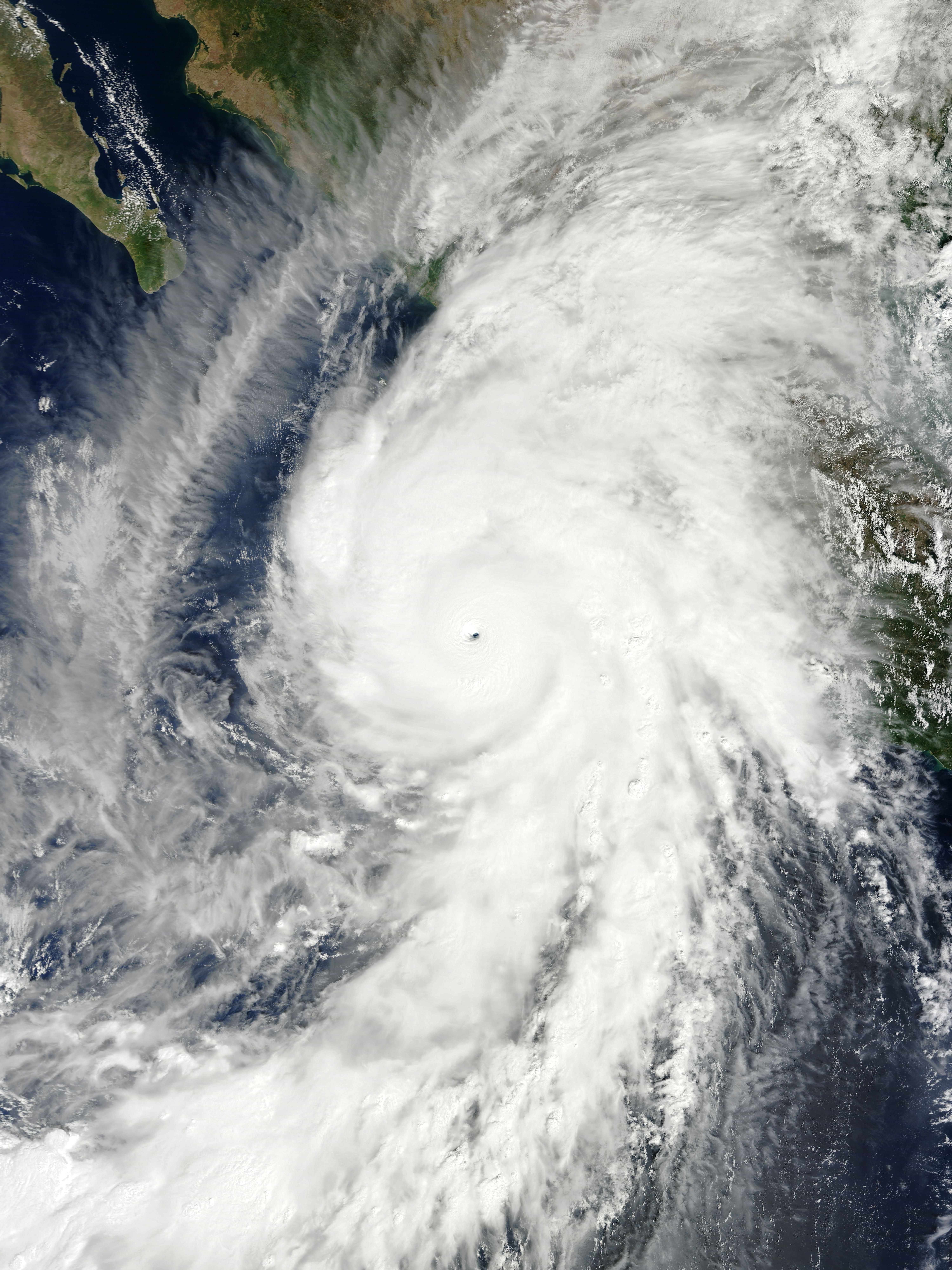
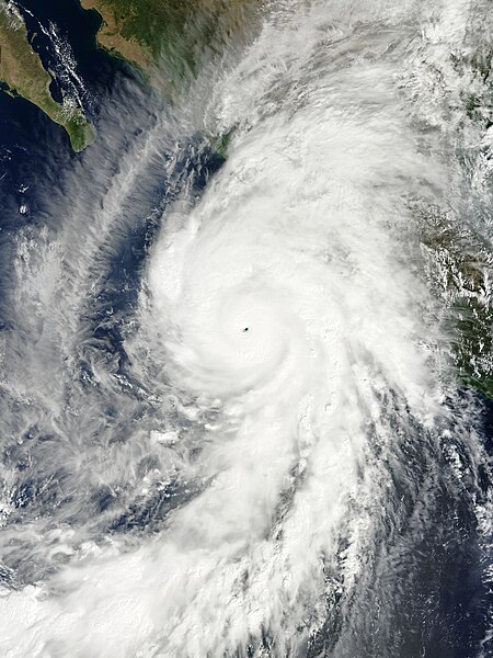
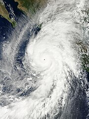
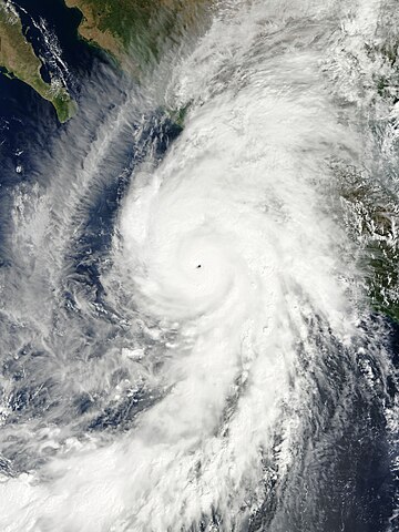
English: Hurricane Patricia shortly after peak intensity and approaching Western Mexico on October 23, 2015. Español: El huracán Patricia en su máximo pico de intensidad y aproximándose al occidente de México el 23 de octubre de 2015. |
| 日期 | |
| 來源 | EOSDIS Worldview |
| 作者 | MODIS image captured by NASA’s Terra satellite |
| Other versions |
|
.jpg)
| Camera location | | View this and other nearby images on: OpenStreetMap |
|---|
|
協議
| This file is in the public domain in the United States because it was solely created by NASA. NASA copyright policy states that "NASA material is not protected by copyright unless noted". (See Template:PD-USGov, NASA copyright policy page or JPL Image Use Policy.) | ||
 |
Warnings:
|
檔案歷史
撳個日期/時間去睇響嗰個時間出現過嘅檔案。
| 日期/時間 | 縮圖 | 尺寸 | 用戶 | 註解 | |
|---|---|---|---|---|---|
| 現時 | 2016年11月12號 (六) 16:24 | | 6,000 × 8,000(9.33 MB) | Meow | Corrected the ratio. |
| 2015年10月23號 (五) 20:20 |  | 6,210 × 8,280(9.44 MB) | Meow | User created page with UploadWizard |
檔案用途
無嘢連來呢份檔案。
全域檔案使用情況
下面嘅維基都用緊呢個檔案:
- ar.wikipedia.org嘅使用情況
- azb.wikipedia.org嘅使用情況
- bn.wikipedia.org嘅使用情況
- ca.wikipedia.org嘅使用情況
- cs.wikipedia.org嘅使用情況
- de.wikipedia.org嘅使用情況
- en.wikipedia.org嘅使用情況
- Cyclone
- Talk:Tropical cyclone
- Talk:Saffir–Simpson scale
- Talk:Hurricane Iniki
- Talk:2004 Pacific hurricane season
- Talk:Hurricane Linda (1997)
- Talk:2005 Pacific hurricane season
- Talk:1977 Pacific hurricane season
- Talk:List of California hurricanes
- Wikipedia:WikiProject Tropical cyclones
- Talk:Hurricane Diana
- Talk:Hurricane Cesar–Douglas
- Wikipedia talk:WikiProject Tropical cyclones
- Talk:Hurricane Fifi–Orlene
- Talk:Hurricane Anita
- Talk:Hurricane Joan–Miriam
- Talk:2002 Pacific hurricane season
- Talk:2003 Pacific hurricane season
- Talk:2000 Pacific hurricane season
- Talk:2001 Pacific hurricane season
- Talk:1999 Pacific hurricane season
- Talk:1998 Pacific hurricane season
- Talk:1997 Pacific hurricane season
- Talk:1996 Pacific hurricane season
- Talk:1995 Pacific hurricane season
- Talk:1994 Pacific hurricane season
- Talk:1993 Pacific hurricane season
- Talk:1992 Pacific hurricane season
- Talk:1991 Pacific hurricane season
- Talk:1990 Pacific hurricane season
- Talk:1989 Pacific hurricane season
- Talk:1988 Pacific hurricane season
- Talk:1987 Pacific hurricane season
- Talk:1986 Pacific hurricane season
- Talk:1985 Pacific hurricane season
- Talk:1984 Pacific hurricane season
- Talk:1983 Pacific hurricane season
- Talk:1982 Pacific hurricane season
- Talk:1981 Pacific hurricane season
- Talk:1980 Pacific hurricane season
睇呢個檔案嘅更多全域使用情況。