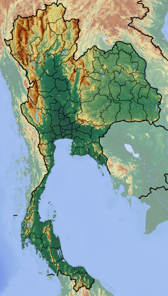
File:Thailand location map Topographic.png
原本檔案 (2,000 × 3,517 像素,檔案大細:10.24 MB ,MIME類型:image/png)
檔案歷史
撳個日期/時間去睇響嗰個時間出現過嘅檔案。
| 日期/時間 | 縮圖 | 尺寸 | 用戶 | 註解 | |
|---|---|---|---|---|---|
| 現時 | 2012年6月12號 (二) 16:55 |  | 2,000 × 3,517(10.24 MB) | Dr Brains |
檔案用途
無嘢連來呢份檔案。
全域檔案使用情況
下面嘅維基都用緊呢個檔案:
- af.wikipedia.org嘅使用情況
- als.wikipedia.org嘅使用情況
- ar.wikipedia.org嘅使用情況
- ast.wikipedia.org嘅使用情況
- ban.wikipedia.org嘅使用情況
- Taman Nasional Mu Ko Ang Thong
- Taman Nasional Laem Son
- Taman Nasional Kaeng Krachan
- Taman Nasional Khao Lak–Lam Ru
- Taman Nasional Kui Buri
- Taman Nasional Sai Thong
- Taman Nasional Si Phang Nga
- Kompléks Wana Dong Phayayen–Khao Yai
- Taman Nasional Thale Ban
- Taman Nasional Thong Pha Phum
- Taman Nasional Chaloem Phrakiat Thai Prachan
- Taman Nasional Chaloem Rattanakosin
- Taman Nasional Hat Khanom–Mu Ko Thale Tai
- Taman Nasional Kaeng Krung
- Taman Nasional Khao Laem
- Taman Nasional Khao Lampi–Hat Thai Mueang
- Taman Nasional Khao Phanom Bencha
- Taman Nasional Khlong Phanom
- Taman Nasional Khuean Srinagarindra
- Taman Nasional Lam Nam Nan
- Taman Nasional Mae Wa
- Taman Nasional Namtok Chet Sao Noi
- Taman Nasional Nam Phong
- Ban Chiang
- Taman Lelintihan Ayutthaya
- Kota Malelintihan Sukhothai miwah Kota Malelintihan Kakait
- ba.wikipedia.org嘅使用情況
- bh.wikipedia.org嘅使用情況
- bn.wikipedia.org嘅使用情況
- bs.wikipedia.org嘅使用情況
- ca.wikipedia.org嘅使用情況
- ceb.wikipedia.org嘅使用情況
- ce.wikipedia.org嘅使用情況
- cs.wikipedia.org嘅使用情況
睇呢個檔案嘅更多全域使用情況。


