
File:Wellesley Islands locator map.jpg
原本檔案 (1,500 × 1,355 像素,檔案大細:573 KB ,MIME類型:image/jpeg)
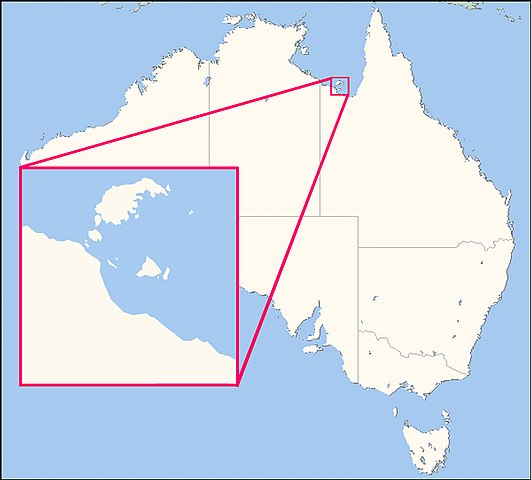
| 描述 | This map shows the location of the Wellesley Islands |
| 日期 | (UTC) |
| 來源 | |
| 作者 |
|
| Other versions | File:Locator map of Mornington Island.jpg |

|
This locator map image could be recreated using vector graphics as an SVG file. This has several advantages; see Commons:Media for cleanup for more information. If an SVG form of this image is already available, please upload it. After uploading an SVG, replace this template with {{vector version available|new image name.svg}}.
|


| This is a retouched picture, which means that it has been digitally altered from its original version. Modifications: Creation of locator map based on Satellite picture File:Mornington island.jpg for the Wellesley Islands, and File:Australia Locator Map.svg for Australia. The original can be viewed here: Australia Locator Map.svg:
|
我,呢份作品嘅作者,決定用以下許可發佈呢件作品:
| 呢個檔案用共享創意 姓名標示-非商業性-相同方式分享3.0 未本地化版本條款授權。 Subject to disclaimers. | ||
| ||
| This licensing tag was added to this file as part of the GFDL licensing update. |

|
根據自由軟體基金會發佈嘅無固定段落、封面文字同封底文字GNU自由文件授權條款第1.2或打後嘅版本,你獲授權可以重製、散佈同埋修改爾份文件。授權條款嘅副本喺章節GNU自由文件授權條款。 Subject to disclaimers. |
Original upload log
This image is a derivative work of the following images:
- File:Australia_Locator_Map.svg licensed with GFDL-en
- 2005-12-19T21:42:45Z Boticario 290x262 (68813 Bytes) == Summary == This map image was created by Wikipedia user [[:en:User:Papayoung|Papayoung]], based on the public-domain data available through the [http://stellwagen.er.usgs.gov/mapit/ Map-It] interface.
Uploaded with derivativeFX
檔案歷史
撳個日期/時間去睇響嗰個時間出現過嘅檔案。
| 日期/時間 | 縮圖 | 尺寸 | 用戶 | 註解 | |
|---|---|---|---|---|---|
| 現時 | 2009年5月14號 (四) 08:17 |  | 1,500 × 1,355(573 KB) | Teofilo | {{Information |Description=This map shows the location of the Wellesley Islands |Source=*File:Mornington island.jpg and File:Australia_Locator_Map.svg |Date=2009-05-14 09:10 (UTC) |Author=*File:Australia_Locator_Map.svg: was created by Wi |
檔案用途
以下嘅1版用到呢個檔:
全域檔案使用情況
下面嘅維基都用緊呢個檔案:
- ast.wikipedia.org嘅使用情況
- ca.wikipedia.org嘅使用情況
- ceb.wikipedia.org嘅使用情況
- da.wikipedia.org嘅使用情況
- de.wikipedia.org嘅使用情況
- en.wikipedia.org嘅使用情況
- eo.wikipedia.org嘅使用情況
- es.wikipedia.org嘅使用情況
- fi.wikipedia.org嘅使用情況
- fr.wikipedia.org嘅使用情況
- gl.wikipedia.org嘅使用情況
- it.wikipedia.org嘅使用情況
- ja.wikipedia.org嘅使用情況
- ka.wikipedia.org嘅使用情況
- ko.wikipedia.org嘅使用情況
- pt.wikipedia.org嘅使用情況
- sv.wikipedia.org嘅使用情況
- www.wikidata.org嘅使用情況