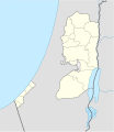
File:West Bank and Gaza Strip location map.svg
閱讀設定

呢個「SVG」檔案嘅呢個「PNG」預覽嘅大細:520 × 599 像素。 第啲解像度:208 × 240 像素|417 × 480 像素|667 × 768 像素|889 × 1,024 像素|1,778 × 2,048 像素|639 × 736 像素。
原本檔案 (SVG檔案,表面大細: 639 × 736 像素,檔案大細:98 KB)
檔案歷史
撳個日期/時間去睇響嗰個時間出現過嘅檔案。
| 日期/時間 | 縮圖 | 尺寸 | 用戶 | 註解 | |
|---|---|---|---|---|---|
| 現時 | 2009年4月28號 (二) 11:35 |  | 639 × 736(98 KB) | NordNordWest | area of West Bank back to correct position |
| 2009年4月28號 (二) 02:02 |  | 639 × 736(109 KB) | Fjmustak | 0.85px solid governorate lines (consistent with Israel, Jordan, Lebanon, etc...) | |
| 2009年4月22號 (三) 18:58 |  | 639 × 736(98 KB) | NordNordWest | corr | |
| 2009年4月17號 (五) 02:02 |  | 638 × 734(119 KB) | Fjmustak | Added governorate boundaries | |
| 2008年11月29號 (六) 18:30 |  | 638 × 734(103 KB) | NordNordWest | ||
| 2008年11月19號 (三) 20:05 |  | 638 × 734(118 KB) | NordNordWest | {{Information |Description= {{de|Positionskarte der Palästinensischen Autonomiegebiete bzw. von Westjordanland und Gazastreifen}} Quadratische Plattkarte, N-S-Streckung 115 %. Geographische Begrenzung der Karte: |
檔案用途
以下嘅4版用到呢個檔:
全域檔案使用情況
下面嘅維基都用緊呢個檔案:
- af.wikipedia.org嘅使用情況
- als.wikipedia.org嘅使用情況
- an.wikipedia.org嘅使用情況
- ar.wikipedia.org嘅使用情況
- az.wikipedia.org嘅使用情況
- ba.wikipedia.org嘅使用情況
- be-tarask.wikipedia.org嘅使用情況
- be.wikipedia.org嘅使用情況
- bg.wikipedia.org嘅使用情況
- bn.wikipedia.org嘅使用情況
- ce.wikipedia.org嘅使用情況
睇呢個檔案嘅更多全域使用情況。


