
File:Mavericks bathymetry.tiff

呢個「TIF」檔案嘅呢個「JPG」預覽嘅大細:463 × 600 像素。 第啲解像度:185 × 240 像素|371 × 480 像素|593 × 768 像素|1,275 × 1,651 像素。
原本檔案 (1,275 × 1,651 像素,檔案大細:6.02 MB ,MIME類型:image/tiff)
摘要
| 描述 |
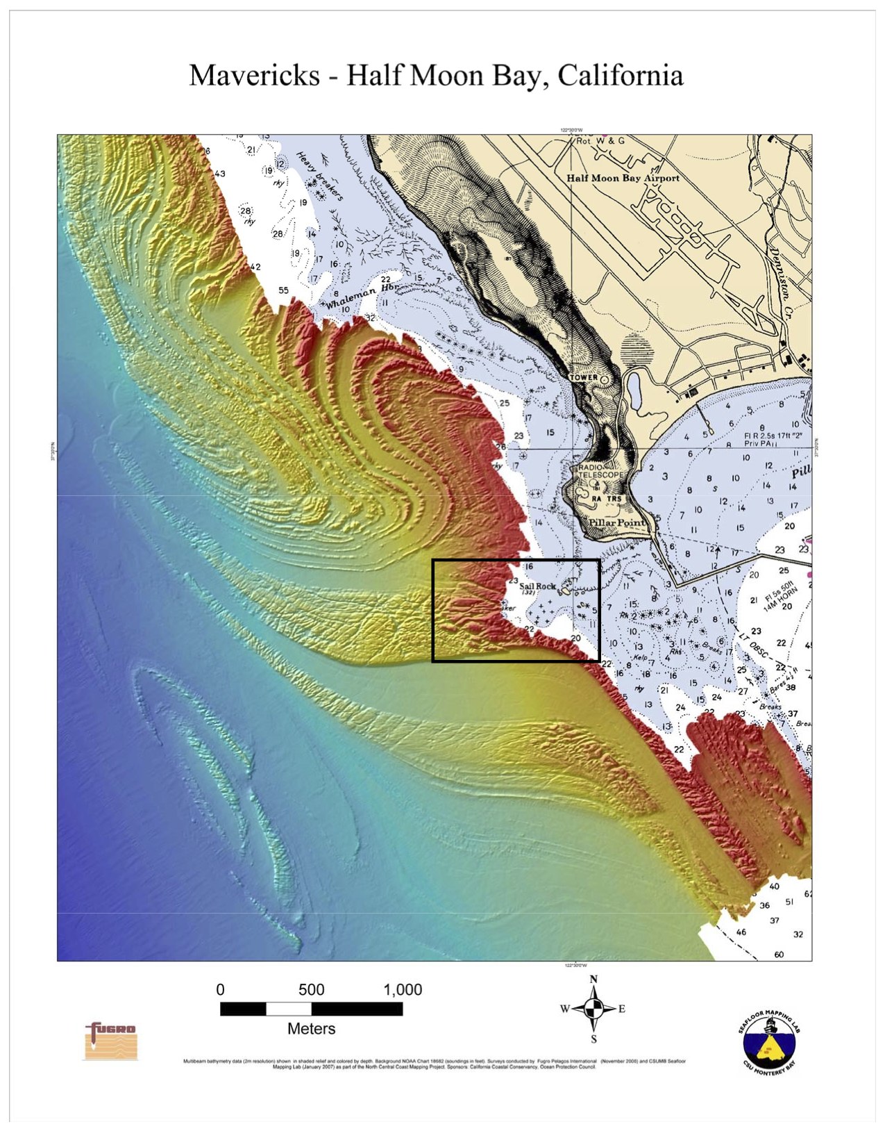
English: Bathymetry off Half Moon Bay, California. Rectangle indicates the location of the Mavericks surf break. |
| 日期 | |
| 來源 | Image here, description here, including statement that this is public domain. |
| 作者 | NOAA |
| Other versions | Derivative works of this file: Mavericks bathymetry - cropped.jpg |
| Camera location | | View this and other nearby images on: OpenStreetMap |
|---|
協議
This image is in the public domain because it contains materials that originally came from the U.S. National Oceanic and Atmospheric Administration, taken or made as part of an employee's official duties.
|
檔案歷史
撳個日期/時間去睇響嗰個時間出現過嘅檔案。
| 日期/時間 | 縮圖 | 尺寸 | 用戶 | 註解 | |
|---|---|---|---|---|---|
| 現時 | 2010年2月15號 (一) 01:18 |  | 1,275 × 1,651(6.02 MB) | Avenue | {{Information |Description={{en|1=Bathymetry off Half Moon Bay, California. Rectangle indicates the location of the Maverick surf break.}} |Source=Image [http://sanctuaries.noaa.gov/jointplan/presskit/mb/map_mav_bathy.pdf here], description [http://sanctu |
檔案用途
無嘢連來呢份檔案。
全域檔案使用情況
下面嘅維基都用緊呢個檔案:
- tr.wikipedia.org嘅使用情況