君士坦丁 (阿爾及利亞)
閱讀設定
| Constantine قسنطينة Qacentina | ||
|---|---|---|
| City | ||
Overview of Constantine | ||
| ||
| 綽號:City of Bridges | ||
 Location of Constantine within Constantine Province | ||
| Location within Algeria | ||
| Country | ||
| Province | Constantine Province | |
| District | Constantine District | |
| Cirta | 203 BC | |
| 政府 | ||
| • President | A. Chibane (2007–12) | |
| 面積 | ||
| • 總計 | 2,288 平方公里(883 平方英里) | |
| 海拔[1] | 694 米(2,277 英尺) | |
| 人口(2018)census[2] | ||
| • 總計 | 464,219 | |
| • 密度 | 200/平方公里(530/平方英里) | |
| 時區 | CET(UTC+1) | |
| Climate | Csa | |
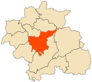
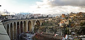
君士坦丁(粵拼:gwan1 si6 taan2 ding1,阿拉伯文:قسنطينة,法文:Constantine)係喺阿爾及利亞東北部一埠,係君士坦丁省首府,阿爾及利亞第三大城市,距離首都阿爾及爾322公里。根據2008年人口普查,佢有448,374人喺度住。
氣候
[編輯]| 君士坦丁氣候平均數據 | |||||||||||||
|---|---|---|---|---|---|---|---|---|---|---|---|---|---|
| 月份 | 1月 | 2月 | 3月 | 4月 | 5月 | 6月 | 7月 | 8月 | 9月 | 10月 | 11月 | 12月 | 全年 |
| 歷史最高温 °F(°C) | 78.8 (26.0) |
77.9 (25.5) |
82.8 (28.2) |
88.9 (31.6) |
94.1 (34.5) |
101.7 (38.7) |
112.1 (44.5) |
110.8 (43.8) |
102.2 (39.0) |
93.6 (34.2) |
84.4 (29.1) |
78.4 (25.8) |
112.1 (44.5) |
| 平均高温 °F(°C) | 56.1 (13.4) |
56.7 (13.7) |
60.4 (15.8) |
65.5 (18.6) |
73.2 (22.9) |
79.3 (26.3) |
86.9 (30.5) |
87.8 (31.0) |
77.4 (25.2) |
69.3 (20.7) |
61 (16.1) |
55.4 (13.0) |
69.08 (20.6) |
| 平均低温 °F(°C) | 38.3 (3.5) |
38.8 (3.8) |
40.5 (4.7) |
44.6 (7.0) |
52.7 (11.5) |
56.5 (13.6) |
61.2 (16.2) |
61.2 (16.2) |
56.7 (13.7) |
50.9 (10.5) |
45.3 (7.4) |
38.1 (3.4) |
48.73 (9.29) |
| 歷史最低温 °F(°C) | 14.5 (−9.7) |
17.1 (−8.3) |
23.4 (−4.8) |
32.5 (0.3) |
39.6 (4.2) |
40.8 (4.9) |
43 (6.1) |
42.8 (6.0) |
39.6 (4.2) |
31.8 (−0.1) |
26.8 (−2.9) |
14.9 (−9.5) |
14.5 (−9.7) |
| 平均降水量 英寸(mm) | 2.457 (62.4) |
2.476 (62.9) |
1.803 (45.8) |
1.831 (46.5) |
1.138 (28.9) |
0.685 (17.4) |
0.634 (16.1) |
0.602 (15.3) |
0.85 (21.6) |
1.346 (34.2) |
2.051 (52.1) |
2.657 (67.5) |
18.48 (469.4) |
| [未記出處或冇根據] | |||||||||||||
人口
[編輯]| 年 | 居民數 |
|---|---|
| 1977年(普查) | 345,566人 |
| 1987年(普查) | 443,727人 |
| 1998年(普查) | 462,187人 |
| 2007年(統計) | 442,862人 |
攷
[編輯]- ↑ "Datos". Mundomanz.com. 喺2020-05-29搵到.
- ↑ "(1998-2008)" (PDF). 喺2013-03-12搵到.
拎
[編輯]- 阿爾及利亞康斯坦丁的小瀑布 Wayback Machine嘅版面存檔備份


